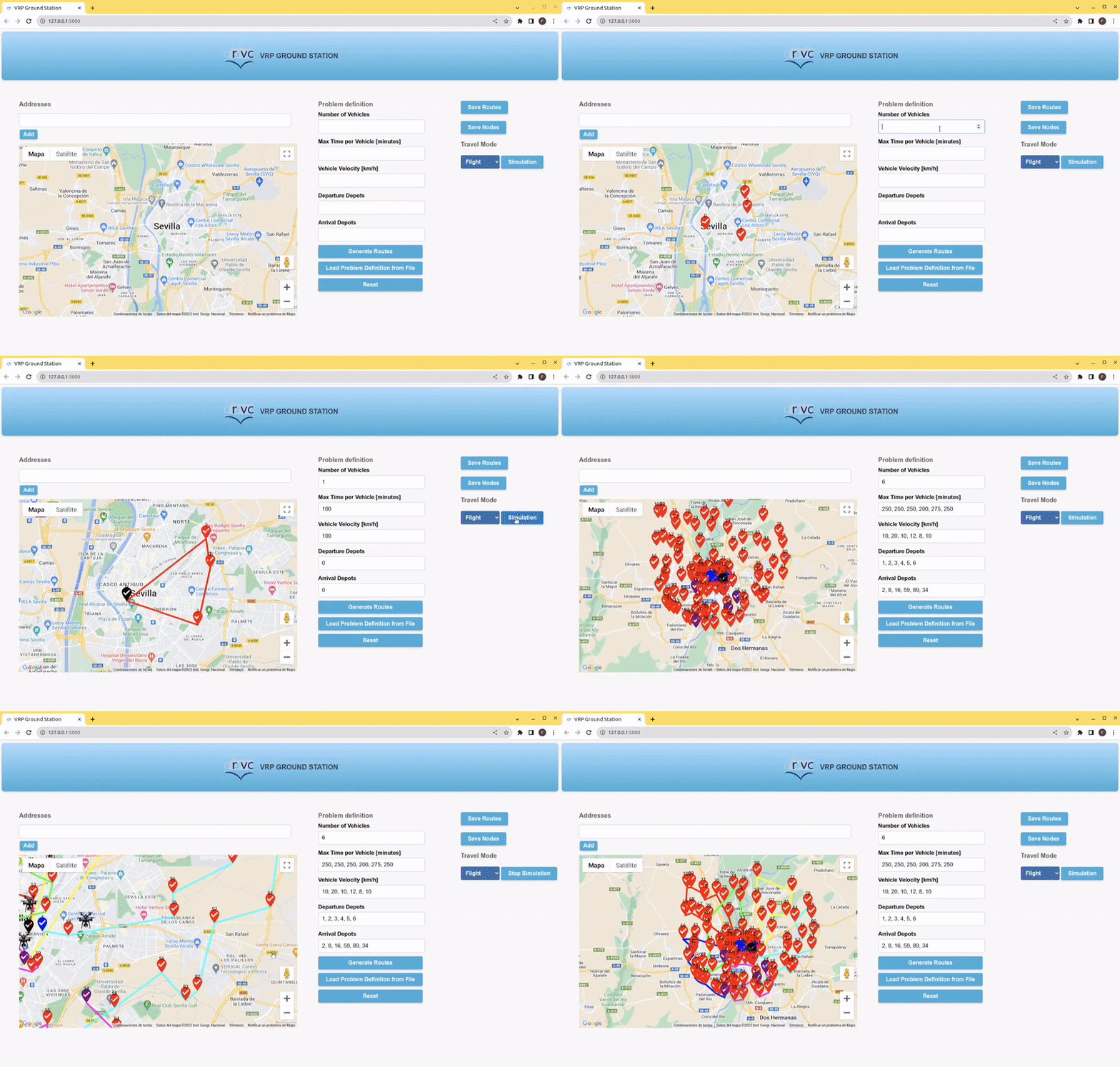
This repository provides an Human-Machine Interface (HMI) to solve the Vehicle Routing Problem (VRP) for a heterogeneous swarm of Unmanned Aerial Vehicles (UAVs). It optimizes the time in which N UAVs visit M locations, considering the diverse capabilities of each vehicle and adhering to each drone's restrictions.
-
Multi-depot: Define several departure and arrival depots. Each UAV can take off and land at different locations.
-
Heterogeneity: Each vehicle can possess distinct capabilities, including various velocities and battery requirements (maximum time of flight).
-
HMI: Interact with the web application to define the problem interactively. Add addresses or coordinates to visit, and specify each vehicle's capabilities. Generate, simulate, and save the routes and the problem definition. Configuration files are also supported.
-
Simulation: Simulate the route generation and real-time execution of UAVs.
-
OR-Tools: Currently leveraging the OR-Tools open-source library for combinatorial optimization to compute the routes. Other methods can be seamlessly integrated (see Routes Computation section).
- To install Multi-UAV-VRP you can create a conda environment (optional).
conda create --name vrp
conda activate vrp
- Clone the repository.
git clone https://github.com/javierganan99/Multi-UAV-VRP.git
cd Multi-UAV-VRP
- Install the requirements.
pip install -r requirements.txt
To use the HMI, you need a Google Maps API Key to load the map into the webpage.
- Set your Google Maps API Key as an enviroment variable.
Linux and Mac:
export MAPS_API_KEY=<YOUR_API_KEY>
Windows:
setx MAPS_API_KEY <YOUR_API_KEY>
- Launch the web app.
python3 /path/to/Multi-UAV-VRP/main.py
You can define the problem using configuration files, the HMI, or a hybrid approach.
The default problem definiton is located at /path/to/Multi-UAV-VRP/cfg/problem_definition.yaml file. You can load it to the HMI using the Load Problem Definition from File button.
Within the HMI, you can overwrite the following problem elements:
- Number of vehicles: The N number of UAVs.
- Maximun time-of-fligh per vehicle: A list of N times in the format t1, t2, ..., tn.
- Velocity of each vehicle: A list of N velocities in the format v1, v2, ..., vn.
- Departure depots: Introduce the N departure locations' indexes in a list i1, i2, ..., in.
- Arrival depots: The same as Departure depots but for the arrival depots of the drones.
You can also add or delete the locations to visit. Use the Directions text box or click the position on the map to add a direction. The Directions text box accepts human-readable directions (e.g., La giralda, Seville), and latitude, longitude coordinates (e.g., 37.411872181, -6.001852909). To delete locations, hover over the map location marker and click Delete.
The Travel mode can be selected in the HMI, supporting the following modes: Flight, Driving, Walking, Biking, and Transit. Except for Flight, all modes compute the distance between each location using the Distace Matrix Google API. In the flight mode, the Haversine formula is employed without using any external API.
Note that although UAVs often fly without restrictions between 2 locations, certain applications such as surveillance or monitoring might require the drones to follow specific paths, like roads, bike paths, or pedestrian paths. For such cases, the travel distance is estimated more precisely using suitable travel modes.
⚠️ If you use a Travel mode other than the Flight mode and your problem includes more than ~50 locations, be cautious. Calculating the Distance Matrix might take too long for time-critical applications. Additionally, excessive use of the HMI (specially in modes other than Flight) may incur costs due to exceeding the free Distace Matrix Google API requests.
We currently support OR-Tools open-source Python library for routes calculation. It is well-documented and provides useful utilities for routing problems, such as the VRP. Refer to their guide for examples related to the VRP problem.
In this project, we define the find_routes function in the /path/to/Multi-UAV-VRP/app/utils/or_tools_method.py file to compute optimized routes. You can modify this function or create a new one to solve the VRP with other methods. Define your problem related parameters and your method's parameters in the /path/to/Multi-UAV-VRP/cfg/problem_definition.yaml and the /path/to/Multi-UAV-VRP/cfg/solver_configuration.yaml configuration files, respectively. Your function should take input from both dictionaries.
You can create another function to adapt the output format of the solution to be compatible with Multi-UAV VRP. We currently use adapt_solution function to convert the OR-Tools format to the required format. This function should take the output of the find_routes function and produce a dictionary in the following format:
result = {
    'routes': {
        # N vehicle IDs, should be integers from 0 to (N-1)
        0: {
             # Latitude and longitude list of nodes to visit
            'coordinates': [(37.3830519, -5.9902257), (37.3842311, -5.9709563), ...],
             # A list representing the indexes of the coordinates of the routes in the problem definition
            'nodes': [20, 10, 2, ...],
             # Estimated time to complete the route [s]
            'time': 12069,
            # Hexadecimal color to visualize the route path
            'color': '#00FF00',
            # Velocity of the vehicle [m/s]
            'velocity': 3.2,
        }
        1: ...
    },
    # Time to complete the longest route [s]
    'total_time': 15000
}Francisco Javier Gañán - fjganan14@gmail.com
