- LiDAR Simulation Library
- LiDAR Placement Evaluation in V2X Scenario
- LiDARPlacementOptimizing
- RainyPCSim
- ReSimAD
- Technical Papers
LiDAR.simulation.and.placement.mp4
LiDAR Simulation Library Details
### Requirements- Carla (>=0.9.12)
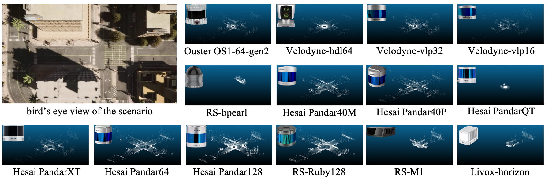
- Surround LiDAR
- pandar64
- ruby128
- pandar128
- vlp16
- hdl64
- hdl32
- pandar_qt
- bpearl
- pandar_40m
- pandar_40p
- pandar_xt
- vlp32
- os1_64_gen2
- waymo_top
- Solid State LiDAR
- mems_m1
- Risley Prism LiDAR
- horizon
- mid40
- mid70
- avia
- tele
- Default Carla LiDAR
- default LiDARs
LiDARSimLib/Unreal/CarlaUE4/Plugins/Carla/Source/Carla/Sensor/livox.cpp
line9: modify depend on your own carla path
LiDARSimLib/PythonAPI/lidar_lib_example/lidar_display.py
line30: modify depend on your own carla path
make clean
make PythonAPI
make launchlidar_bp = world.get_blueprint_library().find('sensor.lidar.ray_cast') # choose ray_cast or ray_cast_semantic
lidar_bp.set_attribute("lidar_type", "Surround") # set lidar_type as Surround, Solid_state, Risley_prism
lidar_bp.set_attribute("name","pandar64") # set name as any one in LiDAR List
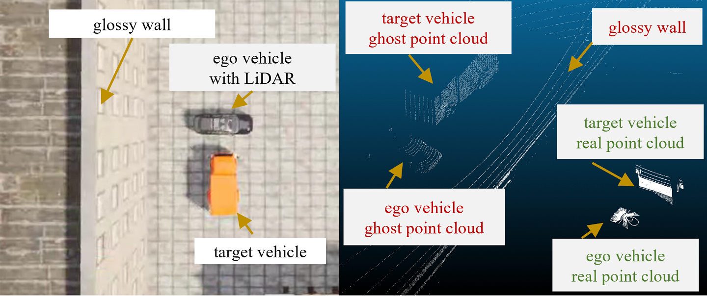
lidar_bp.set_attribute("enable_ghost", "true") # enable ghosting object effect
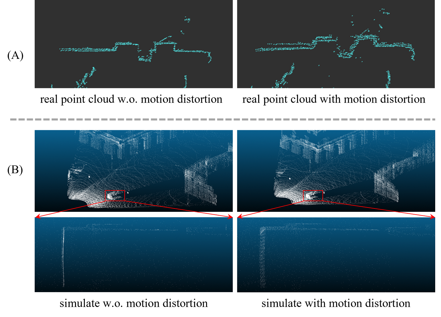
- Import the LidarMotonDistortion module
import sys
sys.path.append("/your/path/of/carla/LibCustomFunction") # append the LibCustomFunction
from enable_motion_distortion import LidarMotonDistortion
- Init LidarMotonDistortion with file_path and distortion delay_time
lidar_motion_distort = LidarMotonDistortion("./horizon/", 10) # file_path is where the data you want to save. delay_time is the ratio of simulator frequency to lidar frequency.
- Enable motion distortion
ego_lidar.listen(lambda data: lidar_motion_distort.enable_motion_distortion(data, True))
Implement Details
We build our evaluation code upon [v2x-vit](https://github.com/DerrickXuNu/v2x-vit) project.Code and usage will be release soon.
Simulate rain effect for LiDAR and collect synthetic LiDAR data in CARLA. We have released the RainyPCSim Dataset obtained using the this method.
github_rainy_for_lidar.mp4
RainyPCSim Details
- Carla (>=0.9.12)
- Following LiDAR Simulation Library Copy and modify files from RainyPCSIM/carla/* to $CARLA_ROOT
- Rebuild carla
make clean
make PythonAPI
make launch
- Launch CARLA, and open
$CARLA_ROOT/Unreal/CarlaUE4/Content/Carla/Blueprints/Vehicles/BaseVehiclePawn.uassetin the blueprint editor. - Add component ProxyParticleSpawn.uasset. Click
Add Componentbotton, search and add ProxyParticleSpawn component. - Create waymo_top LiDAR
lidar_bp = world.get_blueprint_library().find('sensor.lidar.ray_cast')
lidar_bp.set_attribute("lidar_type", "Surround")
lidar_bp.set_attribute("name","waymo_top")
We build our synthetic dataset using OpenCDA simulation tool.
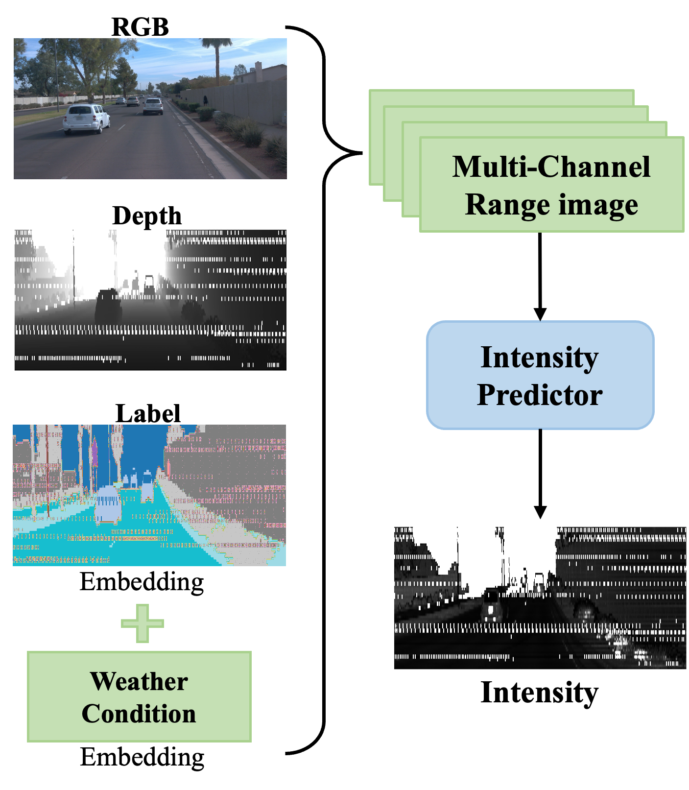
Please refer to Intensity_predictor.md to learn more usage about the predictor module.
Please refer to ReSimAD/README.md to learn more usage about the project.
@inproceedings{cai2023analyzing,
  title={Analyzing Infrastructure LiDAR Placement with Realistic LiDAR Simulation Library},
  author={Cai, Xinyu and Jiang, Wentao and Xu, Runsheng and Zhao, Wenquan and Ma, Jiaqi and Liu, Si and Li, Yikang},
  booktitle={2023 IEEE International Conference on Robotics and Automation (ICRA)},
  pages={5581--5587},
  year={2023},
  organization={IEEE}
}
@inproceedings{jiang2023optimizing,
  title={Optimizing the Placement of Roadside LiDARs for Autonomous Driving},
  author={Jiang, Wentao and Xiang, Hao and Cai, Xinyu and Xu, Runsheng and Ma, Jiaqi and Li, Yikang and Lee, Gim Hee and Liu, Si},
  booktitle={Proceedings of the IEEE/CVF International Conference on Computer Vision},
  pages={18381--18390},
  year={2023}
}
@article{yang2023rainy,
  title={Realistic Rainy Weather Simulation for LiDARs in CARLA Simulator},
  author={Donglin Yang, Zhenfeng Liu, Wentao Jiang, Guohang Yan, Xing Gao, Botian Shi, Si Liu, Xinyu Cai},
  journal={under review},
  year={2023}
}
@article{zhang2023resimad,
  title={ReSimAD: Zero-Shot 3D Domain Transfer for Autonomous Driving with Source Reconstruction and Target Simulation},
  author={Zhang, Bo and Cai, Xinyu and Yuan, Jiakang and Yang, Donglin and Guo, Jianfei and Xia, Renqiu and Shi, Botian and Dou, Min and Chen, Tao and Liu, Si and others},
  journal={arXiv preprint arXiv:2309.05527},
  year={2023}
}

