

![]()
This library provides all countries's national and prefectural boundaries in the form of geopandas dataframe, by dynamically fetching from GADM dataset.
pip install gadmimport geopandas as gpd
from gadm import GADMDownloader
downloader = GADMDownloader(version="4.0")
country_name = "Vietnam"
ad_level = 0
gdf = downloader.get_shape_data_by_country_name(country_name=country_name, ad_level=ad_level)
assert isinstance(gdf, gpd.GeoDataFrame)
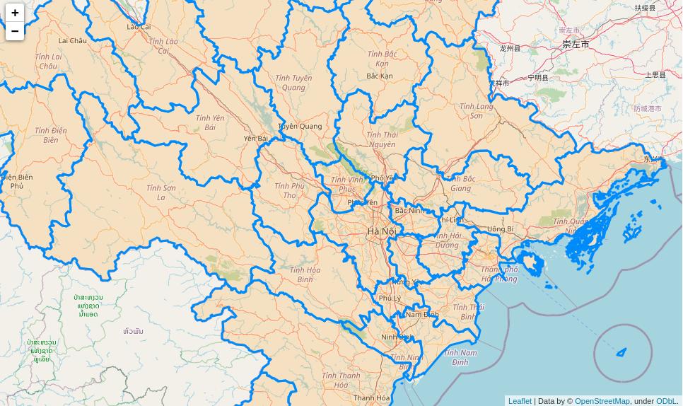
gdf.plot()GADM's data frame can be interactively visualized on a jupyter notebook with folium
import folium as fl
import geopandas as gpd

from gadm import GADMDownloader

downloader = GADMDownloader(version="4.0")

country_name = "Vietnam"
ad_level = 1
gdf = downloader.get_shape_data_by_country_name(country_name=country_name, ad_level=ad_level)

m = fl.Map(zoom_start=10, tiles="OpenStreetMap")
for _, r in gdf.iterrows():
    sim_geo = gpd.GeoSeries(r["geometry"]).simplify(tolerance=0.001)
    geo_j = sim_geo.to_json()
    geo_j = fl.GeoJson(data=geo_j, style_function=lambda x: {"fillColor": "orange"})
    fl.Popup(r["VARNAME_1"]).add_to(geo_j)
    geo_j.add_to(m)
m
Check the following example
conda env create --file environment.yml
conda activate gadm