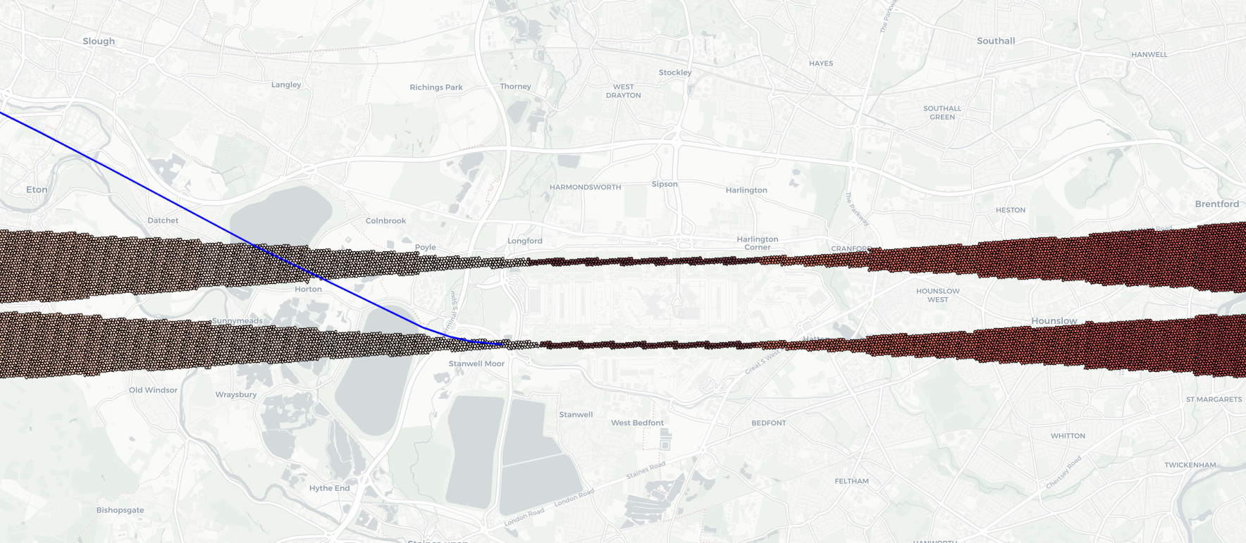
HexAeroR is a EUROCONTROL R package designed for aviation professionals and data analysts. It allows for the determination of used airports, runways, taxiways, and stands based on available (ADS-B) flight trajectory coordinates. This tool aims to enhance aviation data analysis, facilitating the extraction of milestones for performance analysis.
- Airport Detection: Identifies airports involved in a flight's trajectory.
- Runway Utilization: Determines which runways are used during takeoff and landing.
You can install the development version of HexAeroR from GitHub with:
# install.packages("devtools")
devtools::install_github("euctrl-pru/HexAeroR")This is a basic example which shows you how to solve a common problem:
library(HexAeroR)
## basic example code
This will prompt you to download the geospatial metadata from Zenodo necessary to run the package. It will only cache once. The parquet datasets are available here: https://zenodo.org/records/10651018.
# Load trajectory data
df <- load_dataset(name = "trajectories.parquet", datatype = "test_data")

# Create unique ID for each trajectory
df$id <- paste(df$icao24, df$callsign, as.Date(df$time), sep = "-")

# Identify runways

list(scored_rwy_detections_df, rwy_detections_df) <- identify_runways(df)# Load approach hex dataset for an airport (e.g., EGLL)
egll <- load_dataset(name = "EGLL.parquet", datatype = "runway_hex")
# Visualize approach cones using leaflet for interactive maps
library(leaflet)
map_viz <- leaflet(egll) %>%
addTiles() %>%
addPolygons(color = ~border_color, fillOpacity = .7, fillColor = ~color_map_name) %>%
setView(lng = mean(df$lon), lat = mean(df$lat), zoom = 13) %>%
addPopups(~lon, ~lat, ~tooltip_columns)
# Print the map
print(map_viz)Download the HTML here: egll_departure.html
- [pending implementation] Taxiway Analysis: Analyzes taxi routes for efficiency and optimization.
- [pending implementation] Stand Identification: Identifies aircraft stands, enhancing ground operation analysis.
We welcome contributions to HexAeroR! Feel free to submit pull requests, report issues, or request features.
HexAeroPy is licensed under the MIT License - see the LICENSE file for details.
Special thanks to EUROCONTROL and the Performance Review Commission (PRC).
For support or queries, please contact us at pru-support@eurocontrol.int.

