z3tt / WarmingStripesGeofacet

🌡️ The Famous Warming Stripes by Ed Hawkins as Geofacet

Geek Repo:Geek Repo

Github PK Tool:Github PK Tool

The Famous Warming Stripes as Geofacet

Temperature Anomalies by Country (1880–2019 compared to 1950–1980 baseline)

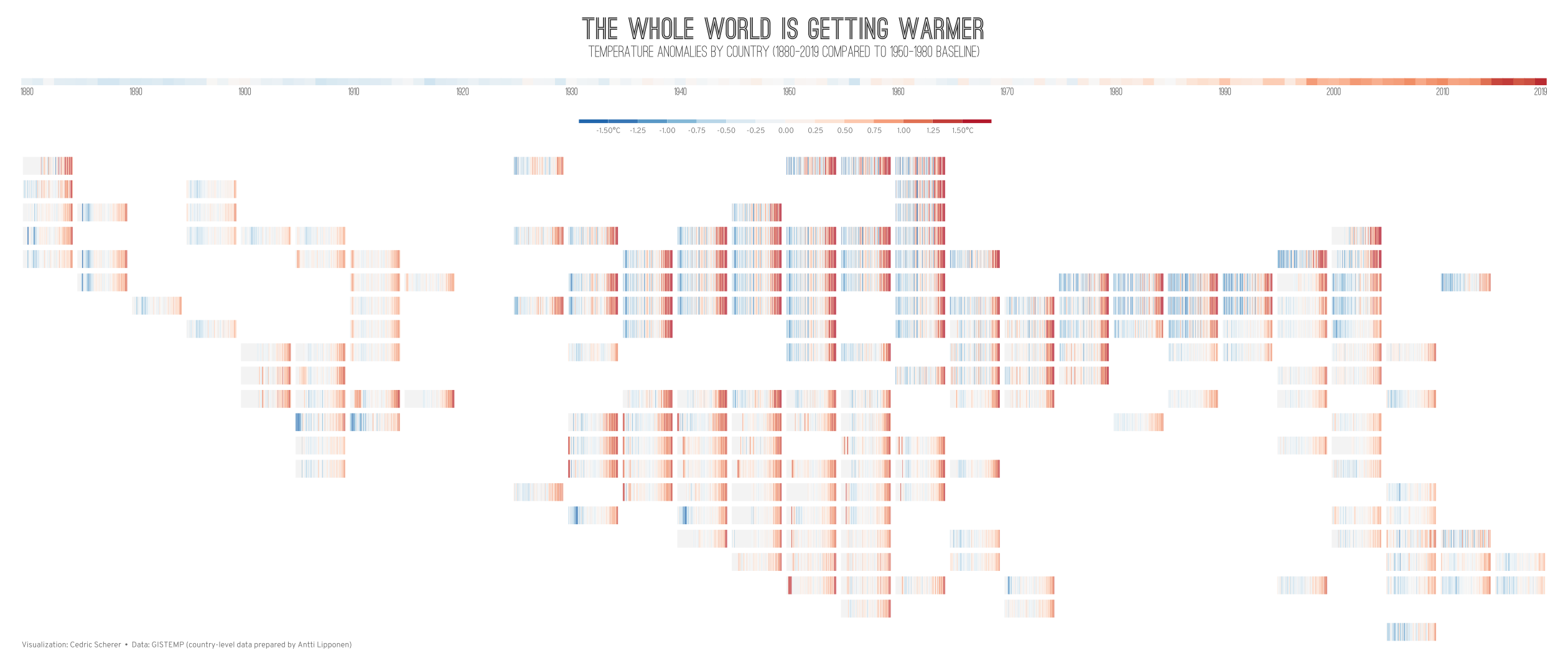
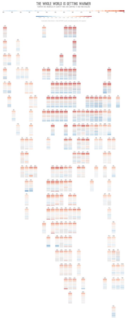
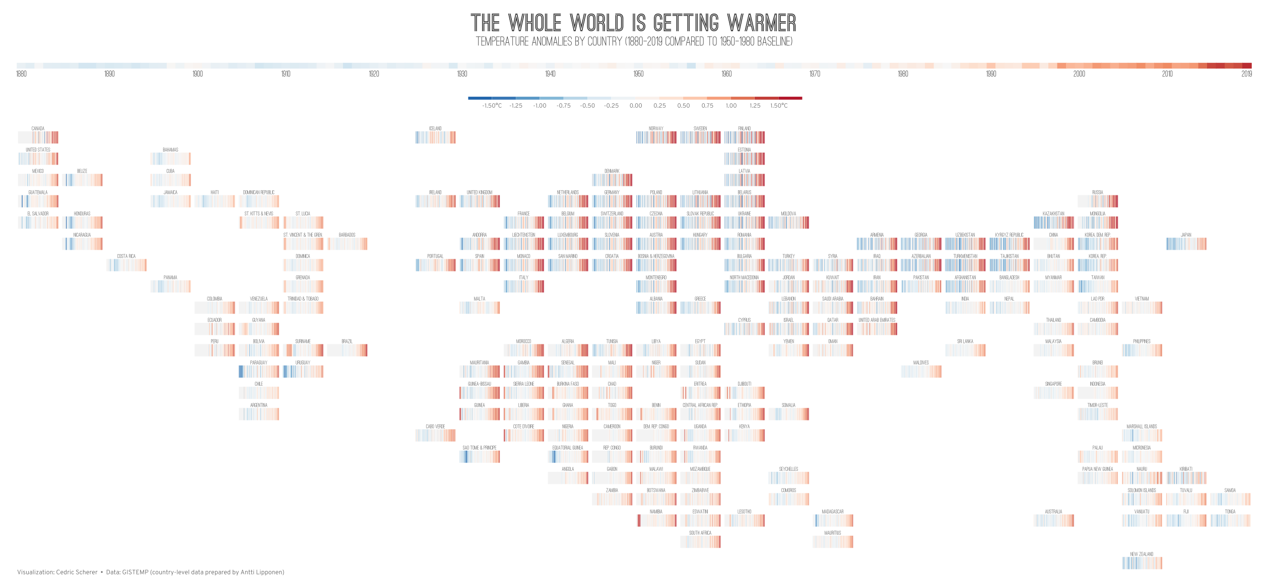
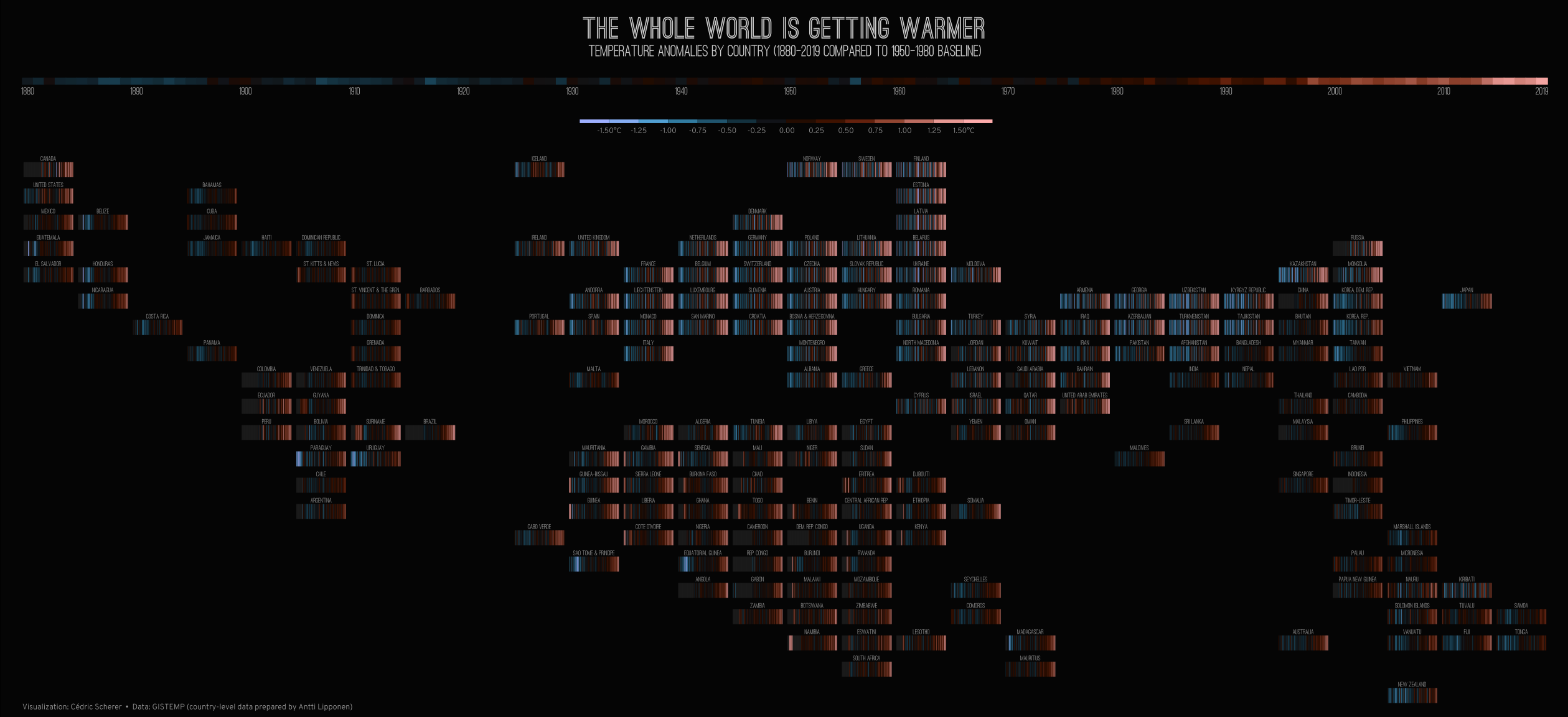
A series of so-called geofacets (similar to tile maps) using the famous Warming Stripes by Ed Hawkins. I used this approach to illustrate the fact that every country worldwide is getting warmer Below you will find different editions of the global version as well as single maps for each continent (Africa, the Americas, Asia, Europe, and Oceania). All main maps come in light and dark versions.

World

Warming Stripes for all countries as geofacet
Version of the Warming Stripes geofacet on a dark background
Lossless version (light) | Lossless version (dark)

Africa

Warming Stripes of African countries as geofacet
Lossless version (light) | Lossless version (dark)

The Americas

Warming Stripes of African countries as geofacet
Lossless version (light) | Lossless version (dark)

Asia

Warming Stripes of African countries as geofacet
Lossless version

Warming Stripes of African countries as geofacet
Lossless version

Europe

Warming Stripes of African countries as geofacet
Lossless version (light) | Lossless version (dark)

Oceania

Warming Stripes of African countries as geofacet
Lossless version (light) | Lossless version (dark)

Global Version without Country Labels:

Clean version of the Warming Stripes geofacet without country labels
Lossless version

Global Version in Portrait Format:

Version with vertical Warming Stripes
Lossless version


Attribution-NonCommercial-ShareAlike 4.0 International (CC BY-NC-SA 4.0)


Buy Me A Coffee

About

🌡️ The Famous Warming Stripes by Ed Hawkins as Geofacet