- YESeg-OPT-SAR is a sufficiently annotated high-resolution remote sensing dataset for land use classification, which combines high-resolution RGB optical images with SAR images at a resolution of 0.5 meters.
-
YESeg-OPT-SAR uses high-resolution optical and SAR images from Google Earth L18 products imaged during 2010/10/21-2016/8/25 with a spatial resolution of 0.5 m.
-
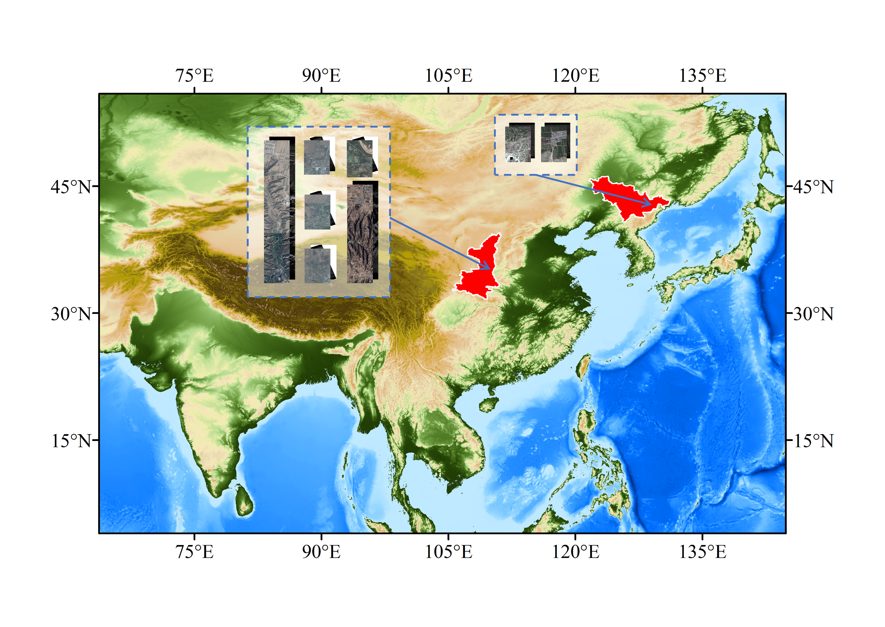
It contains 2231 pairs of images of the same area with a size of 256×256. The dataset contains two study areas, one covers an area in the longitude range of 122.836°E-122.869°E and the latitude range of 45.105°N-45.133°N, and the other with a longitude range of 110.135°E-110.160°E and latitude range of 34.593°N-34.626°N,which covering a wide range of different terrain and vegetation.The location of the study area is shown on the map below.

-
The images in the dataset are fully labeled with pixel-level categories, including background, bare ground, vegetation, trees, houses, water, roads, and others, where the label values and category percentages are shown in the table below.
| Label | Name | Percent(%) |
|---|---|---|
| 0 | background | 2.26 |
| 1 | bare ground | 55.84 |
| 2 | low vegetation | 26.55 |
| 3 | trees | 5.29 |
| 4 | houses | 4.39 |
| 5 | water | 1.69 |
| 6 | roads | 3.88 |
| 7 | other | 0.11 |
The dataset are organized as:
├─YESeg-OPT-SAR dataset
│  ├─label
│  │  ├─1
│  │  │    1.png
│  │  │    ……
│  │  ├─10
│  │  ├─11
│  │  ├─……
│  │  ├─HY_C
│  │  └─HY_D
│  ├─optical
│  │  ├─1
│  │  ├─10
│  │  ├─11
│  │  ├─……
│  │  ├─HY_C
│  │  └─HY_D
│  └─sar
│      ├─1
│      ├─10
│      ├─11
│      ├─……
│      ├─HY_C
│      └─HY_D
The optical images and SAR images of some typical features in the YESeg-OPT-SAR dataset with the corresponding annotation results are shown below.

If you encounter any problem in using YESeg-OPT-SAR dataset or have any feedback, please contact:
- Ye Yuanxin : yeyuanxin@home.swjtu.edu.cn
- Wei Kan : 1196581377@qq.com
Dataset is avaliable:
Googledrive: https://drive.google.com/file/d/1AWgZis0ygT2UjosdIaVMqr8lNEEmhC5o/view?usp=sharing
BaiduYun: https://pan.baidu.com/s/1uBKAG4W5S-o87t4u0F3nJQ?pwd=w4x3 password:w4x3