Including extents of the High-Mountain Asia region and the sub-resions, as well as the main rivers, lakes and glaciers vector data in this region.
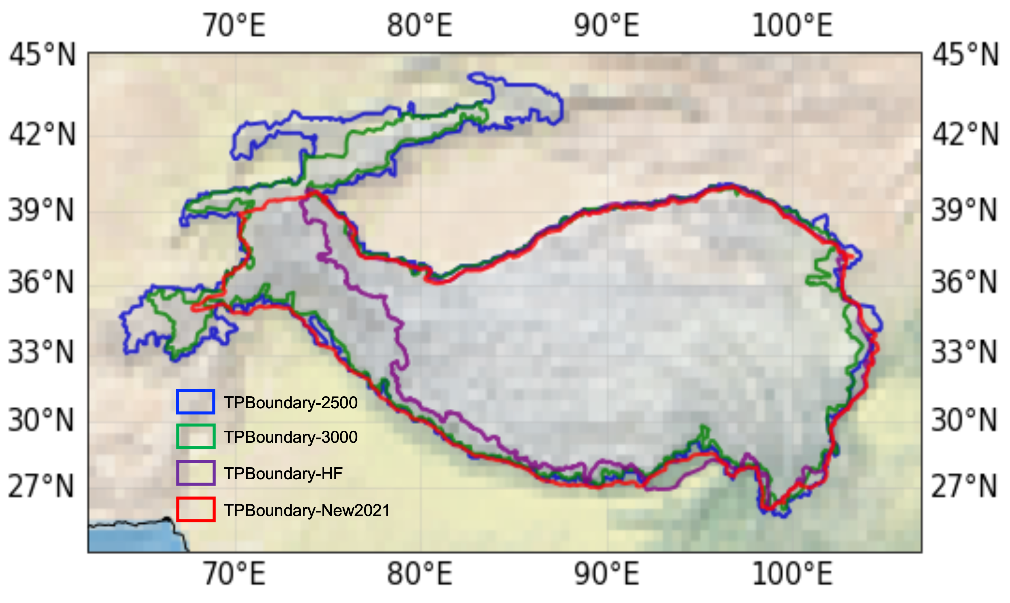
TPBoundary_2500, TPBoundary_3000, TPBoundary_HF and TPBoundary_ New. References:
- Zhang, Y., Ren, H., Pan, X. (2019). Integration dataset of Tibet Plateau boundary. National Tibetan Plateau Data Center, DOI: 10.11888/Geogra.tpdc.270099. CSTR: 18406.11.Geogra.tpdc.270099. (Data citation)
- Zhang, Y.L., Li, B.Y., Zheng, D. (2002). A discussion on the boundary and area of the tibetan plateau in china. Geographical Research.
- Zhang, Y.L., Li, B.Y., Liu, L.S., Zheng, D. (2021). Redetermine the region and boundaries of Tibetan Plateau. GEOGRAPHICAL RESEARCH, 40(6), 1543-1553.

References:
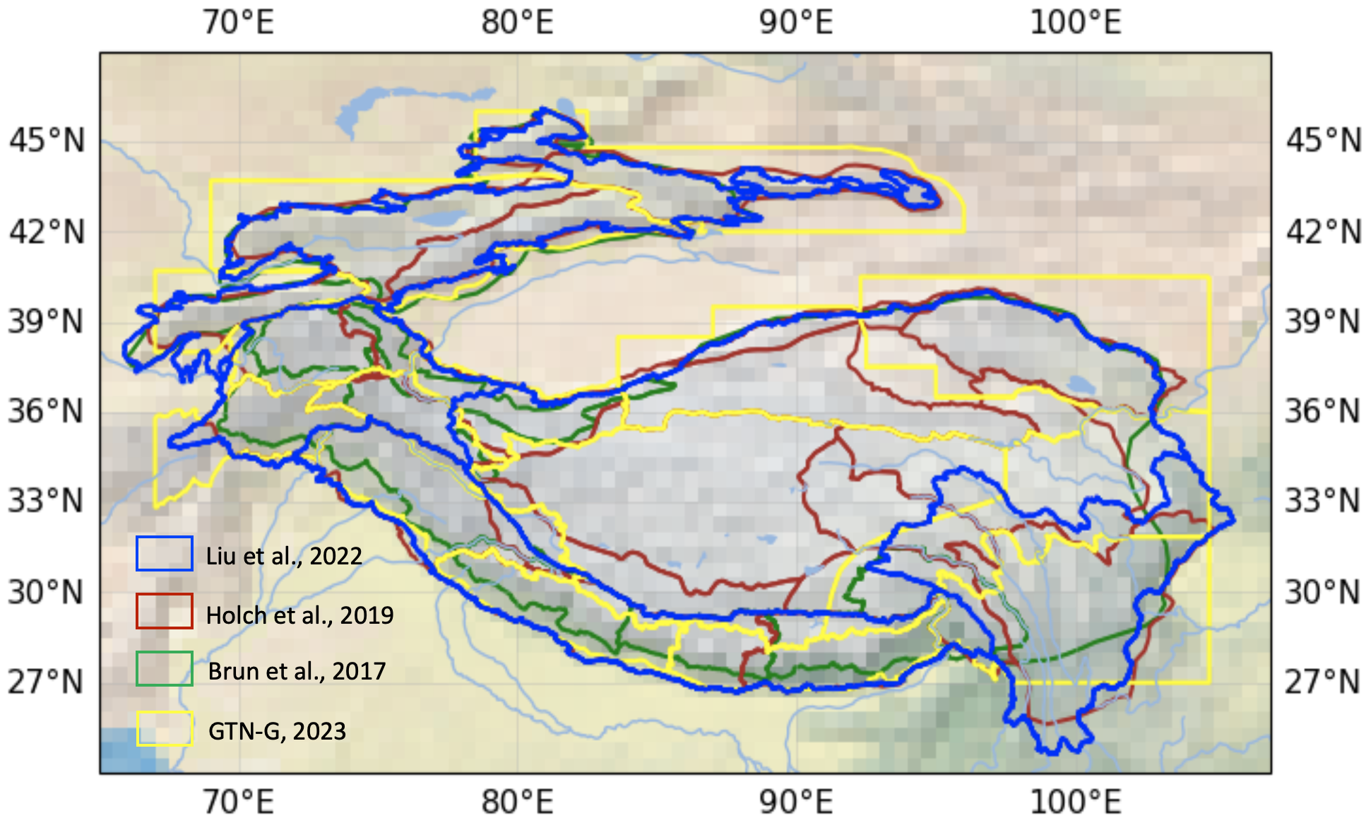
- Brun F, Berthier E, Wagnon P, et al. A spatially resolved estimate of High Mountain Asia glacier mass balances from 2000 to 2016[J]. Nature geoscience, 2017, 10(9): 668-673.
References:
- Bolch T, Shea J M, Liu S, et al. Status and change of the cryosphere in the extended Hindu Kush Himalaya region[M]. The Hindu Kush Himalaya Assessment. Springer, Cham, 2019: 209-255.
References:
- GTN-G. GTN-G Glacier Regions. 2023. doi:10.5904/gtng-glacreg-2023-07.
(Comprising 4 subregions: Tibetan Plateau, Himalaya, Hengduan Mountains and Mountains of Centra Asia) References:
- Liu J, Milne R I, Zhu G F, et al. Name and scale matters: Clarifying the geography of Tibetan Plateau and adjacent mountain regions[J]. Global and Planetary Change, 2022: 103893.

References:
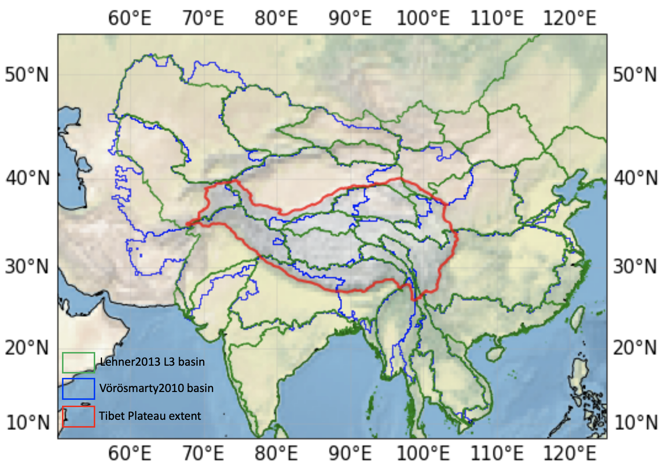
- Vörösmarty, C. J., McIntyre, P. B., Gessner, M. O., Dudgeon, D., Prusevich, A., Green, P., et al. (2010). Global threats to human water security and river biodiversity. Nature 467, 555–561. doi: 10.1038/nature09440
- Shean D E, Bhushan S, Montesano P, et al. A systematic, regional assessment of high mountain Asia glacier mass balance[J]. Frontiers in Earth Science, 2020, 7: 363.
Reference:
- Lehner, B., Grill G. (2013). Global river hydrography and network routing: baseline data and new approaches to study the world’s large river systems. Hydrological Processes, 27(15): 2171–2186.

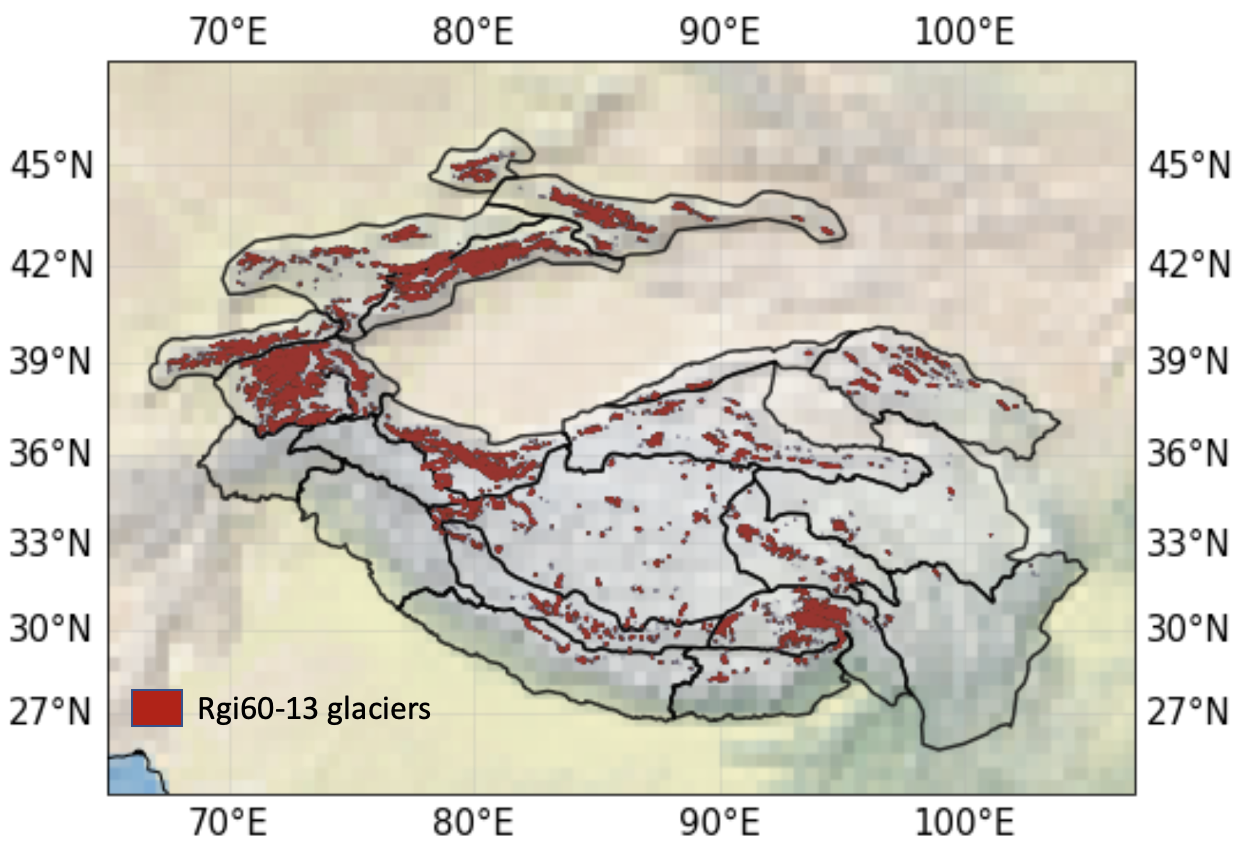
RGI60_13(Central Asia); RGI60_14(South Asia(West)); RGI60_15(South Asia(East)). References:
- RGI Consortium (2017). Randolph Glacier Inventory – A Dataset of Global Glacier Outlines: Version 6.0: Technical Report. Technical report, Global Land Ice Measurements from Space. doi: 10.7265/N5-RGI-60.

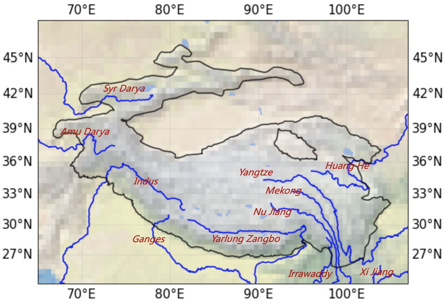
Main rivers in HMA References:
- download from: https://datacatalog.worldbank.org/search/dataset/0042032

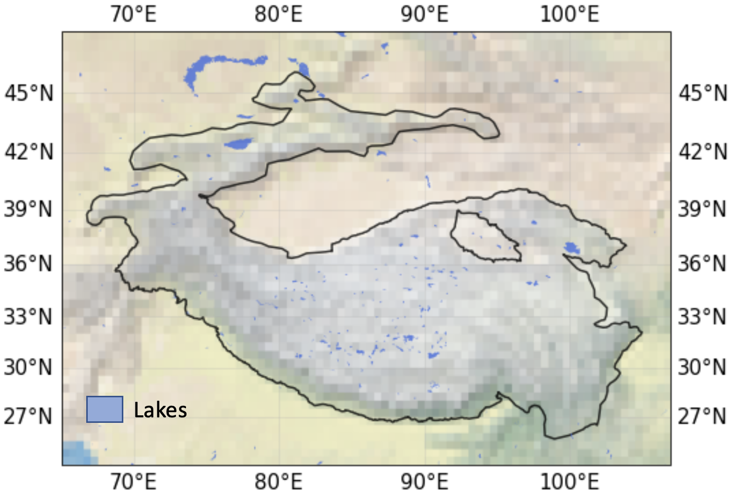
Global Lakes and Wetlands Database Level-1 (GLWD-1) Dataset. References
- Lehner, B. and Döll, P. (2004): Development and validation of a global database of lakes, reservoirs and wetlands. Journal of Hydrology 296/1-4: 1-22.