Shoreline_extract
Matlab scripts for extracting subaerial delta shoreline from a collection of Landsat images.
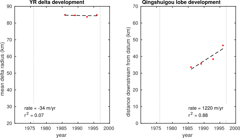
Simplified demonstration version of the code used in Moodie et al. to make the shoreline traces and determine the rates of delta development of the Yellow River delta.
Dependencies
This code was written with Matlab 2017b on Ubuntu 16.04. It has intentionally been written to be OS agnostic, but does depend on Matlab 2017 or newer. It has successfully been run on Matlab 2018b (latest tested version).
Limitations
This code was written to process Landsat images of the Yellow River delta, China. While most of the code is agnostic of the image/location it is processing, there are some operations that are specific to the location.
These limitations mainly occur in the context of image cropping and shoreline extraction:
- the limits of cropping are explicitly defined in the code
- a padding operation assumes land is in the lower left of the image
- some size parameters in shoreline extraction may need to be tweaked
The code will probably not work out of the box when applied to another system because of these limitations, BUT with a minimal amount of work (the authors are happy to help!) it could be made to work.
Using the program
Obtain the source code
The code should be downloaded by cloning this repository. WARNING: the default branch of this repository is almost 1 GB in size, because it contains 4 Landsat Level 1 products (though these have also been stripped to only necessary parts to reduce their size).
This default branch can be cloned with:
git clone https://github.com/amoodie/shoreline_extract.git
A branch of the repository without the data is also available, for a reduced file size or if you wish to use your own data with the codebase. This version can be cloned with:
git clone -b no_data https://git@github.com/amoodie/shoreline_extract.git
File/folder structure
A tree of the default branch, simplified for brevity, is produced below
.
├── data/
│   ├── LT04_L1TP_121034_19890128_20170204_01_T1/
│   ├── LT05_L1TP_121034_19851125_20170218_01_T1/
│   ├── LT05_L1TP_121034_19921112_20170121_01_T1/
│   ├── LT05_L1TP_121034_19951223_20170105_01_T1/
│   ├── empty.txt
│   └── qinshuigou_channelline.csv
├── output/
|   ├── *.mat
│   └── empty.txt
├── private/
├── source/
│   ├── build_shorelineset.m
│   └── explore_shorelineset.m
├── LICENSE.txt
└── README.md
The main functions live in the source folder.
This folder contains two files:
build_shorelineset.mexplore_shorelineset.m
These files make up the application, and should be run sequentially.
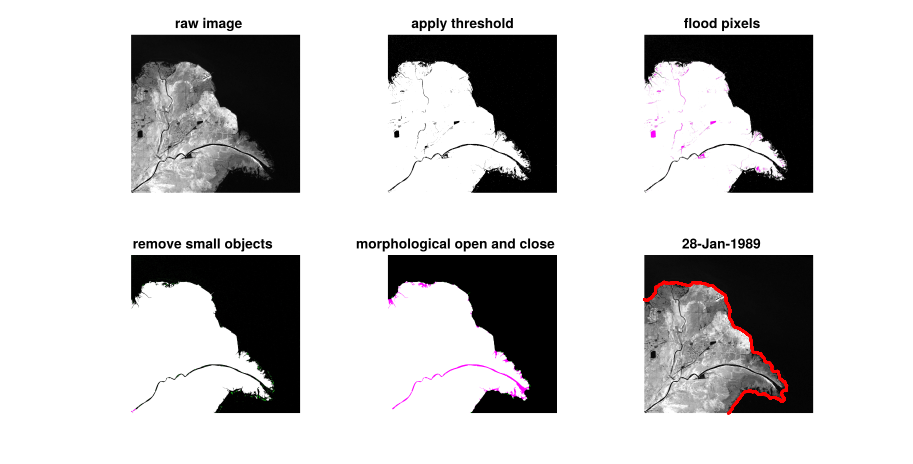
The build_shorelineset.m file processes the raw data into a collection of data files that contain xy coordinates of the shoreline.
Then, explore_shorelineset.m manipulates the extracted shorelines to determine usable data from the shoreline trajectories.
After running these scripts, the output folder will be populated with the shoreline location and processed data.
The data used in developing the script are provided as part of this repository, but you can also obtain them (or others) for yourself from the Level 1 Landsat data at the USGS Earth Explorer website. There were four scenes used to make the images and plots in this README:
LT04_L1TP_121034_19890128_20170204_01_T1LT05_L1TP_121034_19851125_20170218_01_T1LT05_L1TP_121034_19921112_20170121_01_T1LT05_L1TP_121034_19951223_20170105_01_T1
You can download these scenes explicitly, or any other scenes that fall into the WRS_PATH = 121 and WRS_ROW = 034 flight path from any time.
These files should be placed into the data folder as uncompressed folders (see the file tree above for where the folders should be located).
Actually, the folders could be placed anywhere, if the meta.directory parameter in build_shorelineset.m is changed to the appropriate path.
The private folder contains the images and movies used in this documentation.
Running the program
Once the data are properly organized into the data folder, you can open your Matlab environment and navigate to and open build_shorelineset.m.
See the parameter list at the top of the script, and make any modifications if necessary.
Run the program.
After finishing this script, you can navigate to and open the explore_shorelineset.m script.
This script can be run as is, assuming you have not changes the data output location from the previous script.
This will produce a demonstration plot of the shoreline intersection routine and the resulting data from all the shorelines.
Documentation
The only documentation to this program is this file. However, the code is pretty well commented, and any changes you need to make should be pretty easy.
If there are actually people hoping to use this code, I will add more documentation support for both the program files, and potentially further split the files into function files for easier documentation.
The shoreline extraction routine
The shoreline extraction routine is described in the supplementary material in Moodie et al.
License
This program is licensed under the MIT license, see LICENSE.txt for the full license.
Disclaimer and acknowledgments
This code was written by Andrew J. Moodie and Brandee Carlson as part of a National Science Foundation funded research project assessing the sustainability of anthropogenically influenced deltas. The research is supported by Grant No. 1427262 and an NSF Graduate Research Fellowship to A.J.M. under Grant No. 1450681. Any opinion, findings, and conclusions or recommendations expressed in this material are those of the author(s) and do not necessarily reflect the views of the National Science Foundation.


