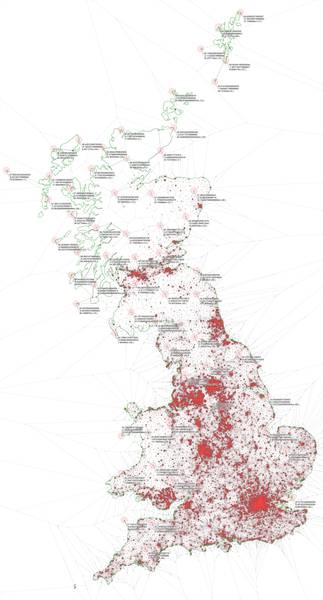
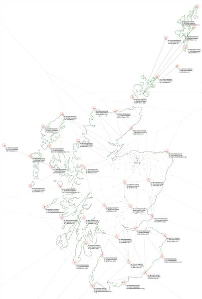
Based on a set of locations (nodes) these scripts will try to figure out which points are the furthest away from these locations in a country.
It uses the following algorithm:
First it tries to find locations, which are potentially far away from our input set:
- It generates the Voronoi-graph based on the input set of locations
- It checks each of the generated vertices whether they are within the country's boundaries or not. Any point that's in the boundary gets added to the potential list of candidates
- Each of the vertices of the boundary are also added to the potential candidates list
- Finally any point on the boundary that is bisected by a Voronoi-edge is also added to the candidate list
The vertices of the Voronoi-graph are good candidates as they are the furthest point away from their neighbouring locations. However some of these points can be outside of the country's boundaries. To make sure they are also accounted for both the vertices in the country's boundaries are added to the list, as well as any place where the boundary was intersected by a voroni-edge. These are the points where distances are at a local maximum, so it's worth checking.
Once we have a set of potential locations, we simply go through them, find the nearest node to them, and check it's distance. Then we sort these nodes according to how large it's distance is.
To make the result not too clustered, we also remove points that are too close together at the end. This makes sure that remote border locations, which have a large amount of points in the search set will not be over-represented in the result, as we are interested in more distinct locations anyway.
Once we have the end values we render them to a map as well.
Note: the voronoi diagram is calculated using a metric on a plate carrée projection of longitude and latitude values, with an optional adjustment based on median latitude. For countries that span a large latitude range this might not be exact enough on the top and bottom part of the image, and might skew which points should be considered and which not. However distance calculations afterwards are done using great circle distances, so they should be accurate.
The app requires Node.JS to be installed, and the proper modules downloaded using npm install.
Once the setup is done create a new config file (or use any existing one).
You can check any of the examples inside the configs directory for templates.
Once you have the config simply run:
./generate_data.js <config_filename>
Some useful config values you can change:
INPUT_FILE_NAME: The input file containing the set of points we wish to avoid. It's a JSON array of[lon,lat]pairs preferably in WGS84.BOUNDARY_FILE_NAME: The file containig the boundary of the country in geoJSON multi-polygon format. For fast results only run it one land, but the script should work fine with datasets containing islands as well.OUTPUT_FILE_NAME: The file where the rendered image should be saved without extension. A.png,.svg,.geojsonand.jsonfile will be generated with thet filename prefix.IMAGE_WIDTH: Set this to the preferred image width size. The height of the image will be calculated automatically to keep the aspect relations.NUMBER_OF_CLUSTERS: The amount of points we wish to obtain at the end.CLUSTERING_MINUMUM_DISTANCE: Sets how far away two points need to be (in km) in order to be considered for inclusion.BORDER_PROCESSING_MODE: Determines what kind of intersections between the Voronoi-edges and the border should be checked. 0 is the slowest but most complete, 1 is a middle ground, which should work for most cases, but might skip some points around concave features and islands, and 2 is a fast solution that only gives satisfactory results on single-polygon, convex countries.AUTO_ADJUST_COORDINATE_MAPPING: Sets whether to use plain plate carrée projection, or try to compesate is based on the median latitude for a nicer image. Should be turned off if the median latitude is too far off the North or South, or not in the[-90..90]range.
You can also change the styling on the output by changing any of the other values, please consult the start of the generate_data.js file about the available options.
In the generated output you can find the following files:
.pngand.svgdepicting the Voronoi-graph, the potential points, and the top X clusters that were selected including details on where they are, and how far they are from the closest node..geojsonshowing all of the nodes, and the selected clusters along with some metadata. The bounday of the country is also included for reference..jsonadditional file containing the following details:boundingBox: the bounding box of the country and the nodespoints: the list of all potential points where there is a local maximum for distance, along with a link to one of the neighbours and this distance. The format is[[pointLon,pointLat],[destinationLon,destinationLat],distanceInKm]destinations: the list of all potential points filtered down by clustering points that are close to each other out. This will effectevily partition the country up into clusters that are cover similar areas. For the top X clusters this will not only contain one neighbouring point but others as well - which might be slightly further to the point though.statistics: this will contain some average and median calculations. The main thing to note here is thedestMedian, as this will show the median value of the distances of the clusters. As the clusters will effectively cover similar areas, this means half of the country will be covered by half of the clusters, and the other half by the others. So the median distance would mean that you have a 50% chance to be in a cluster where no matter where you are you are closer to a node than the specified distance. In other words if someone drops you off randomly in the country it's likely you'll be at most this distance to the nearest. Note: this is only a rough approximation and will only be true in case the points are not too sparse.
Some examples:
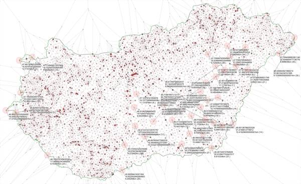
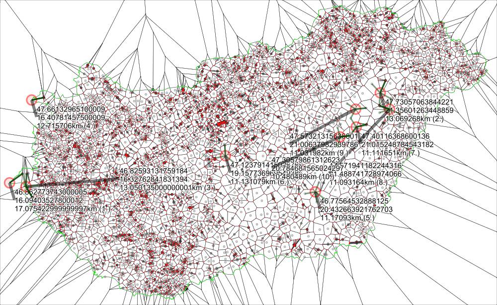
Almost all settlements in Hungary have a street or square named "Kossuth". If you wish to be the furthest away from any of them, the best place is around the tripoint border between Hungary, Austria and Slovenia where you'll be 17km away from one.
On average, if you are in a random place in Hungary, it's likely you will be within 3km of a Kossuth street or square.
The dataset is called kossuth_points.json. To generate the file I used the following scripts:
-
Download Hungary.osm.pbf from http://data.osm-hr.org/hungary/
-
Extract all streets from the osm into an xml:
osmosis –read-pbf-fast hungary.osm.pbf file="hungary.osm.pbf" --way-key keyList=highway --way-key keyList=name --used-node --tag-filter reject-relations --write-xml file="hungary2.osm"
- Extract street names from it and filter by kossuth
osmconvert hungary2.osm --all-to-nodes --csv=""@id @lon @lat name" --csv-headline | grep -i kossuth > streets.csv
- Finally I converted the CSV to JSON using vi manually.
There's also a script added called generate_street_names.rb that does steps 3 and 4 automatically to a list of street names
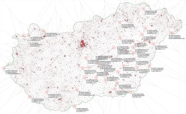
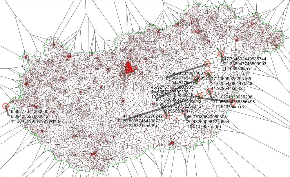
There's plenty of sports complexes in Hungary. To be the furthest from one, you have to be just North-East of Hortobágy National Park in the middle of nowhere, where the closest complex will be a mere 12km away.
On average, if you are in a random place in Hungary, it's likely you will be within 3.5km of a Sports Complex.
The dataset is from a list I gathered for another project called Magyar Stadionok: https://github.com/sztupy/magyar-stadionok
Also it's widely known that there are a lot of pubs in the UK. However there's not that many of them in the Highlands, you can actually be 72km from one if you go to the right spot (or, if you include Hirta Isle the distance is 80km).
The best you can do is 13km in Wales, and 11.8km in England (excluding Lundi Isle where it's 26km).
On average, if you are in a random place in Great Britain, it's likely you will be within one km of a pub
Data source: https://www.getthedata.com/open-pubs
The Isles are left out from distilleries unfortunately, especially Shetland, where Unst is 240km away from the nearest distillery. On the mainland... well you have to head towards England to get 102km away from Scotch.
On average, if you are in a random place in Scotland, it's likely you will be within 15km of a Distillery
Dataset is from here: http://adn.biol.umontreal.ca/~numericalecology/data/scotch.html
