Implementation for our ISPRS 2020 paper PARKING OCCUPANCY ESTIMATION ON SENTINEL-1 IMAGES.
Authors:
Positions can be generated from KMLs for example:
python utils_generate_positions_from_kmls.py kmls_folder id
Where kmls_folder is a folder containing kmls and id is an identifier (for example "retail_parkings")
Generates a NPZ file containing coordinates of all parkings to monitor in the positions folder.
For example, you can run the following command:
python utils_generate_positions_from_kmls.py sample_kml_folders test_parkings.npz
That will generate the positions/test_parkings.npz file.
This file can be opened with python:
import numpy as np
data = np.load('positions/test_parkings.npz')
data['shapes'] # contains all parkings coordinates
data['dirnames'] # contains filenames of kmls
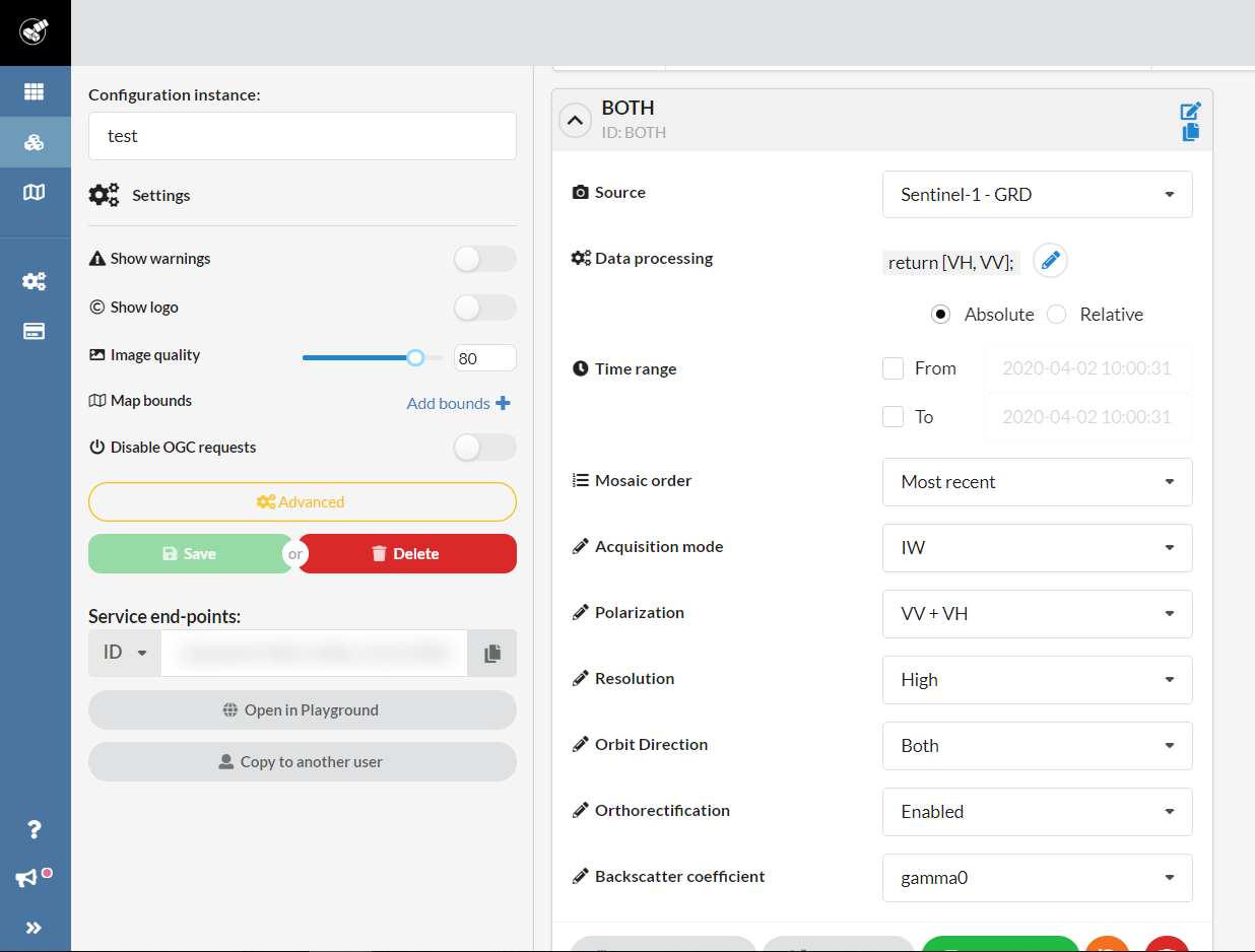
Prior to this step, we assume that you have created a sentinel-hub instance and that you have added the BOTH layer configured as shown below.
Generate dataset (example below from sentinel-hub website)
python generate_dataset_sentinelhub.py id sentinel_hub_instance_id
Where id is an identifier (for example "retail_parkings"), and sentinel_hub_instance_id is the Sentinel-hub instance id.
Generates folders in data/{id} containing images.
Example:
python generate_dataset_sentinelhub.py test_parkings {{YOUR_SENTINEL_HUB_ID}}
Will generate in the folder data/test_parkings all images data. The inside structure is the following:
- parking_1
- images # contains all images of parking 1
- 20190101_060728_S1A_DESCENDING_008.tif
- ...
- metadata.npz # contains several informations about the parking (bounding box, shape of parking)
- images # contains all images of parking 1
- parking_2
- ...
Generate parking masks.
python generate_masks.py
Generates images (all ids) in data indicating where the parking is and where it is not.
Generate parking masks.
python generate_stats_per_orbit.py id
python generate_masks_minus_always_occupied.py id
Where id is an identifier (for example "retail_parkings").
generate_stats_per_orbit.py generates stats per orbit (median, std, min).
generate_masks_minus_always_occupied.py generates a mask removing areas where it is always occupied.
Estimate occupancy rates.
python estimate_simple.py
Applies a simple thresholding on all images (all ids). See parameters python estimate_simple.py --help.
TODO
CSV are generated using following script:
python generate_csvs.py id
Where id is an identifier (for example "retail_parkings").
CSVs and graphs are generated in the output_csv/{id} folder.
