Click below to try:
------------------> TRY ONLINE <------------------
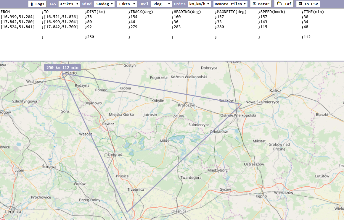
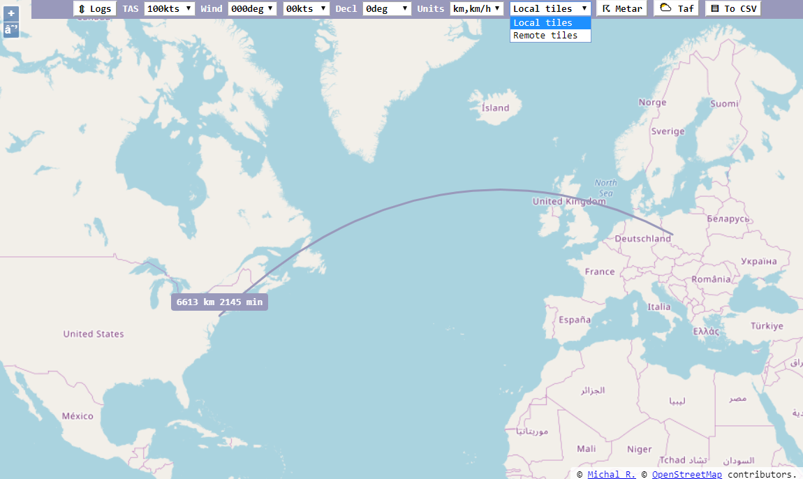
- Flight planning with wind and magnetic declination correction with great circle path for longer routes
- Output in
km/h,kmornm,kts, input via selection of value (both unit systems shown)

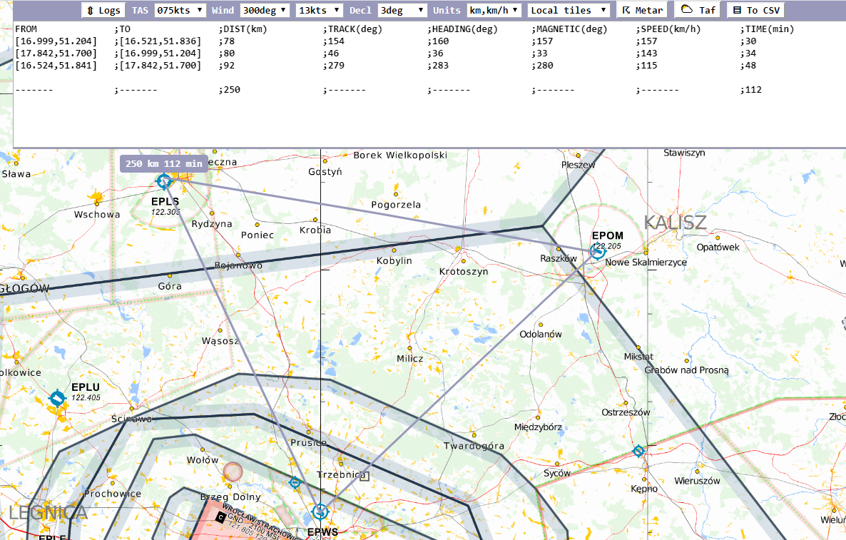
- Background map png tiles in
EPSG:3857format, like from https://www.openflightmaps.org/ (possibility to download ~1GB zip with tiles for given region, then pasteslippyTiles_original.zip\original\merged\256\latestcontents to local./tilesfolder)- Default remote tiles from
https://{a-c}.tile.openstreetmap.org/{z}/{x}/{y}.png, possibility to change via?remote_tile_url={url1}&remote_tile_url={url2}&...

- Default local tiles from
./tiles/{z}/{x}/{y}.png, possibility to change via?local_tile_url=...

- Possibility to switch between background maps during planning route
- Remote maps work out-of-the-box, while local maps require setup
- Default remote tiles from
- Open
METARandTAFfor given route in separate page ([https://aviationweather.gov/adds/]), follows great circle path - Open
ADSBhistory based onICAOtransponder code (adsbexchange service) - Remember last path
- Export plan to CSV file for further adjustments in external tools
remote_tile_url- remote tile source url(s) with z,x,y coordinates embedded, likehttps://site.org/{z}/{x}/{y}.png, defaults tohttps://{a-c}.tile.openstreetmap.org/{z}/{x}/{y}.pnglocal_tile_url- local tile source url(s) with z,x,y coordinates embedded, likehttps://site.org/{z}/{x}/{y}.png, default for local execution -file:///site scheme, defaults to./tiles/{z}/{x}/{y}.pnglog_units- the resultCSVoutput units,metric(km/h, km) ornautical(kt, nm)z- the initialEPSG:3857zoom level, defaults to5lon- initial map's center longitude, defaults to16.5238lat- initial map's center latitude, defaults to51.8320
The assumption is that local tiles, by default located in ./tiles next to the html file, can be used as alternative background map layer. User can download the offline version from https://github.com/rogalmic/flight-planner/releases , which contains some tiles up to zoom level 6, then add more zoom levels for specific location from any source. This way planning can be done in offline scenario. User can also set 2 different urls for local/remote tiles, then switch then during planning (topography vs airspace).
Since this project goal is to be simple calculation helper, the wind is set manually. However once route is set, there is a way to query METARs and TAFs for given route. User needs to manually read the weather info and input wind direction and speed.
- OSM MAP VERSION
- OSM MAP VERSION (results in nm and kts, US centered)
- WIKIMEDIA MAP VERSION
- OPENFLIGHTMAPS MAP VERSION
- ARCGISONLINE MAP VERSION
- OPENTOPOMAP MAP VERSION
- as simple as possible with interaction options at every step, nothing purely automatic
- based on OSM, but with possibility to change to different source
- remember offline data in
tilesfolder, see https://github.com/hdjarv/osm-tile-downloader, offline deliverable built intravis
- recent browser with support for
HTML5andECMAScript 2015
- Really easy, just try :)
Visual Studio CodeGit
-
Get repo
git clone "https://github.com/rogalmic/flight-planner.git"
code "./flight-planner/"
-
Select debug option (chrome or firefox)
-
Run debug session
-
Optionally load tiles in proper folder structure to
./tiles/{z}/{x}/{y}.png(EPSG:3857format)
