PMGSY (Pradhan Mantri Gram Sadak Yojana) released ~7,97,300 geo-tagged rural facilities data on it's portal omms.nic.in
- License: Government Open Data License - India (GODL).
- Citation: PMGSY Rural Facilities Dataset, Ministry of Rural Development 2020 http://omms.nic.in
- This repo contains cleaned csv files for individual state.
- Combined India dataset (120MB) is available on Kaggle
- Last updated on 21th December 2020. When possible please refer to original source (as data could update)
Visuals are shared under Creative Commons Attribution 4.0 International (CC BY 4.0) license.
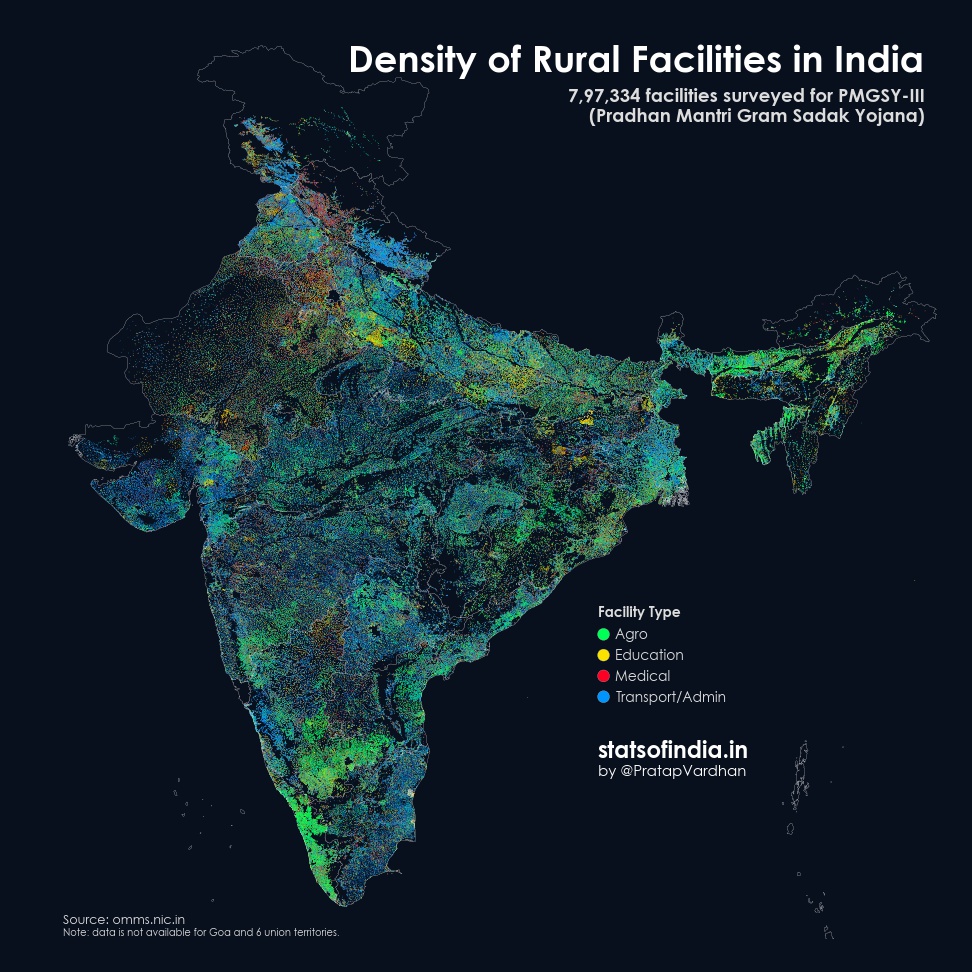
PMGSY recently released ~7,70,000 geo-tagged rural facilities data on it's portal. This map shows the density across India colored by category type (Agro, Education, Medical, Transport/Admin).
— Pratap Vardhan (@PratapVardhan) November 27, 2020
'Glow' signifies concentration. Read the thread for details. Caveats below. 1/n pic.twitter.com/occs2fRvcf
Columns include
- State
- District
- Block
- Habitation Name
- Habitation ID
- Facility Name
- Address
- File Upload Date
- Facility Category
- Facility Subcategory
- Lattitude
- Longitude