A pure python toolbox for easy programmatic processing of remote sensing imagery from various public sources.
- Bursts from Sentinel-1 TOPS InSAR pairs can now be processed and combined without using SNAP.
- A new processor for IW subswath can be used -- see
s1-easy-tops-insar.ipynbin thenotebookfolder. - Bursts can also be processed individually using the
S1.coremodule for more flexibility. Results can be further processed as in-memory arrays or written as GeoTiff files. An example of such processing is found ins1-tops-core-demo.ipynb - More features/improvements will be added in the near future such as:
- Better memory and multi-core handling (probably using
dask) - Full product (all subswaths and polarization) processing with optional AOI selection
- Multi-temporal stacks
- Radiometric terrain correction
- Better memory and multi-core handling (probably using
- In a more distant future:
- Tools for change detection, polarimetry, speckle filtering, DEM generation
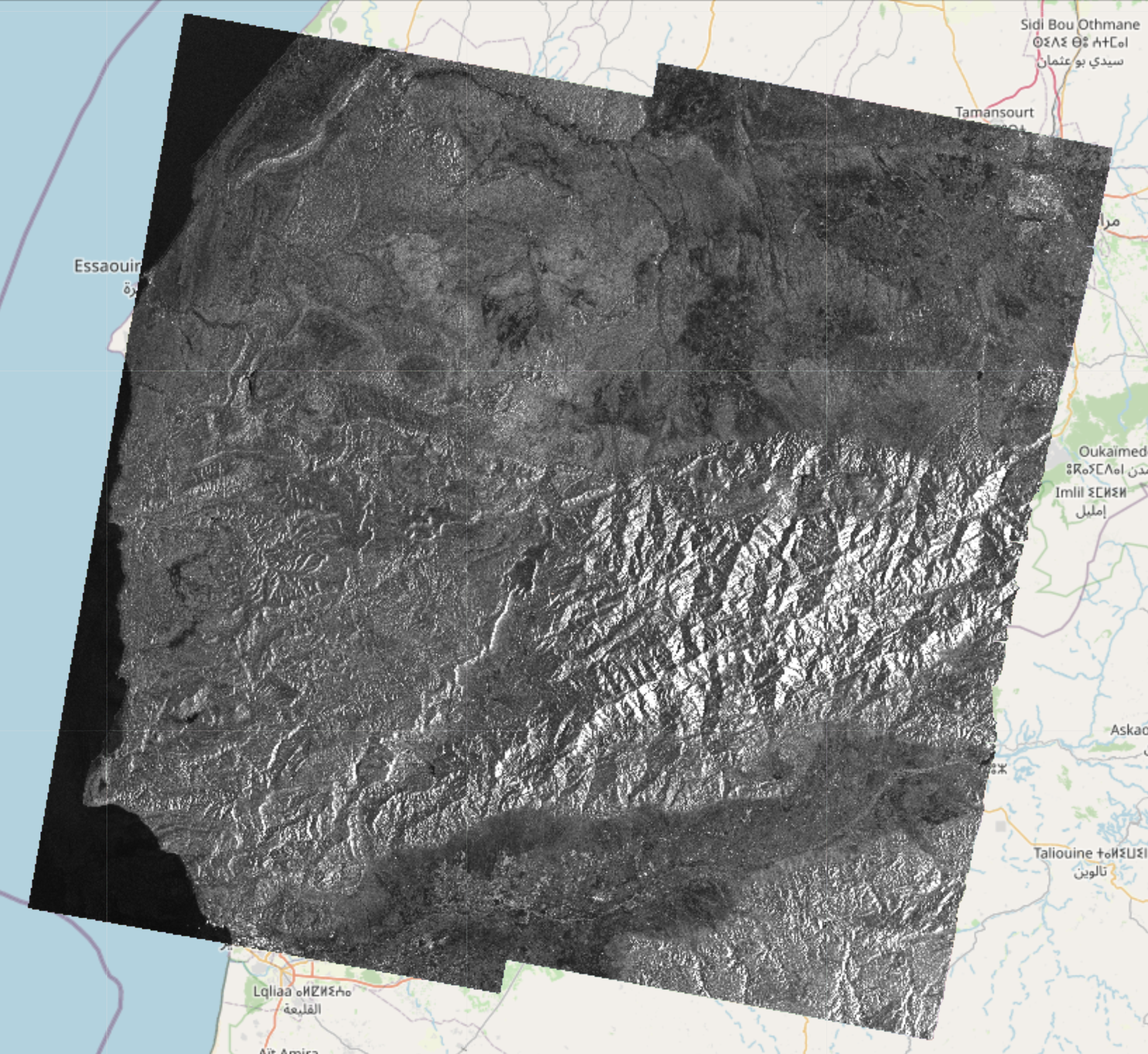
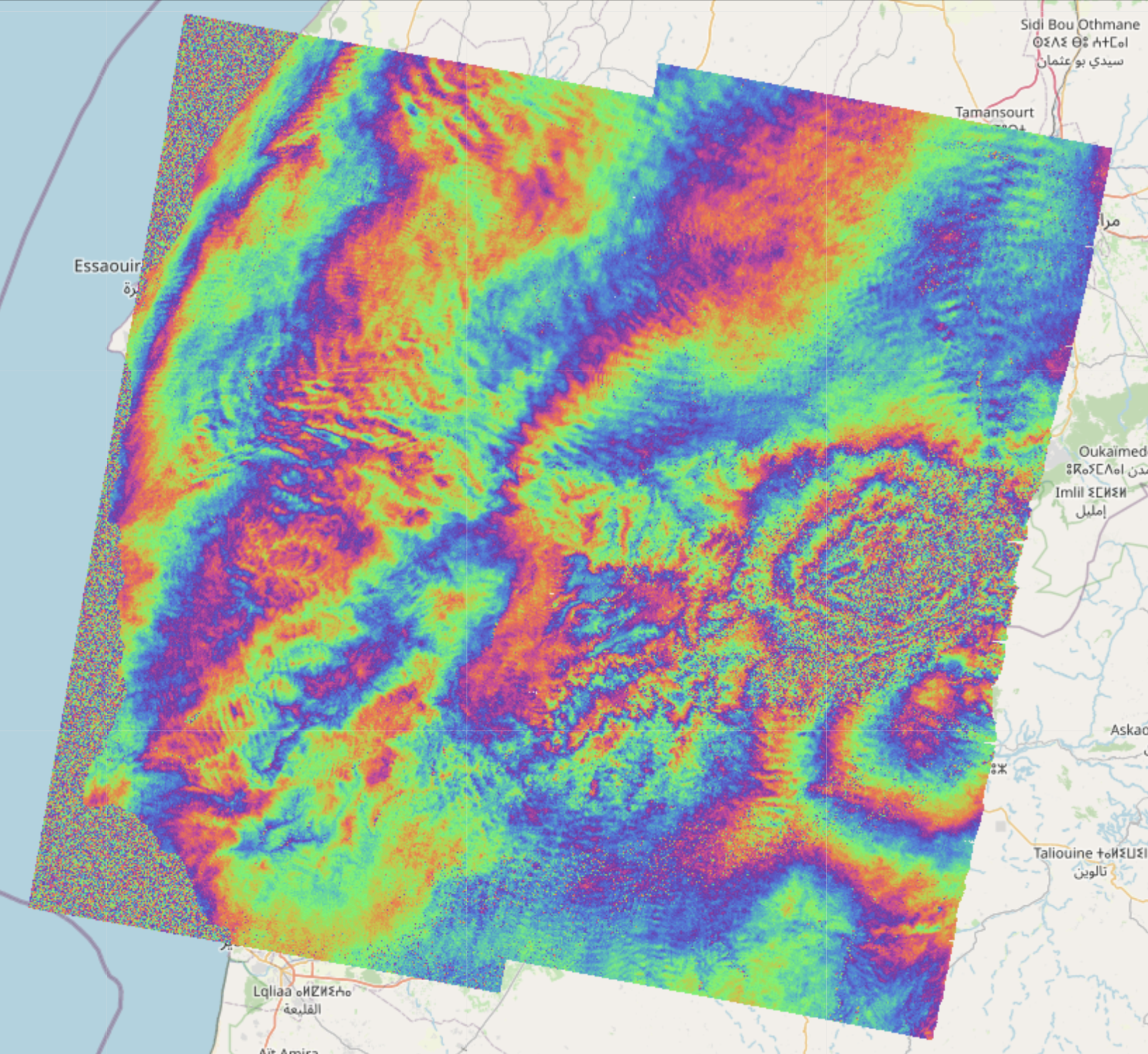
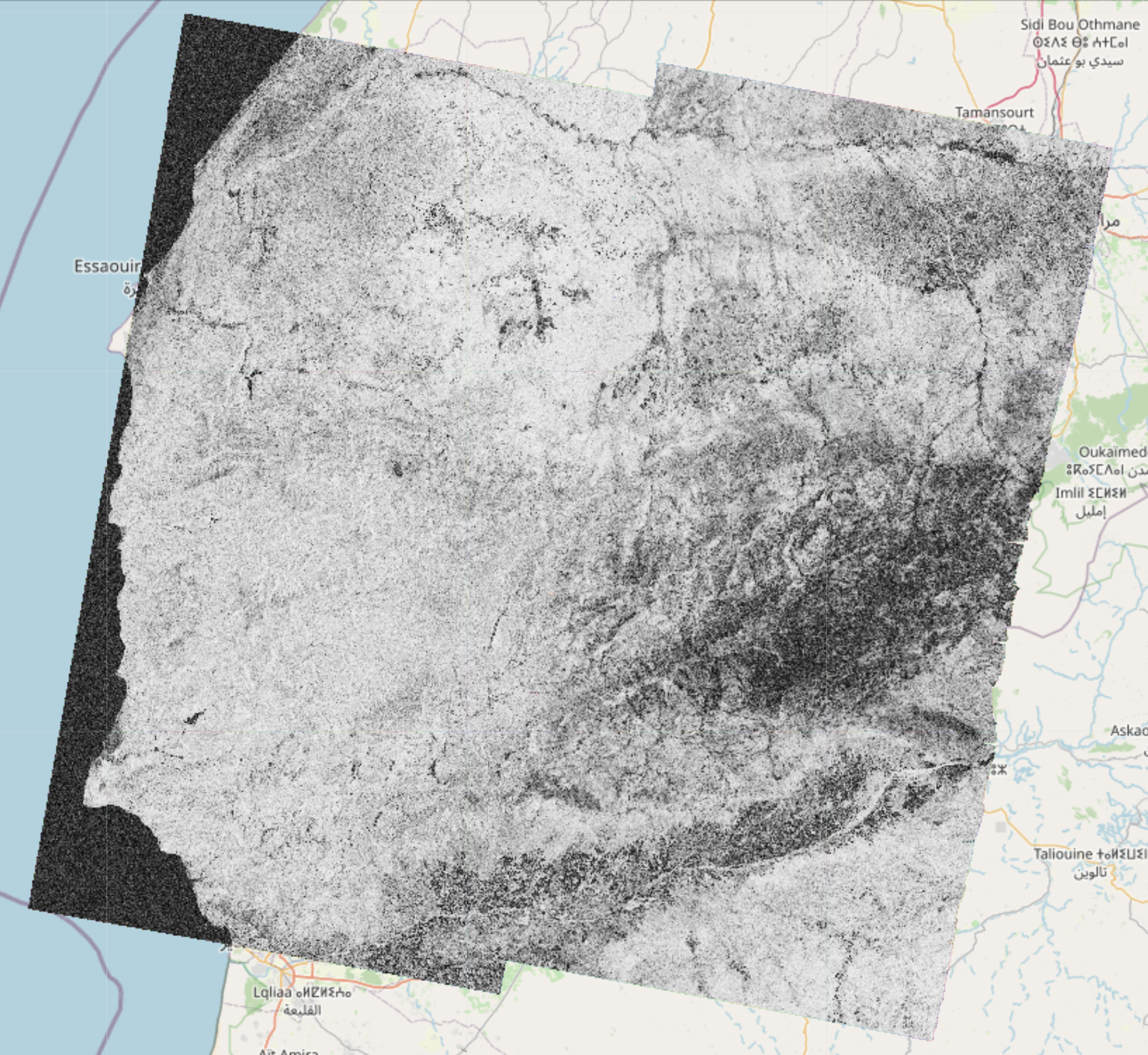
Here are examples of amplitude, phase and coherence computed using this framework:
- Because this project is in active development the API is likely to change.
- Currently, the available features are:
- Sentinel-1
- New standalone InSAR processor (see previous section)
- Legacy InSAR processor (running SNAP graphs through PyroSAR) computing the coherence, phase and intensities of an interferometric pair of SLC products
- Write the result as a geocoded (terrain corrected) COG (Cloud Optimized GeoTIFF) file
- Display these rasters on top of a folium map in a jupyter notebook
- Sentinel-2
- Tile merging and geocoding
- Write any band to COG files
- Visualization of color composites (Natural RGB, CIR, SWIR, etc) on a folium map
- DEM
- Automatically downloads and crops a DEM given a geometry
- All products
- Search catalog (using EODAG) and download products
- Explore products by displaying their footprint on a folium map (custom function)
- Show remote and local images on top of folium maps in the notebook
- Sentinel-1
- Example notebooks can be found in the
notebooks/folder
- The package comes in two flavors
- A conda package that contains the main functionality (Sentinel-1 InSAR, Sentinel-2 tile mosaic and DEM download)
- A docker container (for more advanced users) that additonally works with a TiTiler server for interactive visualization in the notebooks
- The legacy SNAP based processor is only available in the docker version.
- It is recommended to first create a conda environment to avoid package conflicts
conda env create -n eo_tools
conda activate eo_tools
conda install conda-forge::eo_tools- It works as a dev container for VSCode.
- Clone into the location of your choice.
- Volumes paths can (and should) be changed in
docker-compose.yml. - After opening the main directory, VSCode should detect the devcontainer file and ask to build the container. Once the container is running, the example notebooks can be used.
- Alternatively, it should also be possible to start the container from the main directory with
docker-compose up -din a terminal and attach to the container with any editor supporting docker.
- Please make sure
jupyteris installed in your environment - Example jupyter notebooks demonstrate the different features
- For conda use the notebooks in the
notebooks-cfdirectory - For docker use the notebooks in the
notebooksdirectory
- This project was originally forked from: https://github.com/eo2cube/s1_processor/, however since 99% of the code is now original, I have detached the fork.
- Visualization functions are using TiTiler https://developmentseed.org/titiler/
- Product discovery and download are using EODAG https://github.com/CS-SI/eodag
- The old S1 processor uses pyroSAR https://github.com/johntruckenbrodt/pyroSAR which executes graphs with ESA's SNAP software https://github.com/senbox-org


