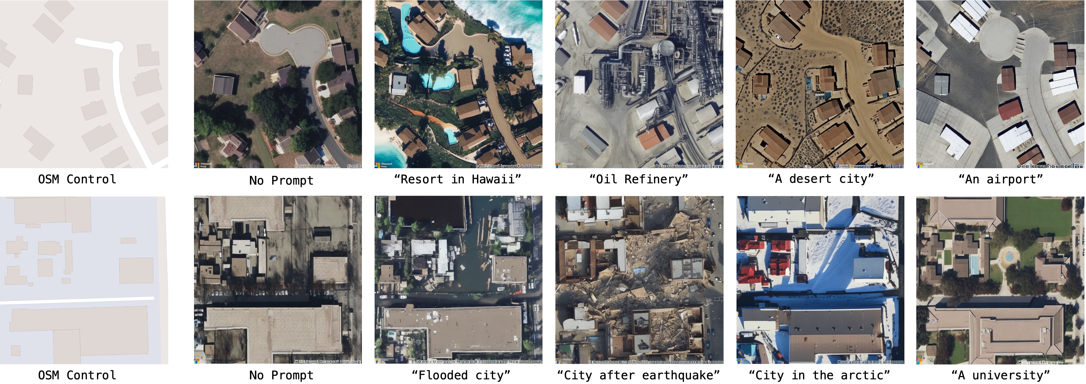
This repository is the official implementation of GeoSynth [CVPRW, EarthVision, 2024]. GeoSynth is a suite of models for synthesizing satellite images with global style and image-driven layout control.
Models available in 🤗 HuggingFace diffusers:
All model ckpt files available here - Model Zoo
- Update Gradio demo
- Release Location-Aware GeoSynth Models to 🤗 HuggingFace
- Release PyTorch
ckptfiles for all models - Release GeoSynth Models to 🤗 HuggingFace
Example inference using 🤗 HuggingFace pipeline:
from diffusers import StableDiffusionControlNetPipeline, ControlNetModel
import torch
from PIL import Image

img = Image.open("osm_tile_18_42048_101323.jpeg")

controlnet = ControlNetModel.from_pretrained("MVRL/GeoSynth-OSM")

pipe = StableDiffusionControlNetPipeline.from_pretrained("stabilityai/stable-diffusion-2-1-base", controlnet=controlnet)
pipe = pipe.to("cuda:0")

# generate image
generator = torch.manual_seed(10345340)
image = pipe(
    "Satellite image features a city neighborhood",
    generator=generator,
    image=img,
).images[0]

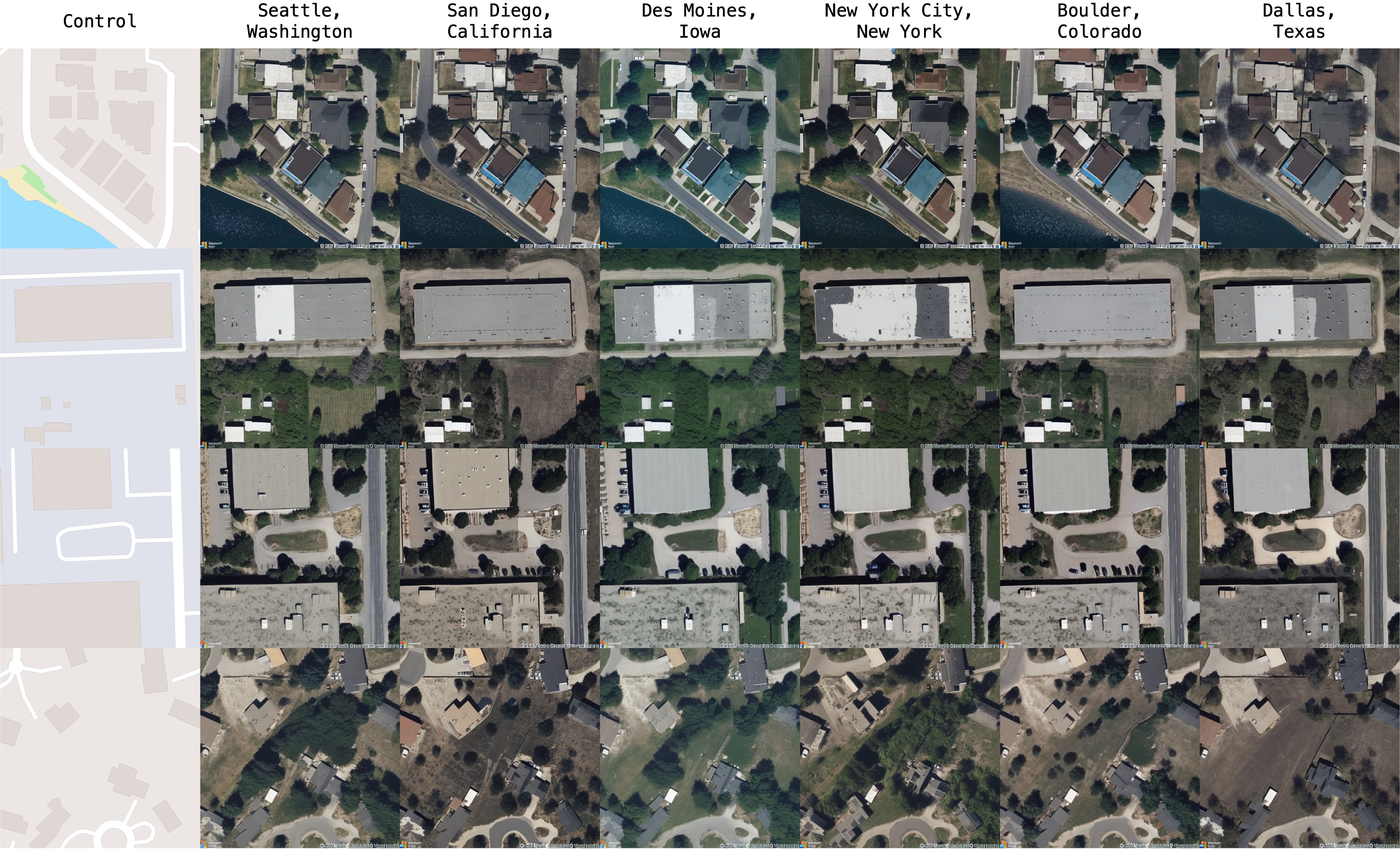
image.save("generated_city.jpg")Our model is able to synthesize based on high-level geography of a region:
Look at train.md for details on setting up the environment and training models on your own data.
Download GeoSynth models from the given links below:
| Control | Location | Download Url |
|---|---|---|
| - | ❌ | Link |
| OSM | ❌ | Link |
| SAM | ❌ | Link |
| Canny | ❌ | Link |
| - | ✅ | Link |
| OSM | ✅ | Link |
| SAM | ✅ | Link |
| Canny | ✅ | Link |
@inproceedings{sastry2024geosynth,
  title={GeoSynth: Contextually-Aware High-Resolution Satellite Image Synthesis},
  author={Sastry, Srikumar and Khanal, Subash and Dhakal, Aayush and Jacobs, Nathan},
  booktitle={IEEE/ISPRS Workshop: Large Scale Computer Vision for Remote Sensing (EARTHVISION),
  year={2024}
}Check out our lab website for other interesting works on geospatial understanding and mapping:


