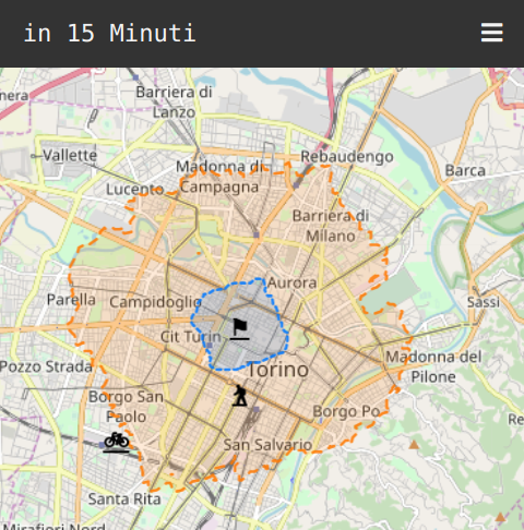
Get a map of your nearby zone and find out how far you can go in just 15 minutes.
You just need to click on the map to see coloured the zones reachable in that time, and you can share that map using a qrcode.
A stub for printing the map with the qrcode is also provided.
You'll need a .pbf file of the zone you're interested in (see for example
here, section
"OSM for Streets").
Create a pbf directory in the project's root; it will be mounted inside the
containers.
In ugly_conf you'll find a default configuration for the city of Turin,
Italy. Edit the limits for your latitude and longitude.
(Also note that there is some rounding up of the coordinates, so that queryes can be afficiently cached).
We'll serve our own tiles; for doing so we need to run
./init.shJust run
docker-compose upBe patient: the tiles server and the isochrone server are pretty big and needs some time for starting.
Then go to localhost:9090 and enjoy!
