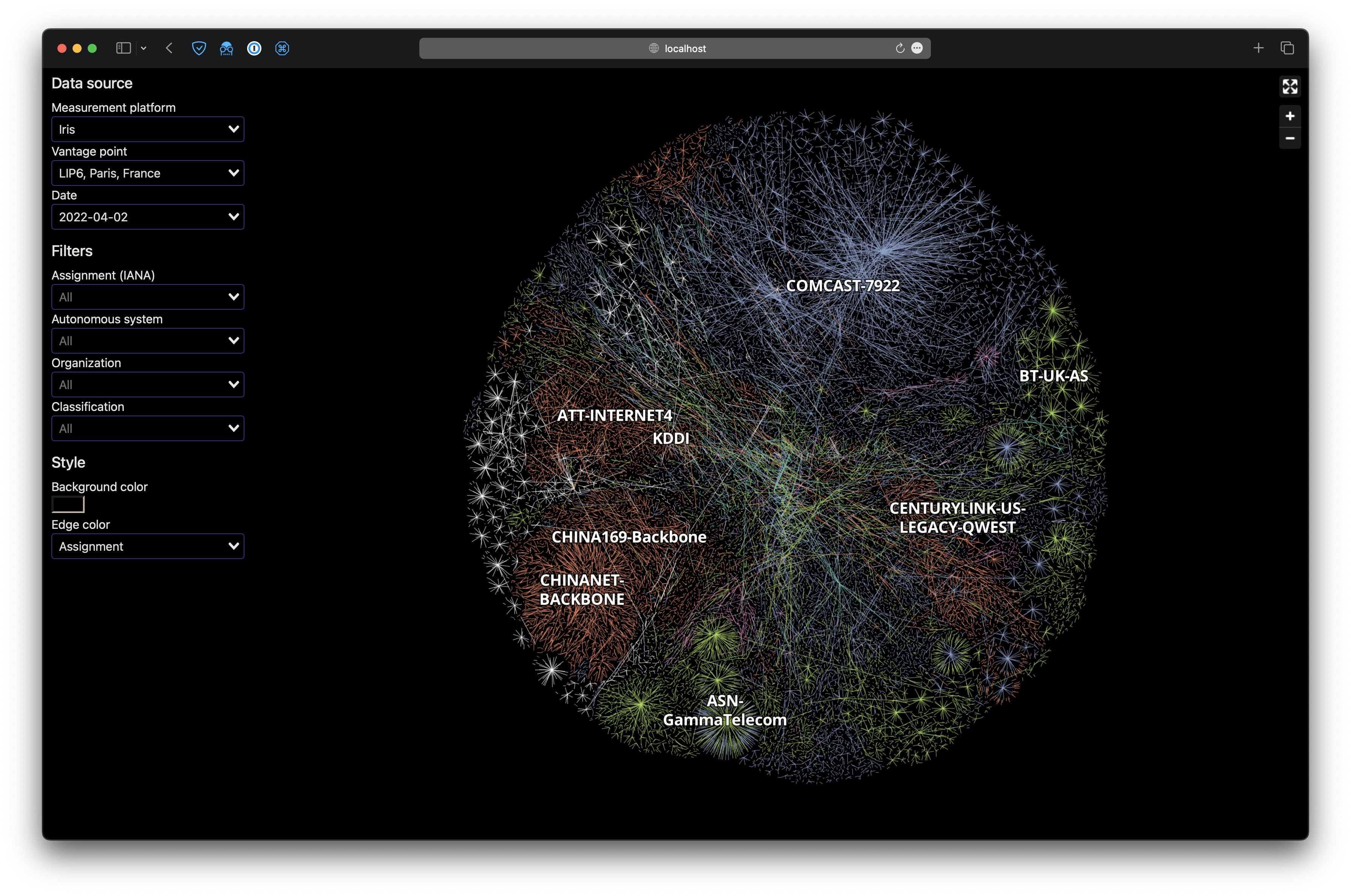
This repository contains the source code for the web interface demoed in "Towards an interactive visualization of the Internet" (slides, dataset).
To reproduce the web interface demoed in the talk, download the tileset (5.2GB) and start the server:
curl -Lo data/iris-2022-04-02.mbtiles 'https://zenodo.org/record/8034723/files/iris-2022-04-02.mbtiles?download=1'
docker compose up
Then, open http://localhost:1234 in your browser.
We provide four data files:
iris-2022-04-02.edges: the IP-level graph in the LGL formatiris-2022-04-02.layout: the coordinates of each IP address as computed by the LGL algorithmiris-2022-04-02.geojsonl: points and lines representing IP addresses and links, augmented with RIR and AS informationiris-2022-04-02.mbtiles: the tileset used by Mapbox GL
In this section we show how to build the tileset starting from the IP-level graph.
If you want to run this on your own data, simply replace iris-2022-04-02.edges with your own file.
You can use the write_lgl function of networkxtra to convert a graph to the LGL format.
- minilgl for computing the layout
- tippecanoe for building the tilesets
- Python and Poetry
curl -Lo data/iris-2022-04-02.edges.zst 'https://zenodo.org/record/8034723/files/iris-2022-04-02.edges.zst?download=1'
zstd -d data/iris-2022-04-02.edges.zstlglayout2d -t 4 data/iris-2022-04-02.edges
mv lgl.out data/iris-2022-04-02.layoutWith this graph containing 1.3M nodes and 3.5M edges this should take ~2 hours, depending on your machine and the number of threads set with -t.
Create a virtual environment for the internet_maps module and enter a shell inside it:
poetry -C python/ install
poetry -C python/ shell
Augment the graph with RIR and AS information, convert the node positions to the approriate coordinate system and output a GeoJSONL file:
internet-maps geojson --bgp-date 2022-04-02 --scale 10 \
    data/iris-2022-04-02.edges data/iris-2022-04-02.layout data/iris-2022-04-02.geojsonl
This is relatively fast, although downloading the BGP RIB can take some time.
We encode some metadata in the tileset name as a JSON string.
tippecanoe \
    --drop-densest-as-needed \
    --extend-zooms-if-still-dropping \
    --force \
    --hilbert \
    --maximum-zoom=g \
    --read-parallel \
    --name='{"data_source": "Iris", "vantage_point": "LIP6, Paris, France", "date": "2022-04-02"}' \
    --output data/iris-2022-04-02.mbtiles data/iris-2022-04-02.geojsonl
This should take ~15 minutes depending on your machine.
