Created by Mariona Carós, Santi Seguí and Jordi Vitrià from University of Barcelona and Ariadna Just from Cartographic Institute of Catalonia
This work is based on our arXiv report, proceedings of the 24th International Conference of the Catalan Association for Artificial Intelligence (CCIA 2022)
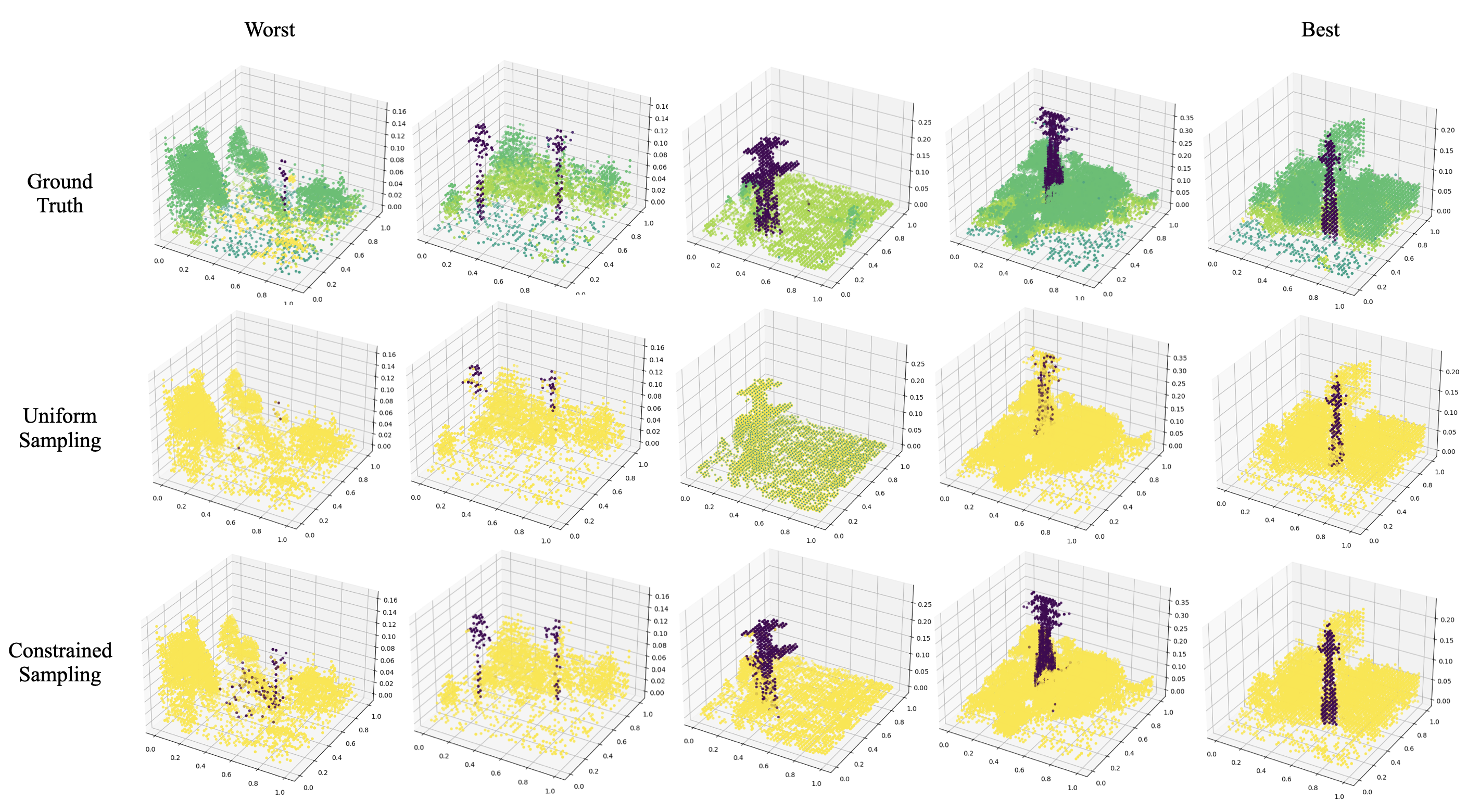
Airborne topographic LiDAR is an active remote sensing technology that emits near-infrared light to map objects on the Earth’s surface. Derived products of LiDAR are suitable to service a wide range of applications because of their rich three-dimensional spatial information and their capacity to obtain multiple returns. However, processing point cloud data still requires a large effort in manual edit- ing. Certain human-made objects are difficult to detect because of their variety of shapes, irregularly-distributed point clouds, and a low number of class samples. In this work, we propose an end-to-end deep learning framework to automatize the detection and segmentation of objects defined by an arbitrary number of LiDAR points surrounded by clutter. Our method is based on a light version of PointNet that achieves good performance on both object recognition and segmentation tasks. The results are tested against manually delineated power transmission towers and show promising accuracy.
Pipeline for 3D segmentation on LiDAR data with Deep Learning:
If you find our work useful, please consider citing:
@article{caros2022object,
  title={Object Segmentation of Cluttered Airborne LiDAR Point Clouds},
  author={Caros, Mariona and Just, Ariadna and Segui, Santi and Vitria, Jordi},
  journal={arXiv preprint arXiv:2210.16081},
  year={2022}
}
The code has been tested with Python 3.7, Pytorch v1.8, CUDA 11.6 on Ubuntu 20.04.
You may also need to install pdal library to transform height above sea (HAS) data into height above ground (HAG).
pip install pdal
Execute the following commands from the main directory.
First, execute:
python data_proc/1_get_windows.py --LAS_files_path path/LAS_files/here --sel_class $selected_class --min_p 20
This function splits our dataset into windows of a fixed size with and without our target object.
First x,y,z of points labeled as our target object are obtained.
Then, objects are segmented and the center of each object is stored, objects with less than min_p points are discarded.
Finally, two versions of the same point cloud window are stored. A first one with a tower and a second one without tower.
Point cloud cubes not containing the target object are stored as well.
Then, use PDAL library to get HAG data by executing the following code for all .LAS files:
pdal translate $input_file $output_file hag_nn --writers.las.extra_dims="HeightAboveGround=float32"
Finally, run:
python data_proc/2_preprocessing.py --in_path path/input_files --out_path path/output_proc_files
This function first removes ground and points above 100 meters and then stores a sampled version using the constrained sampling explained in the paper.
To train models use:
python pointNet/train_classification.py $data_path --path_list_files $list_files_split_path --batch_size 32 --epochs 50 --learning_rate 0.001 --weighing_method EFS --number_of_points 2048 --number_of_workers 4 --c_sample True
python pointNet/train_segmentation.py $data_path --path_list_files $list_files_split_path --batch_size 32 --epochs 50 --learning_rate 0.001 --weighing_method EFS --number_of_points 2048 --number_of_workers 4 --c_sample True
For model inference use:
python pointNet/test_classification.py /dades/LIDAR/towers_detection/datasets pointNet/results/ --weighing_method EFS --number_of_points 2048 --number_of_workers 0 --model_checkpoint $checkpoint_path
python pointNet/test_segmentation.py /dades/LIDAR/towers_detection/datasets pointNet/results/ --number_of_points 2048 --number_of_workers 0 --model_checkpoint
Our code is released under MIT License (see LICENSE file for details).


