Disclaimer: this project is not affiliated with the IGN, it merely uses its API.
This project aims to build a fully-fledged object detector using Tensorflow. It was built to :
- Improve my computer vision knowledge;
- Build a modern micro-service using an API;
- Work on EdgeML hardware : in my case, two Raspberry Pi 4B and a Coral TPU accelerator;
- Enhance my software engineering level (documentation, GitHub actions, Docker...).
A Docker image is available on Docker Hub. Install Docker, then run:
docker pull louistransfer/object_detection_ign:latest
To start the Starlite API, run:
docker run -p 8000:8000 louistransfer/object_detection_ign:latest
Install conda or mamba as a package manager, then get the latest code from the repository by running:
git clone https://github.com/louistransfer/object_detection_ign.git
Then:
cd object_detection_ign
To install the environment, run:
conda create -f environment.yml then conda activate satellite
Then start the Starlite API by running:
uvicorn main:app --reload
Once the API is running (check if the URL http://localhost:8000/health returns the value "healthy"), you can perform inference on two endpoints.
There are 3 possible options to test such requests:
- Use the built-in swagger by accessing http://localhost:8000/schema/swagger. By clicking on "Try me out", you can fill an address or coordinates and receive an image as a response;
- Use the "api_endpoints.ipynb" notebook located in the notebooks folder, which contains pre-defined JSON payloads;
- Use curl to send a request to the API :
On the address endpoint
curl -X POST http://localhost:8000/inference/address -H "Content-Type: application/json" -d '{"address": "Trocadéro, Paris", "layer": "HR.ORTHOIMAGERY.ORTHOPHOTOS", "zoom_level": 19}' --output detection.jpg
On the location endpoint
curl -X POST http://localhost:8000/inference/location -H "Content-Type: application/json" -d '{"latitude": 48.83980726885963,"longitude": -1.549046852─╯20273, "layer": "HR.ORTHOIMAGERY.ORTHOPHOTOS", "zoom_level": 19}' --output detection.jpg
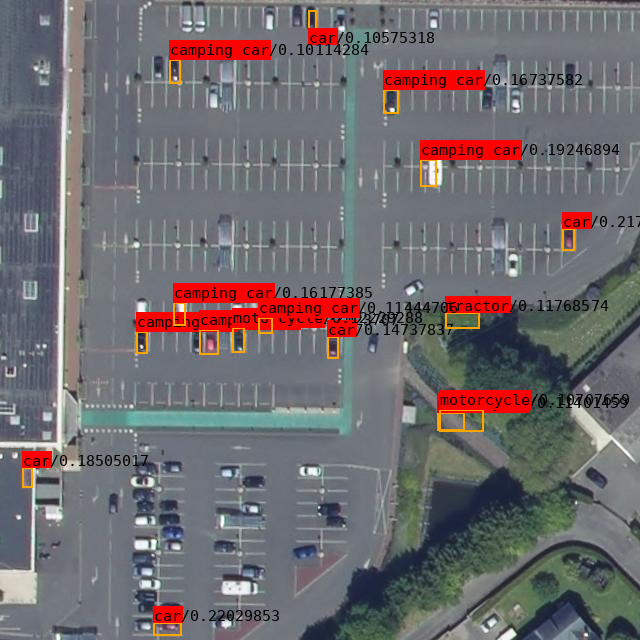
Both requests will be output to an image file called detection.jpg.
layer: the set of images to use. The default is "HR.ORTHOIMAGERY.ORTHOPHOTOS". See the list of layers on the IGN website here. zoom_level: level of zoom of the picture, from 1 (country scale) to 19 (neighborhood scale). In order for the detection model to work, it is recommended to stay at 19 (the maximum available zoom level).
The model is built on 3 independent modules :
- A WMTS Client which is used to either load satellite or aerial images from the IGN's WMTS API;
- An object detector leveraging Tensorflow's Model Maker API. The project was initially built on PyTorch, however the need to have a final model in .tflite format to use the Coral TPU required a framework change since conversions to the ONNX format failed;
- An API built using the Starlite module. FastAPI was considered, however the package's leadership is an issue. Starlite is more robust and has managed to remove the Starlette dependency recently.

