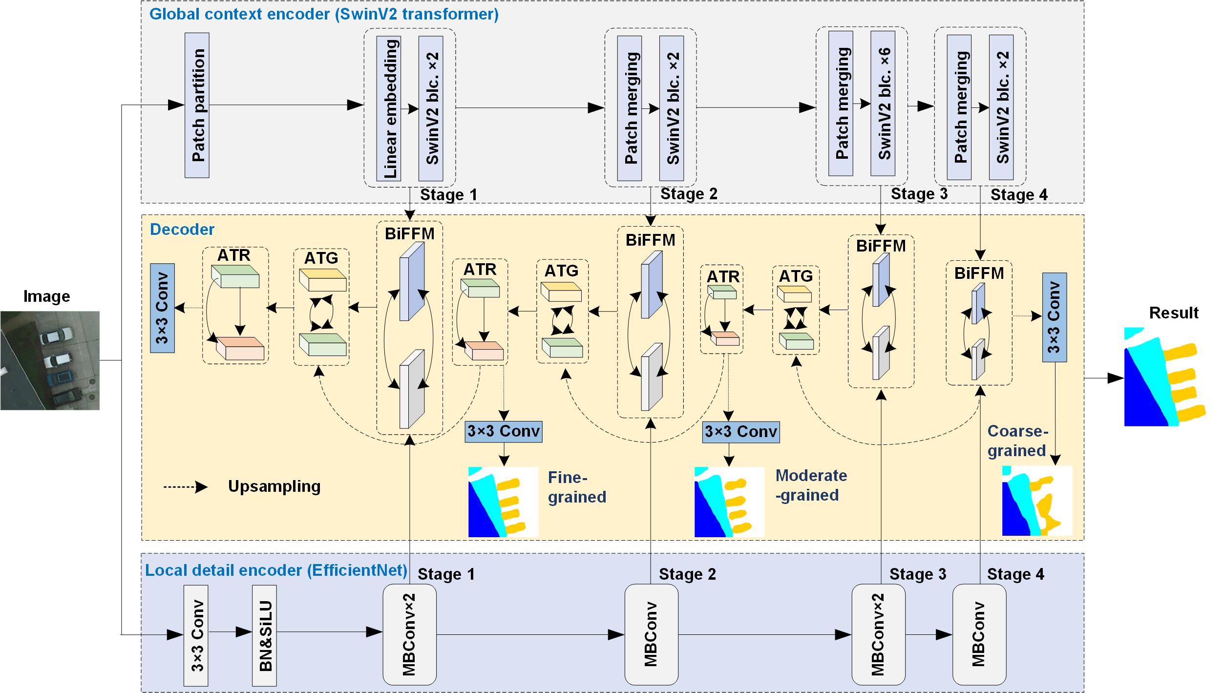
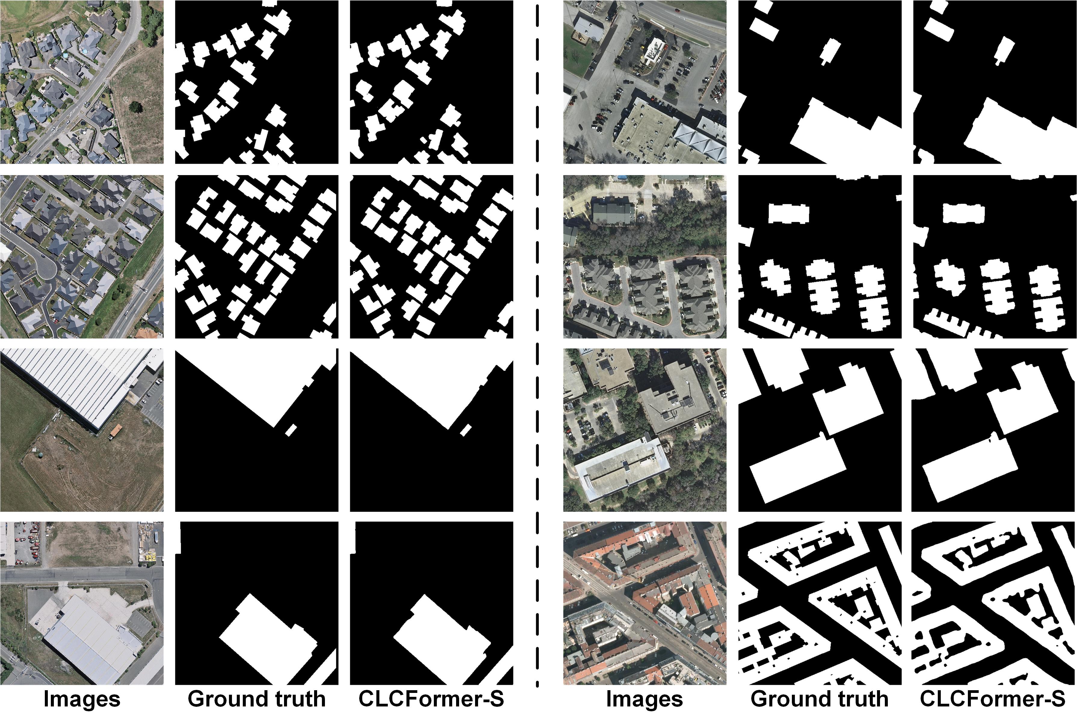
Official Pytorch Code base for [Integrating spatial details with long-range contexts for semantic segmentation of very high resolution remote sensing images]
This paper presents a cross-learning network (i.e., CLCFormer) integrating fine-grained spatial details within long-range global contexts based upon convolutional neural network (CNN) and transformer, for semantic segmentation of very high-resolution (VHR) remote sensing images.
The code is stable while using Python 3.7.0, CUDA >=11.0
- Clone this repository:
git clone https://github.com/long123524/CLCFormer
cd CLCFormer
To install all the dependencies using conda or pip:
PyTorch
timm
OpenCV
numpy
tqdm
PIL
Inria building dataset:https://project.inria.fr/aerialimagelabeling/
WHU building dataset:http://gpcv.whu.edu.cn/data/building_dataset.html
Potsdam dataset:https://www.isprs.org/education/benchmarks/UrbanSemLab/Default.aspx
Efficientnet & SwinV2: 链接:https://pan.baidu.com/s/1gVVYyFJa-3bGpaMMRtKGFg 提取码:vs11
-
Train the model python train_isic.py
-
Evaluate python accuracy_evaluation.py or python accuracy_multi_class.py
We are very grateful for these excellent works ST-UNet, TransFuse and BuildFormer, which have provided the basis for our framework.
Long J, Li M, Wang X. Integrating spatial details with long-range contexts for semantic segmentation of very high resolution remote sensing images. IEEE GEOSCIENCE AND REMOTE SENSING LETTERS, 2023,20:1-5. DOI: 10.1109/LGRS.2023.3262586

