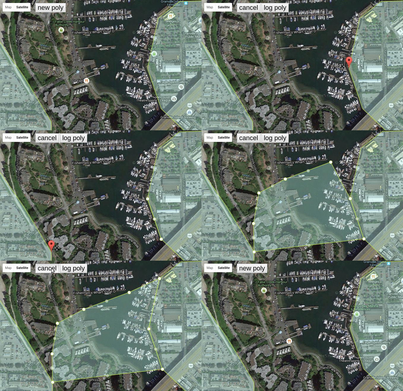
Google Maps V3 Polygon Snapping
Check out the jsfiddle
Vanilla JS: No Deps.
bower install polysnapper
###properties
map: agoogle.maps.Mapobject.threshold: an integer minimum number of meters that will cause a snap to occur.marker: agoogle.maps.Markerthat will appear when the users' mouse is within threshold distance from any point in polygonskeyRequired: a boolean. If true, requires key to be held for snappingkey: either'shift'or'ctrl'for now. requires keyRequired to betruepolygons: an array ofgoogle.maps.Polygonobjects that are snappable. These polygons MUST have asnapable:trueproperty set on them. This allows you to use already existing polygon collections and only snap to the polygons you desire.polystyle: an object literal describingStrokeWeight,fillColor, etc that will be used on the polygon the user begins drawing whenenable()is calledhidePOI: when drawing polygons, often Points of Interest get in the way of click events. You can automagically hide them onenable()and show them ondisable().onEnabled: a callback onceenabled()has been called.onDisabled: a callback oncedisabled()has been called.onChange: a callback when a point is added, removed, or moved.
###methods
enable(): invoke the custom drawing manager to begin drawing your polygon.disable(): cancel the custom drawing manager and remove the polygon from the map.enabled(): a boolean. whether we are in the enabled state, or not.polygon(): returns the currently editing polygon. You should call this immediately before callingdisable()to get a copy of your polygon.
a brief example might look like:
    var PS = PolySnapper({
          map: map,
          threshold: 20,
          key: 'shift',
          keyRequired: true,
          polygons: polygons,
          polystyle: polystyle,
          hidePOI: true,
          onEnabled: function(){
    		console.log("enabled");
          },
          onDisabled: function(){
    		console.log("disabled");
          },
          onChange: function(){
            console.log("a point was added, removed, or moved.");
          }
    });

    //first enable the manager (enter drawing mode)
    PS.enable();

    //user draws the polygon, point by point, snapping when necessary.
    //now, retrieve the polygon from the manager.
    the_poly = PS.polygon();

    //and disable the manager (exit drawing mode and clean up poly).
    //you should now use the_poly as a polygon reference
    PS.disable();