- Pytorch == 0.4.1
- Python 3
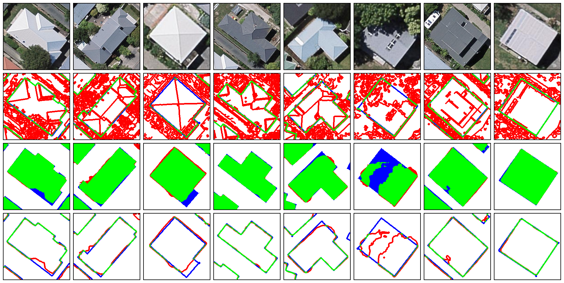
Geoseg
  ├── data/
  │   └── original image tiles
  ├── dataset/
  │   └── image&mask slices from data
  ├── checkpoint/
  │   └── pre-trained models
  ├── logs/
  │   ├── curve
  │   └── raw
  │   └── snapshot
  │   speed.csv
  ├── result/
  │   └── quantitative & qualitative result
  ├── src/
    ├── __init__.py
    ├── models
    │   └── network archs. FCNs, UNet, etc.
    ├── estrain.py
    ├── losses.py
    ├── metrics.py
    ├── runner.py
    ├── test.py
    ├── train.py
    └── vision.py
- Download repo.
git clone https://github.com/huster-wgm/geoseg.git
- Download data => NZ32km2
- Download data => Vaihingen
Details about the datasets can be found at Citation.
- Download pre-trainded models (FCNs)
- On NZ32km2(Binary building segmentation) Google Drive
- On ISPRS Vaihingen (6-class segmentation) Google Drive
(Only FCN8s, 16s, and 32s. Others here)
- Step-by-step tutorial
Jupyter-notebook LINK
- BR-Net on NZ32km2

- Update training & testing data
- Add support for more dataset
- NZ32km2 dataset
The location, scale, resolution and preprocessing of the NZ32km2 dataset please refer to paper.LINK
@article{wu2018boundary,
  title={A boundary regulated network for accurate roof segmentation and outline extraction},
  author={Wu, Guangming and Guo, Zhiling and Shi, Xiaodan and Chen, Qi and Xu, Yongwei and Shibasaki, Ryosuke and Shao, Xiaowei},
  journal={Remote Sensing},
  volume={10},
  number={8},
  pages={1195},
  year={2018},
  publisher={Multidisciplinary Digital Publishing Institute}
}
- ISPRS Vaihingen dataset
The location, scale, resolution and preprocessingof the ISPRS Vaihingen dataset please refer to paper.LINK
@article{wu2019stacked,
  title={A Stacked Fully Convolutional Networks with Feature Alignment Framework for Multi-Label Land-cover Segmentation},
  author={Wu, Guangming and Guo, Yimin and Song, Xiaoya and Guo, Zhiling and Zhang, Haoran and Shi, Xiaodan and Shibasaki, Ryosuke and Shao, Xiaowei},
  journal={Remote Sensing},
  volume={11},
  number={9},
  pages={1051},
  year={2019},
  publisher={Multidisciplinary Digital Publishing Institute}
}
- Source code
If you use the code for your research, please cite the paper.LINK
@article{wu2018geoseg,
  title={Geoseg: A Computer Vision Package for Automatic Building Segmentation and Outline Extraction},
  author={Wu, Guangming and Guo, Zhiling},
  journal={arXiv preprint arXiv:1809.03175},
  year={2018}
}