Contacts: caleb@earthrise.media, glynis@earthrise.media
We have developed a system that analyzes satellite data to detect aggregations of waste. To our knowledge, no operational monitoring system for municipal solid waste exists. On land, the spectral diversity of waste and land cover makes it challenging to devise spectral indices that can effectively discriminate waste.
This system was developed for the Global Plastic Watch platform, which targets the identification of plastic and municipal waste. With remote detection of waste aggregations, one can measure rather than model waste distributions and monitor waste site development through time, through a globally consistent and comprehensive dataset. The outputs of the tool can be seen at globalplasticwatch.org.
Our waste detection tool is composed of two convolutional neural networks that analyze and combine spectral, spatial, and temporal signals in Sentinel-2. The two networks work in tandem. Candidate regions generated by the first that are then cross-validated by the second. The first ingests per-pixel spectrograms, twelve-band spectra concatenated across two time steps. This data structure leverages both spectral and temporal patterns when assessing the likelihood that a given pixel contains plastic waste. Candidate waste sites are then generated via blob detection on the raster of positively-classified pixels. A second neural network validates the candidate sites. This secondary network operates on patches of raster data rather than individual pixels, incorporating spatial context in its evaluations along with the spectral and temporal data.
Points that are classified by both networks are denoted as "candidate sites." These candidates are then evaluated by a curator using publicly-available high-resolution satellite data, Google Street View imagery where available, and/or Planetscope data. This process has the benefit of limiting the number of false positives. However, it is imperfect. The high-resolution data is frequently older than the data used for detection. Thus, a candidate waste site might be rejected if it is newly created. Additionally, waste aggregations are not always obvious to identify even in the high resolution images. Thus, some sites are labeled as "uncertain" if the validator needs additional information.
Full details of the system are detailed in the technical paper, currently under review in Nature Scientific Reports, and available as a preprint on arXiv.org.
In this analysis, we evaluated every 10 × 10m Sentinel-2 pixel captured in all of Albania (2.87 × 10^4^ km^2^) at nine time steps between January, 2019 and March, 2021. This produced 2.5 billion predictions at the pixel level and 9.6 million classifications of patches. To reduce variance, we average the time-step outputs to arrive at a final assessment of the presence of waste.
Detection can be run in multiple configurations. We chose to run the system in a high sensitivity configuration, which produces more false positive results, but is also the most likely to identify waste. Though the client region of interest is limited to the areas near Vlora and to the south, we found it valuable to analyze the full country. Waste pollution is frequently transported by rivers, thus a waste site located outside of the study region may still contribute plastic pollution to the target area of interest.
Following manual candidate validation using high-resolution imagery, we were able to confirm the identification of 39 municipal waste sites and 13 industrial waste sites. Because construction waste is so visually and spectrally similar to rocky terrain, it is challenging to confirm these locations by visual inspection. We identified 49 of these sites that could not be confirmed, but are likely construction waste candidates.
For each of these sites, we created a metadata profile capturing geophysical and environmental parameters. These parameters are:
-
Distance to Nearest Waterway
-
Nearest Water Type
-
Drainage Direction
-
Height Above Nearest Drainage
-
Upstream Drainage Area
-
Elevation
-
Fine Earth Density
-
Landform Type
-
Population within 1, 5, and 10 km radii
-
Land Slope
-
Soil Clay Fraction
-
Soil Sand Fraction
-
Soil Great Group
-
Site Area
Based on these characteristics, we computed a risk score for each confirmed municipal waste site. The risk index is a composite of:
-
site area (smaller is better)
-
distance to waterway (further is better)
-
population within 5 km (fewer is better)
-
percentage of clay in the soil (higher is better to avoid groundwater contamination)
The z-score for each variable is calculated at every site using the population of all waste sites detected globally. Because all variables other than clay % follow a log normal distribution, the log of the value is taken before computing the z score. Distances to waterways are offset by +10 meters in order to avoid taking a log of 0.
Mathematically, the risk score is expressed as:
Each parameter is weighted according to the methodology developed in Widyarsana et al., 20191.
The raw data containing the locations and metadata for each site type provided as csv and GeoJSON files can be found at https://github.com/earthrise-media/albania-waste/tree/main/data
The master data file is included in this report, and contains metadata and locations for all three classes of waste sites. This file can also be found at https://github.com/earthrise-media/albania-waste/blob/main/data/albania_all.csv
We also created a set of tools for exploring the data. All site types are displayed on an interactive map at https://earthrise-media.github.io/plastics/albania-waste-1.0. The sites can be filtered by any of the metadata parameters in order to find sites of interest using the "filtering" tab.
For each detected site type, we also generated a display of high resolution imagery for each site location. Each high-resolution tile is shown with 30cm Mapbox imagery, and links to the corresponding location in Google maps for inspection of surrounding areas.
-
Confirmed sites: https://earthrise-media.github.io/albania-waste/albania-confirmed
-
Industrial sites: https://earthrise-media.github.io/albania-waste/albania-industrial
-
Uncertain candidates: https://earthrise-media.github.io/albania-waste/albania-possible
We have also created a map of reported waste sites that combines detections by our algorithm, data from OpenStreetMap, and data from the Albanian Ministry of Tourism and the Environment. https://earthrise-media.github.io/albania-waste/albania-synthesis
Based on the evaluation of risk scores, we have made a rough determination of these three sites most likely to cause environmental harm.
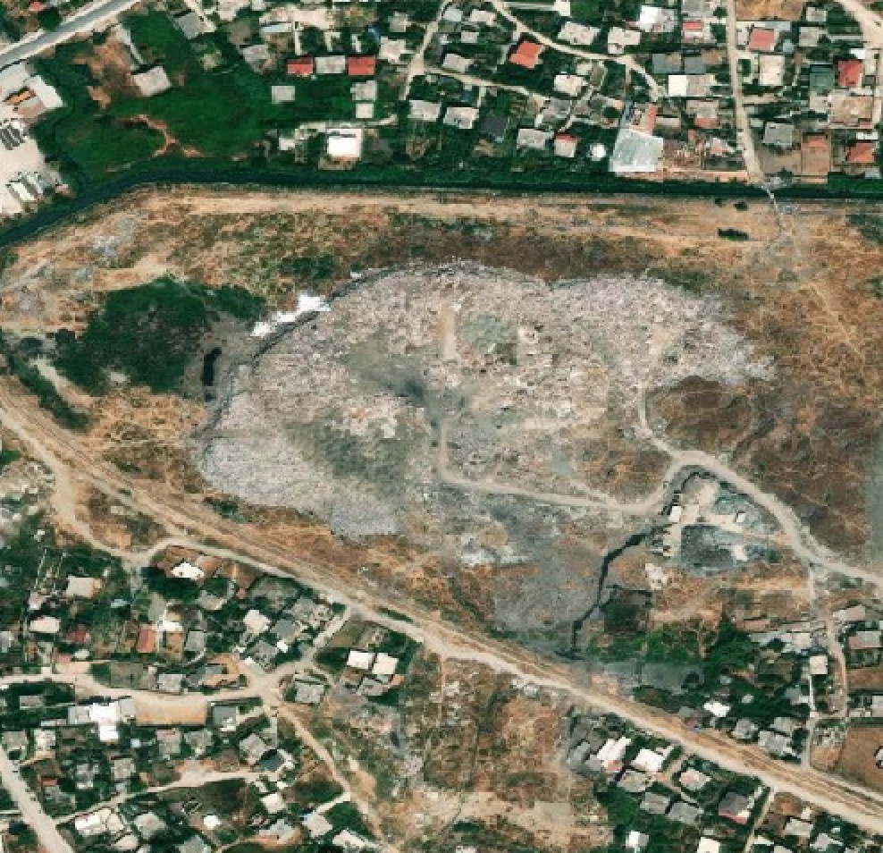
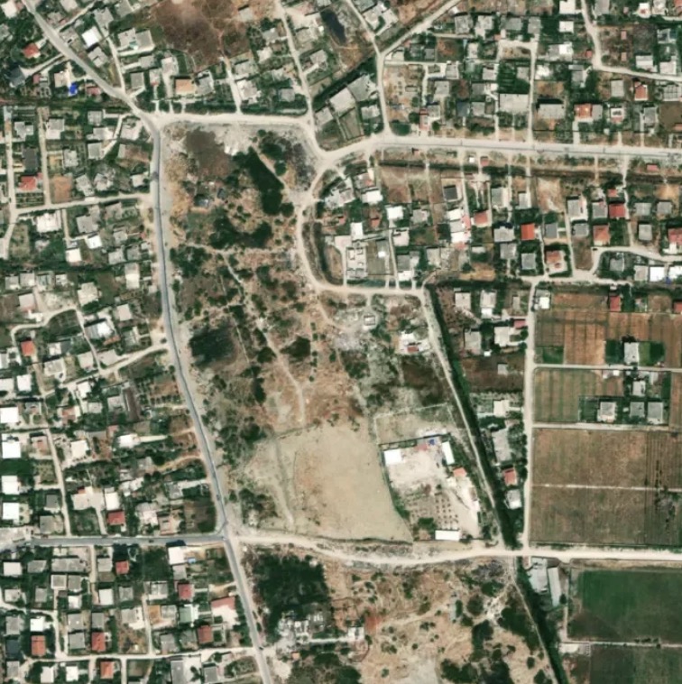
- 40.472°N, 19.466°E. Risk score, 0.31. The site is encroaching on a canal, has a large surface area, and has a population of nearly 9,000 nearby.
- 40.480°N, 19.472°S. Risk score, 0.28. This site appears to be an informal dumping ground in the heart of Vlorë, with 11,000 people living within 1 km. It is also adjacent to a canal, which poses a plastic pollution transport risk.
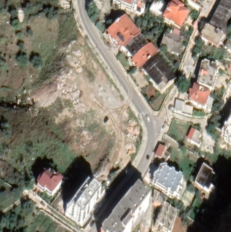
- 40.424°N, 19.493°S. Quantitative risk score can not be computed as this is an unconfirmed site. Though the site can not be confirmed with certainty from the high resolution satellite imagery, this is quite likely to be a waste site. It is in a tourism-heavy district, and falls quite close to the coast.
There are a number of candidate sites within the region of interest that the models identified, but could not be confirmed. It would be advisable to prioritize on-the-ground validations of sites at the following coordinates in addition to site #3 listed above. Sites are listed in order from north to south and link to their locations on a map.
Footnotes
-
Widyarsana, I. Made Wahyu, et al. "Risk assessment and rehabilitation potential of municipal solid waste landfills in Bali Province, Indonesia." GEOMATE Journal 17.63 (2019): 164-171. ↩


