Spatial indices to monitor global change
Simple way of computing hydroclimatological indices in R. The users are able to compute state-of-the-art indices by providing the file path to daily tiff files.
The indices included in this package to date are:
-
Rx1day: Maximum 1-day precipitation
-
Rx5day: Maximum consecutive 5-day precipitation
-
SDII: Simple precipitation intensity index
-
R10mm: Annual count of days when PRCP ≥ 10mm
-
R20mm: Annual count of days when PRCP ≥ 20mm
-
Rnnmm: Annual count of days when PRCP ≥ nn mm, where nn is a user-defined threshold
-
CDD: Maximum length of dry spell: maximum number of consecutive days with RR < 1mm
-
CWD: Maximum length of wet spell: maximum number of consecutive days with RR ≥ 1mm
-
R95p: Annual total PRCP when RR > 95th percentile
-
R99p: Annual total PRCP when RR > 99th percentile
-
R95pTOT: Contribution to total precipitation from very wet days
-
R99pTOT: Contribution to total precipitation from extremely wet days
-
PRCPTOT: Annual total precipitation on wet days
Install development version from GitHub :
remotes::install_github("obaezvil/SpatInex")The functions have the same name of the indices. For example, if the user want to calculate the maximum 1-day precipitation (Rx1day), the function with the same name should be applied:
Rx1day(rst.path, vct = NULL,  temporal.scale = c("total", "annual"),
  start.date,  end.date,  date.fmt = "%Y-%m-%d",  pattern = NULL)
Where:
-
rst.path File path to daily raster files for the period of analysis. These files should include the date in any format.
-
vct Vector file of the study area (Optional). It will be used to crop the spatial extent of the raster files if required. This parameter is set to 'NULL'; therefore, the index will be calculated over the entire raster extent by default.
-
temporal.scale either 'total' to use all the period of record (i.e., all the files in the parent folder 'rst.path'), or 'annual' to compute the index annually (From Jan to Dec).
-
start.date Position where the dates of the raster files start. For example, for files named 'ProductA_1989-02-28.tif', the start.date will indicate the position where the date starts (i.e., 10).
-
end.date Position where the dates of the raster files end. For example, for files named 'ProductA_1989-02-28.tif', the end.date will indicate the position where the date ends (i.e., 19).
-
date.fmt Format of the dates included in the file names (default = "%Y-%m-%d").
-
pattern Set to NULL. Is there a specific pattern to list the raster files?
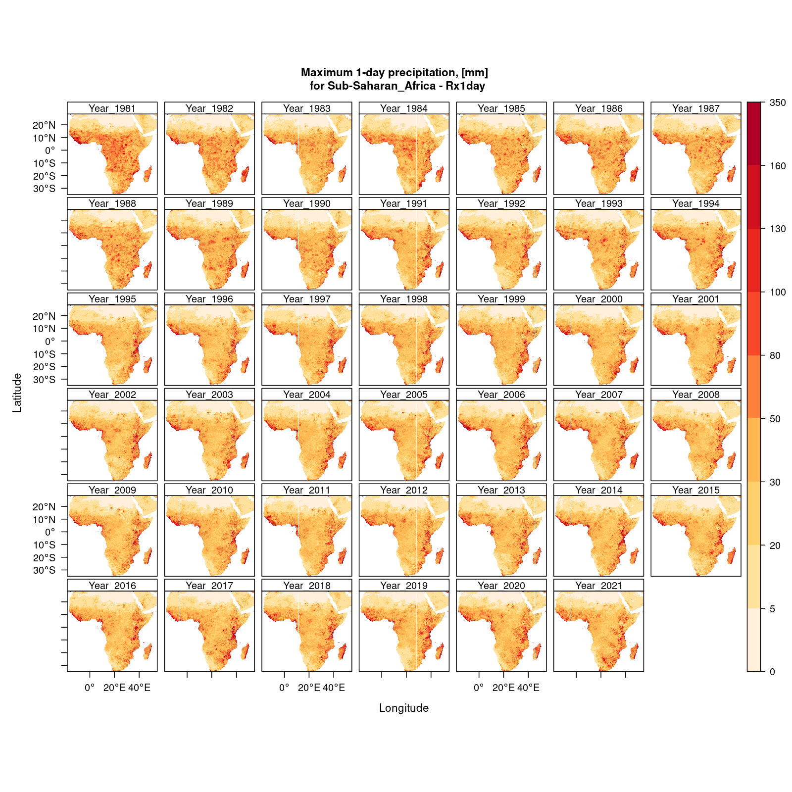
An example of the implementation of Rx1day over Sub-Saharan Africa for 1981--2021 can be observed in the following Figure:

