Heightmap
Lib for creation of 3D map of terrain from raster DEM files. Implementation adopts three.js.
It supports all raster DEM files format (.hgt, .bil, etc..) and all resolutions (3 arc seconds, 1 arc seconds, or more) with big/little endianness where each file describes a LATxLON sector.
Tool decorates the map with Google®'s texture at various resolutions (zoom).
Example
Click to see example of Matterhorn!
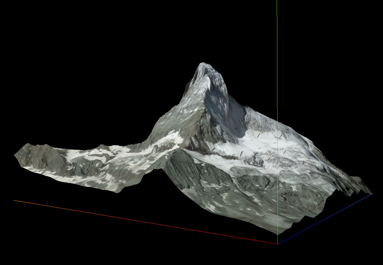
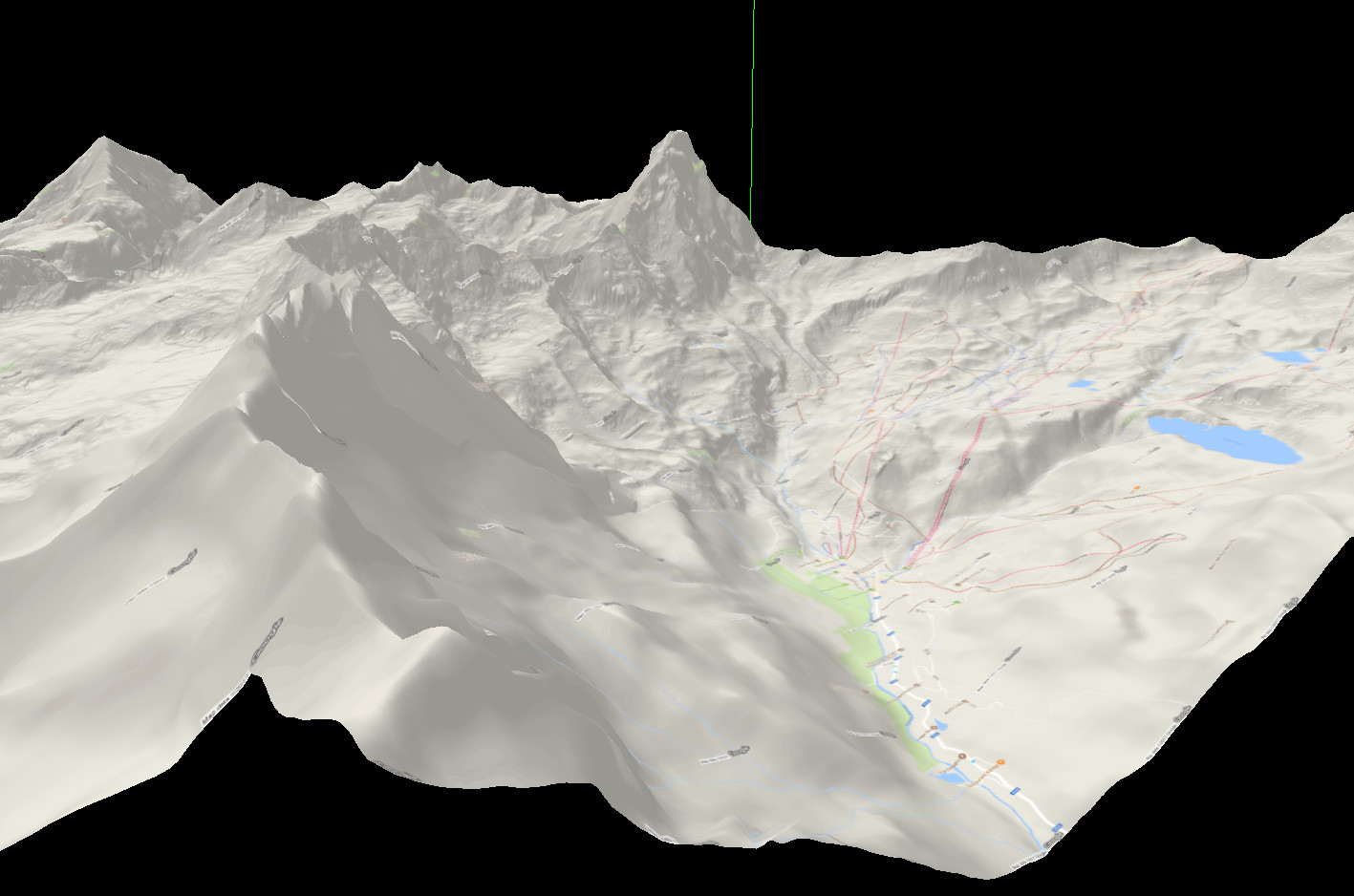
Screenshot with two different textures:
Sat texture, from Nort-West:
Terrain texture, from South-East:
Use
Since three.js lib is bundled in compiled file, all you have to do is include dist/DemHeightmap.js with a direct include in html page or with an AMD loader.
Then create an instance of DemHeightmap passing it a configuration object, and invoke .render() method:
define(['DemHeightmap'], function (DemHeightmap) {
    requirejs(['domReady!'], function (document) {

        var configuration = { /* ... */ }

        var dh = new DemHeightmap(configuration);
        dh.render(45.976581, 7.658447); // Matterhorn coordinates

    });
});
Configuration object
/**
 * @param {Object} configuration {
 *     demType,                     // {String}, selected type, one of keys of this.dem object.                                                     // Default: 'hgt'
 *     googleApiKey,                // {String}, your google API key, mandatory if this.render.type == "texture".
 *     dem: {                       // {Object}, describes where retrieve dem files, where each key is a demType. Mandatory.
 *         KEY: {                   // {Object}, key of single configuration, referred by this.demType
 *             format,              // {String}, file extension.
 *             folder,              // {String}, files folder.
 *             filename,            // {String}, filename pattern, with "{{NS}}", "{{LAT}}", "{{WE}}", "{{LON}}" as vars: see example.
 *             endianness,          // {String}, endianness of file. Allowed values: "little", "big".
 *             uppercaseName,       // {Boolean}, specifies if filenames are in uppercase.
 *             overlap              // {Boolean}, specifies if dem files overlap on last row/column (usually they do).
 *         }
 *     },
 *     render: {                    // {Object}, configuration for render
 *         zoom,                    // {Integer}, defines area dimension, like in Google® map. Allowed values: `11` to `20`.                        // Default: 12
 *         detailsLevel,            // {Integer}, defines details of Google® textures. Allowed values: `0` to `4`.                                  // Default: 0
 *         textureType,             // {String}, defines type of texture. Allowed values: 'terrain', 'satellite', 'roadmap', 'hybrid' from Google®. // Default: 'satellite'
 *         size,                    // {Integer}, defines size in px of single texture, from Google®. Max allowed value 640.                        // Default: 512
 *         scaleFactor:             // {Number}, defines rescalation of elevations.                                                                 // Default: 1
 *         withAnimation,           // {Boolean}, specifies if map elevation is animated.                                                           // Default: true
 *         type,                    // {String}, defines type of rendering: Allowed values: 'texture', 'grid', 'points'.                            // Default: 'texture'
 *         output: {                // {Object}, configuration for render output
 *             width,               // {Integer} width of rendered map.                                                                             // Default: document.width - 20
 *             height,              // {Integer} height of rendered map.                                                                            // Default: document.height - 20
 *             mapContainer:        // {String}, id of html element where map will be rendered in.                                                  // Default: 'map-container'
 *             showElevation        // {Boolean}, specifies if elevation is shown on mouse move                                                     // Default: false
 *             elevationText        // {String}, text to prepend to elevation, in elevationContainer element
 *             elevationContainer   // {String}, id of html element where elevation will be printed in. Mandatory if 'showElevation' is true.
 *         }
 *     }
 * }
 */
.render(LAT, LON[, renderConfig])
DemHeightmap#render method accepts three parameters:
LAT, LON: Numbers, center coordinates, mandatories.
renderConfig is an object with same structure of mainConfiguration.render passed to constructor: if present, same properties will overwrite those in general render configuration.
Other
Lib uses async as lightweight Q replacement for async calls management.
In direct inclusion, this lib registers three vars in global scope: DH, async and THREE.

