![]()
![]()


GeoMesher is a fork of pandamesh. The original package included two mesh generators: Triangle and Gmsh. This fork only includes the Gmsh mesh generator since Triangle seems to be not maintained anymore. Also, GeoMesher adds the following new functionalities:
- A new method for returning the generated mesh as a GeoDataFrame.
- A new function called
gdf_mesherthat can generate a mesh from a GeoDataFrame with a single function call and with sane defaults for the mesh generator. - Remap a scalar field from the source GeoDataFrame to the generated mesh, using an area weighted interpolation method (based on Tobler).
- Handle
MultiPolygongeometries in the source GeoDataFrame.
Note that the remapping functionality of GeoMesher is a simple areal interpolation method. For more advanced interpolation methods, please use Tobler.
You can install GeoMesher using pip:
$ pip install geomesheror using conda (mamba):
$ conda install -c conda-forge geomesherThe following example shows how to generate a mesh from a GeoDataFrame using both the gdf_mesher function and the Mesher class.
We start by getting a GeoDataFrame of South America from the Natural Earth website. Then, we reproject it to a projected coordinate system (UTM zone 20S). Finally, we add a new column called cellsize that will be used to set the maximum size of the mesh elements.
We use the gdf_mesher function to generate the mesh with default parameters and use Mesher to generate the mesh with MESH_ADAPT algorithm. We also use the area_interpolate function to remap the POP_EST column from the source GeoDataFrame to the generated mesh.
import geopandas as gpd
import geomesher as gm

world = gpd.read_file(
    "https://naciscdn.org/naturalearth/110m/cultural/ne_110m_admin_0_countries.zip"
)

south_america = world[world["CONTINENT"] == "South America"]
south_america = south_america.explode(ignore_index=True).to_crs(32620)
south_america["cellsize"] = 500_000.0

mesh_auto = gm.gdf_mesher(south_america, intensive_variables=["POP_EST"])

mesher = gm.Mesher(south_america)
mesher.mesh_algorithm = "MESH_ADAPT"
mesh_adapt = mesher.generate()
mesh_adapt = gm.area_interpolate(south_america, mesh_adapt, intensive_variables=["POP_EST"])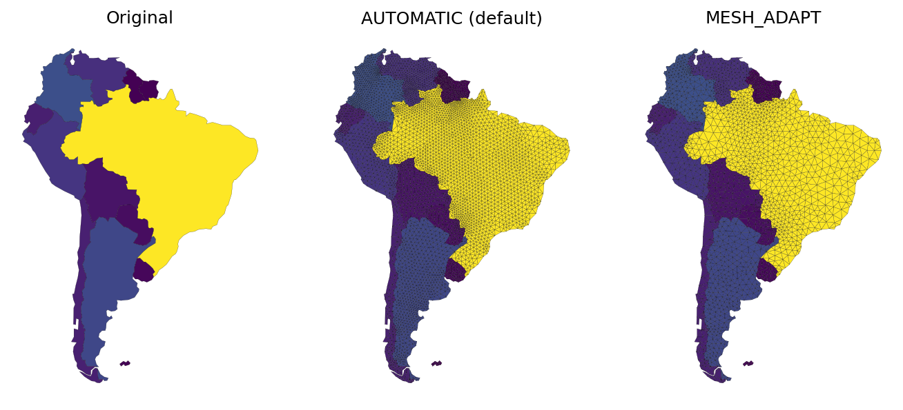
Contributions are very welcomed. Please read CONTRIBUTING.rst file for instructions.
GeoMesher is a fork of pandamesh (MIT License) and uses one of the modules in Tobler (BSD-3-Clause License).