This repo contains QGIS stylesheets (QML) for use with OS OpenMap Local (OML) data in ESRI Shapefile format.
They were created in QGIS 2.12 and make use of the fantastic rule-base labelling.
==============================
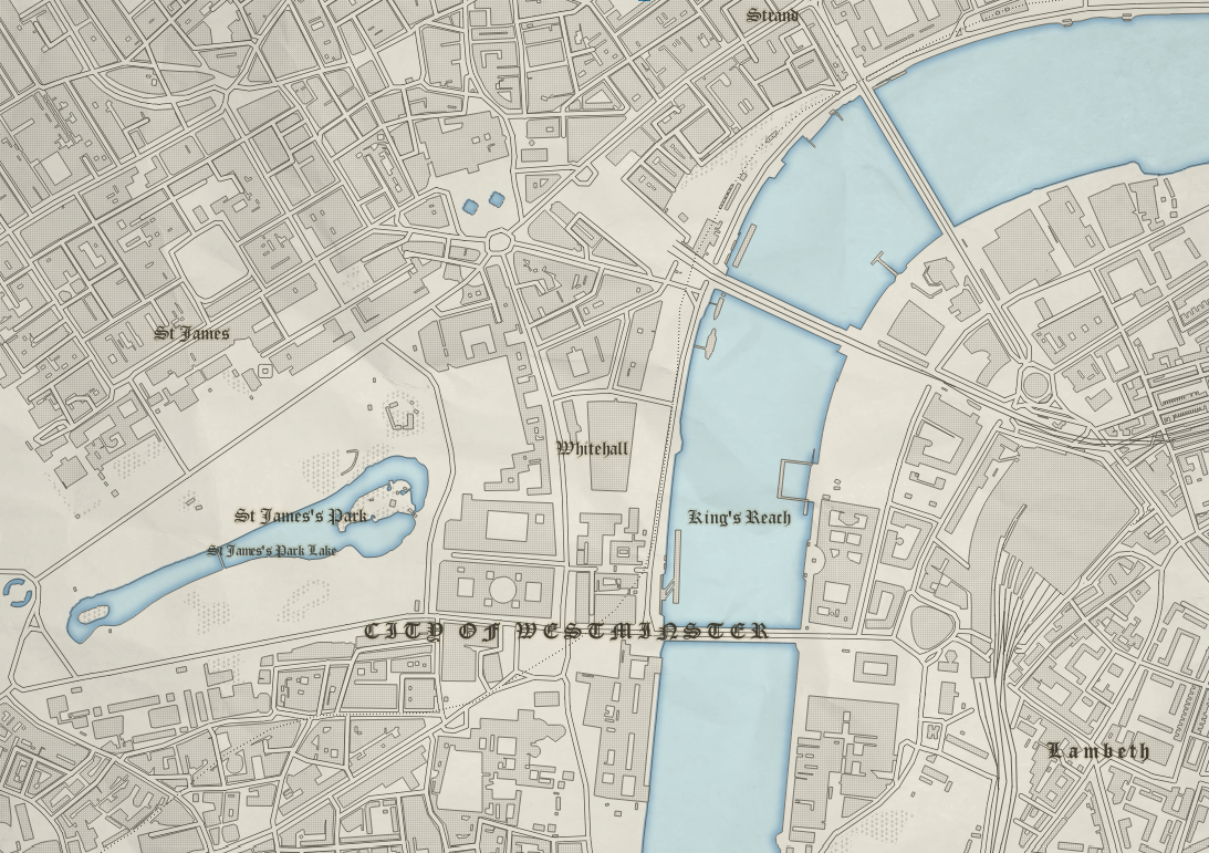
##Background
This style is a recreation of an amazing Ordnance Survey map style from the 1890's which I found here.
##Info
These stylesheets were designed at 1:7,500 and they are legible between 1:5,000 and 1:15,000.
They have been made to work with ESRI Shapefiles which can be downloaded from the Ordnance Survey website.
For the land tint you will need to set your background colour to #f0ecdf.
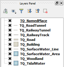
Not all the OML layers are used, I recommend this layer order:
To give the map an old paper effect you can add one in the QGIS Print Composer by following these steps from Anita Graser.
##Credit
Thanks to the wonderful peeps at NLS for making these beutiful maps available for all to see and appreciate and giving me the inspiration to make these stylesheets. And of course thanks to the amazing cartographers of yesteryear who made these beautiful maps and to Ordnance Survey for supplying the open data.