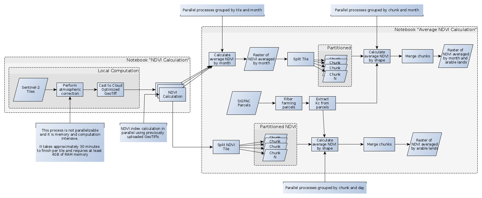
- NDVI: It gets tiles captured by Sentinel-2 and performs atmospheric correction. Then, coumputes NDVI (Normalized Difference Vegetation Index). Finally, it processes the calculated NDVI indexes to compute averages by shape and month.
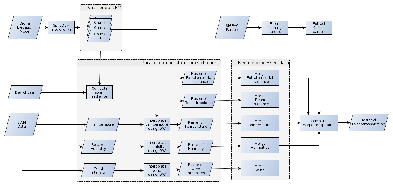
- Water Consumption: It computes water consumption of crop fields based on temperature and solar irradiance.
Note: These notebooks have been developed using Python3.7 - other Python versions might not work.
-
Install Lithops Serverless Framework
-
Setup local Python virtual environment:
$ python3.7 -m venv venv $ source venv/bin/activate $ (venv) pip install -r requirements -
Setup Jupyter notebook kernel.
$ (venv) ipython kernel install --name "geospatial" --user $ (venv) jupyter nbextension enable --py --sys-prefix widgetsnbextension $ (venv) jupyter nbextension enable --py --sys-prefix ipyleaflet -
Start local Jupyter Notebook:
$ (venv) jupyter notebook -
Follow further instructions listed in each notebook.
-
Answare:
- Tonny Velin (tvelin@answare-tech.com)
- Pablo David Muñoz (jlozano@answare-tech.com)
- Cristina Castillo García
- Carlos A. Pineda Martínez
-
Universitat Rovira i Virgili
- Aitor Arjona Pérez (aitor.arjona@urv.cat)

