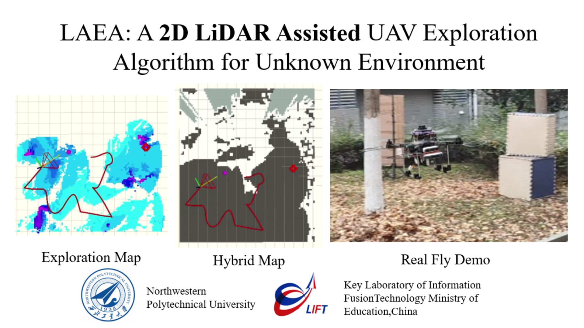
LAEA is a 2D LiDAR-Assisted UAV Exploration Algorithm based on the framework of FAEP. Please kindly star ⭐ this project if it helps you. We take great efforts to develop and maintain it 😁😁. There are two branches of this project, main (Support for Ubuntu 18 Melodic) and noetic (for Ubuntu 20 noetic).

Details about our works (Youtube).
Please cite our paper if you use this project in your research:
- **LAEA: A 2D LiDAR-Assisted UAV Exploration Algorithm for Unknown Environments **, Hou, Xiaolei, Zheng Pan, Li Lu, Yuhang Wu, Jinwen Hu, Yang Lyu, and Chunhui Zhao. 2024, Drones.
@Article{drones8040128,
AUTHOR = {Hou, Xiaolei and Pan, Zheng and Lu, Li and Wu, Yuhang and Hu, Jinwen and Lyu, Yang and Zhao, Chunhui},
TITLE = {LAEA: A 2D LiDAR-Assisted UAV Exploration Algorithm for Unknown Environments},
JOURNAL = {Drones},
VOLUME = {8},
YEAR = {2024},
NUMBER = {4},
ARTICLE-NUMBER = {128},
URL = {https://www.mdpi.com/2504-446X/8/4/128},
ISSN = {2504-446X},
}
Simulation experiment quik overview: Indoor1、Indoor2 and Forest.


We use default px4 gazebo simulation environments, the below dependencies is needed. Among them, regarding the configuration of the px4 gazebo simulation environment, you need to refer to the information on the Internet.
- ros & mavros: Support Ubuntu18.04 Melodic, Ubuntu20.04 Noetic. Please search for the detailed installation tutorial, the following installation steps are for reference only.
# you can use below to install ros-full quickly
# During this process, you need to make a selection from the terminal
wget http://fishros.com/install -O fishros && sudo bash fishros

########################## mavros ########################
# for Ubuntu18.04 Melodic
sudo apt install ros-melodic-mavros ros-melodic-mavros-extras -y
# for Ubuntu20.04 Noetic
sudo apt install ros-noetic-mavros ros-noetic-mavros-extras -y

wget https://gitee.com/robin_shaun/XTDrone/raw/master/sitl_config/mavros/install_geographiclib_datasets.sh
sudo chmod a+x ./install_geographiclib_datasets.sh
# The next step takes a while to install, you can wait patiently
sudo ./install_geographiclib_datasets.sh- PX4-Autopilot: the drone model files and world files required for the px4 simulation are located in the
px4_gazebo/resource. You need to copy the corresponding files to your own px4 environment.
reference: https://github.com/PX4/PX4-Autopilot- others
sudo apt-get install libarmadillo-dev libdw-dev
sudo apt-get install
# nlopt for non-linear optimization
# Source code installation is recommended, as follows
git clone https://github.com/stevengj/nlopt.git
cd nlopt/
mkdir build&&cd build/
cmake ..
make
sudo make install

# for Ubuntu18.04 Melodic
sudo apt install ros-melodic-octomap -y
# for Ubuntu20.04 Noetic
sudo apt install ros-noetic-octomap -yOnce the relevant environment has been configured (especially PX4), you can run simulation experiments using the provided code. The drone model files and world files required for the px4 simulation are located in the px4_gazebo/resource. You need to copy the corresponding files to your own px4 environment.
# cd ~/your_workspace_dir/src
# mkdir -p ~/laea/src&&cd ~/laea/src

# Support Ubuntu18.04 Melodic, Ubuntu20.04 Noetic.
# for Ubuntu18.04 Melodic
git clone https://github.com/Poaos/LAEA --recursive
# for Ubuntu20.04 Noetic
git clone https://github.com/Poaos/LAEA --recursive -b noetic

cd ..
catkin_make

################ 1) Start your simulation environment ###############
# My simulation environment boot example
source ./devel/setup.bash
roslaunch px4_gazebo laea_gazebo_lidar.launch # drone&sensor data&sim-env

################ 2) Activate your drone controller ##################
# We're using the default [mavros_controllers]
# If you want to use the controller for real flight, a carefully adjustment for the parameters is needed, otherwise...
source ./devel/setup.bash
roslaunch px4_gazebo controller.launch # controller

################ 3) Start the octomap mapping service ###############
source ./devel/setup.bash
roslaunch octomap_server scan_mapping.launch # octomap mapping

################ 4) Activate our exploration algorithm ##############
source ./devel/setup.bash
roslaunch exploration_manager explore_test.launch # exploration algorithm

################ 5) rviz for visualization ##########################
source ./devel/setup.bash
roslaunch exploration_manager rviz_alg.launch # rviz

#####################################################################
The above startup steps are many, you can integrate them into a launch file, start separately for ease of understanding.
Of course, any simulation environment is fine as long as it provides the following data required by the algorithm. Specifically, you need to modify the following files:
- exploration_manager/launch/poaozz/explore_test.launch: Provides drone and camera position and depth image
<!-- topic of your odometry such as VIO or LIO -->
<arg name="odom_topic" value="/mavros/local_position/odom" />

<!-- sensor pose: transform of camera frame in the world frame -->
<arg name="sensor_pose_topic" value="/mavros/camera/pose"/>

<!-- depth topic: depth image, 640x480 by default -->
<arg name="depth_topic" value="/camera/depth/image_raw"/>- utils/depthimage_to_laserscan/launch/depth2scan.launch: Provides depth camera data to generate lidar scans
<!-- change here for your camera depth topic name. -->
<remap from="image"       to="/camera/depth/image_raw"/>
<remap from="camera_info" to="/camera/depth/camera_info"/> - utils/laserscan_to_pointcloud/launch/cloud.launch: Provides 2d lidar data
<!-- lidar scan data -->
<arg name="laser_scan_topics" default="/iris_0/scan" />As described in paper, LAEA enables efficient exploration of unknown environments by timely access to the detected special frontier regions. Therefore, you may need to refer to the meaning of the parameters and adjust them for the current exploration environment. Parameter file is located at exploration_manager/launch/poaozz/algorithm_.xml. The main parameters are as follows:
<!-- atsp cost params  -->
<param name="frontier/small_area_thresh" value="2.0" type="double"/>
<param name="frontier/small_thresh_low" value="0.6" type="double"/>
<param name="frontier/isolateArea_gain" value="15" type="double"/>
<!-- max angle gap -->
<param name="exploration/max_yaw_gap" value="100" type="int"/>
<!-- Path time constraints when filtering for middle yaw -->
<param name="exploration/lens_lb_rate" value="1.35" type="double"/>
<param name="exploration/yaw_rotate_rate" value="1.2" type="double"/>Our code is developed based on FAEP. We use NLopt for non-linear optimization and use LKH for travelling salesman problem.