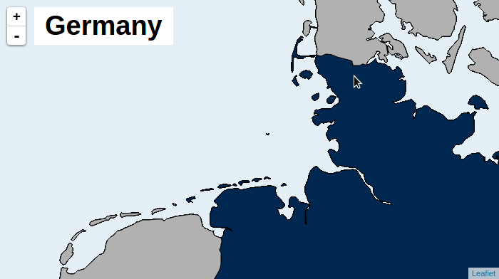
An Interactive Browser-Rendered Vector-Map based on Leaflet, that can display World-Wide Country data at 10m Resolution while still being fully interactive.
This Leaflet-Plugin allows rendering Vector-Maps in any Canvas-Capable Browser. It provides a couple of useful features:
- Realtime Hit-Detection
- Support for High-Resolution Vectordata (10m/px)
- Dynamicly changing Paint-Style on Hover
- Metadata on Hover/Leave-Events (like the Country-Name, Country-Code)
 Click on the Image above to see an interactive Example.
To generate your own Vector-Tiles the tilegen.py Tool can be used. Take a look at its README to get further instructions on how to use it. It employes Fiona to read Vectordata-Sources. Fiona is based on GDAL/OGR and can thus read any Datasource that OGR can, including Shapefiles, SpatiaLite Databases and probably more.
Generating the Tiles is a CPU-Intense activity. The tilegen-Script can run multiple Hours even on fast Computers. For this reason Personalwerk offers pre-generated Tiles at http://osm.personalwerk.de/example-vectiles/. The Files directly accessable in this Folder are for Texting and Experimenting only. If you want to use these Tiles in Production, download all Tiles in a Zip or generate them yourself. The Zip will expand to around 3 GB of Data. The Tiles in this zip are in the public domain.
These Tiles contain Areas for the 247 countries in the world (Greenland as separate from Denmark) in 10m/50m resolution (as provided by naturalearthdata.com. The following Tags are attached to each Area and can be used in Events or Paint-Function:
| key | value |
|---|---|
| admin | Human-Readable (english) name of the Country |
| iso_a2 | ISO-3166-1 ALPHA-2 (2-Character) Code |
| iso_a3 | ISO-3166-1 ALPHA-3 (3-Character) Code |
| subregion | Human-Readable (english) name of the Region this Country is in |
| subunit | identical (?) to admin |
The tiles obtained in the previous section are consumed by the Leafelet-Plugin located at src/. Take a look at its README to get API-Documentation and further explanations of its inner workings.
A usage-Example is provided in examples.