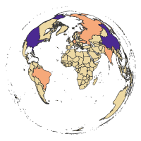
Country-level Land Cover Categories (CLCC) has information about land cover categories areas (in km2) on a country level. You can download the data files for different years from 1992 to 2015.
Country-level Land Cover Transitions (CLCT) has information about transitions (net changes) of the land cover categories areas (in km2) on a country level over five-year periods. Positive values indicate an increase of the given land cover category area and negative values indicate a decrease of the given land cover category area. You can download the data files for different five-year periods between 1992 to 2015.
Country-level Land Cover Gross Changes has information about gross changes of the land cover categories areas (in km2) on a country level over five-year periods.
The scripts used for data preparation are available in the R folder.
- Download National Identifier Grid from SEDAC
- Download ESA CCI Land Cover data for years 1992-2015
- Reproject land cover data to the Equal Area Cylindrical projection
- Split reprojected land cover data into 24 separate files (one file per year)
- Simplify land cover categories into 9 broader IPCC (Intergovernmental Panel on Climate Change) categories
- Reproject National Identifier Grid data to the Equal Area Cylindrical projection and rasterize it
- Calculate land cover categories compositions for each country in each year
- Merge datasets and recalculate areas' unit from the number of cells to square kilometers
- Calculate land cover transitions (net change in land cover categories compositions) over five-year periods
- Join land cover categories and land cover transitions with the administrative areas from the National Identifier Grid dataset
- Download National Identifier Grid from SEDAC
- Download ESA CCI Land Cover data for years 1992-2015
- Reproject land cover data to the Equal Area Cylindrical projection
- Split reprojected land cover data into 24 separate files (one file per year)
- Simplify land cover categories into 9 broader IPCC (Intergovernmental Panel on Climate Change) categories
- Reproject National Identifier Grid data to the Equal Area Cylindrical projection and rasterize it
- Calculate one raster file for each five-year periods by combining two input rasters, e.g., a new value 12 of a pixel represents the change from 1 (agriculture) to 2 (forest)
- Extract land cover transitions for each country in each five-year period
- Calculate land cover gross changes, gains, and losses over five-year periods by processing of the land cover transitions data
- Center for International Earth Science Information Network (CIESIN), Columbia University, (2018). Gridded Population of the World, Version 4 (GPWv4): National Identifier Grid, Revision 11. Palisades, NY: NASA Socioeconomic Data and Applications Center (SEDAC). https://doi.org/10.7927/H4TD9VDP
- ESA, 2017. European Space Agency Land Cover CCI Product User Guide Version 2.0. Tech. rep. https://maps.elie.ucl.ac.be/CCI/viewer/
- Netzel P., Nowosad J., Jasiewicz J., Niesterowicz J, Stepinski T., (2018). GeoPAT 2: user's manual. Zenodo. http://doi.org/10.5281/zenodo.1291123
- GDAL/OGR contributors (2018). GDAL/OGR Geospatial Data Abstraction software Library. Open Source Geospatial Foundation. URL http://gdal.org
- R Core Team (2019). R: A language and environment for statistical computing. R Foundation for Statistical Computing, Vienna, Austria. URL https://www.R-project.org/.
- Jonathan Asher Greenberg and Matteo Mattiuzzi (2018). gdalUtils: Wrappers for the Geospatial Data Abstraction Library (GDAL) Utilities. R package version 2.0.1.14. https://CRAN.R-project.org/package=gdalUtils
- Robert J. Hijmans (2019). raster: Geographic Data Analysis and Modeling. R package version 2.9-2. https://www.rspatial.org/
- Pebesma, E., 2018. Simple Features for R: Standardized Support for Spatial Vector Data. The R Journal 10 (1), 439-446, https://doi.org/10.32614/RJ-2018-009
- Hadley Wickham, Romain François, Lionel Henry and Kirill Müller (2019). dplyr: A Grammar of Data Manipulation. R package version 0.8.0.1. https://CRAN.R-project.org/package=dplyr
- Lionel Henry and Hadley Wickham (2019). purrr: Functional Programming Tools. R package version 0.3.2. https://CRAN.R-project.org/package=purrr
- Jakub Nowosad (2018). rgeopat2: Additional Functions for 'GeoPAT' 2. R package version 0.2.6. https://CRAN.R-project.org/package=rgeopat2
- Maximillian H.K. Hesselbarth, Marco Sciaini, Jakub Nowosad and Sebastian Hanss (2019). landscapemetrics: Landscape Metrics for Categorical Map Patterns. R package version 1.1. https://r-spatialecology.github.io/landscapemetrics/
