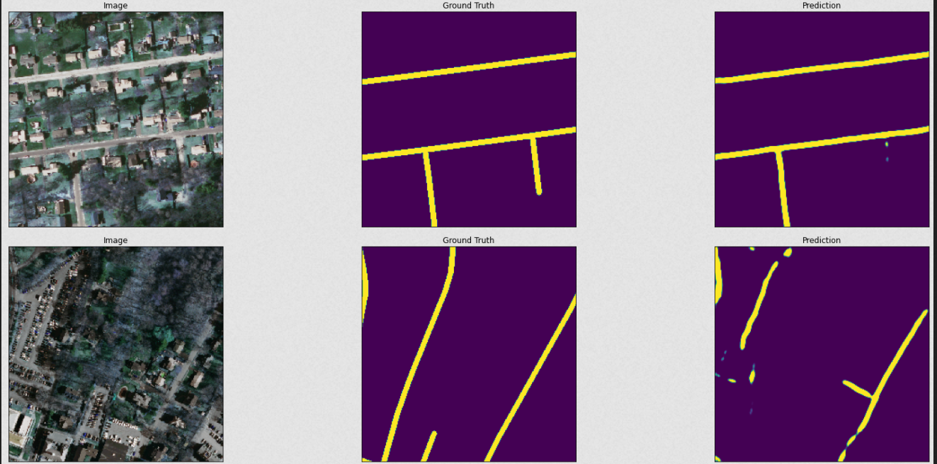
In this notebook we will look at satellite imagery data from Masachusetts and detect roads from the images. The dataset has been obtained from kaggle
The data is organized as follows:
.
└── training
    ├── input
    └── output
├── testing
│   ├── input
│   └── output
where input folder contains the images and output folder contains the corresponding mask images.
-
The size of the images is: (length, width, color_channels) = (1500, 1500, 3)
-
The two tasks in the analysis are: - Data Pipeline: Preprocessing the raw images to make them ready for the deep learning model - Model Pipeline: Build a deep learning model to identify roads from the images
-
Data pipeline does the following:
- Crop input images from (1500, 1500, 3) into multiple smaller images of size (256, 256, 3)
- Apply similar operation on the mask images
- Save images as h5 files.
-
Model pipeline does the following:
- Trains a Unet model on the cropped images
- Validates the model on test data using defined metrics
Here are some predictions from the model:


