High-Performance 2D Delaunay Triangulation and Related Utilities Written in Java
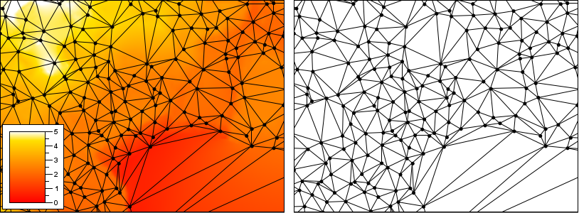
The Delaunay Triangulation defines an optimal form for organizing unstructured or semi-random sample points into a triangular mesh. That optimality makes the Delaunay Triangulation a useful tool for interpolation, grid construction, and surface analysis.
Tinfour is a software library written in Java that provides tools for constructing and applying Triangulated Irregular Networks (TINs) that conform to the Delaunay criterion. Because it is intended to process large data sets, the implementation gives a great deal of attention to performance and memory use. On a conventional laptop, Tinfour is capable of processing sample points at a rate of better than one million points per second.
The Tinfour source code includes extensive documentation. This project also includes an informal paper that describes the uses, algorithms, and implementation of the software with enough detail to support potential developers who may wish to contribute code or employ Tinfour in their own work. For more details, see Data Elements and Algorithms for the Tinfour Libary. The Tinfour API documentation is available at Tinfour API. And, to support our user community, we've recently started a mailing list at the Tinfour Users Group.
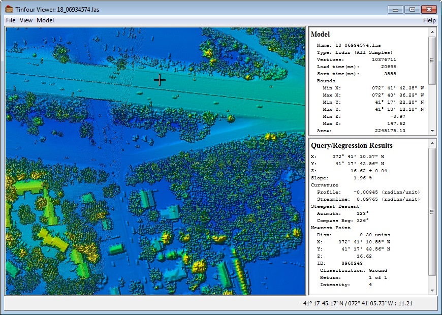
When someone first sees a project like Tinfour, they might reasonably ask that most thorny of questions "What is it good for?" To try to address that question, this library includes a simple demonstration program which allows the user to view and explore raw data, including samples such as Lidar files that contain huge numbers of points. To run the demonstrator, you must have Java installed on your system. If you do not have Java installed on your computer, you may download an installer for free from Oracle Corporation, Java Downloads
Depending on your setup, you may be able to invoke the viewer by simply navigating to your copy of the Tinfour "dist" folder and double clicking the TinfourViewer jar ("Java Archive") file. For Windows users, there is also a run.bat script in the main software distribution. On all systems, you can invoke the viewer from a command window by using the following:
java -Xmx1500m -jar TinfourViewer-1.0.jar
The demonstrator is intended to show how the Tinfour library could be integrated into a full-featured GIS application or other analysis tool. It's a simple implementation with a minimum of features.
Lidar is a system for collecting surface elevation using laser measuring devices mounted on low flying aircraft. It's pretty amazing technology. There are some excellent sources of Lidar data to be had for free, you might start at Free LiDAR Data Sources or [USGS Center for LIDAR Information] (http://lidar.cr.usgs.gov/ "USGS"). The Commonwealth of Pennsylvania was one of the first states to collect and post a comprehensive survey of lidar data, and they did the job right... Their site includes not just lidar data, but the supporting breakline files (Shapefiles), multi-spectral imagery, and project metadata (including Dewberry reports). Visit this excellent resource at PAMAP Lidar Elevation Data.
If you just want to download a single Lidar file and view it, I recommend PAMAP Tile 4100133PAS ftp://pamap.pasda.psu.edu/pamap_lidar/cycle1/LAS/South/2006/40000000/41001330PAS.zip At 36.7 megabytes, it isn't dainty, but it does contain interesting land features and sufficient detail to exercise the major functions of the viewer.
Recently, I found an earlier Delaunay triangulation project by "The Mad Creator" (Bill Dwyer) that provided a four-line demo. It was such a elegant way of introducing the package, that I decided to include one of my own.
  public static void main(String []args) throws Exception {
      IncrementalTin tin = new IncrementalTin(1.0);
      List<Vertex>vertexList = TestVertices.makeRandomVertices(100, 0);
      tin.add(vertexList);
      TinRenderingUtility.drawTin(tin, 500, 500, new File("tin.png"));
}The Tinfour package has two external dependencies. The first is on the laszip4j package, which allows the test and demonstration applications to read Lidar products in the highly specialized LAZ data compression format. This dependency is not part of the core functions, but is necessary for access to these data products.
The second dependency is the Apache Commons Math Library. This dependency is required by the linear algebra and statistics functions needed by the Geographically Weighted Regression classes which are part of the core functionality. If you have an alternate linear algebra library in your own software, it would be possible to refactor the Tinfour code to perform the core regression functions using the alternative. You would, however, have to remove those functions that specifically require statistics elements (such as the T-Distribution) or provide your own alternative
For your convenience, a copy of both the laszip4j and the Commons math packages are included with the Tinfour download.
Tinfour is compiled under Java 8.
Configuring Tinfour in an IDE is pretty simple:
- Create a Java project
- Set up a source reference to (installed path)Tinfour/src/main/java so that your IDE picks up the packages tinfour.*
- If you wish to include the test and example applications, set up a source reference to (installed path)/Tinfour/src/test/java so your IDE picks up the packages tinfour.test.*
- Set up a jar reference to (installed path)/Tinfour/lib/commons-math-3.3.6.1.jar
- Set up a jar reference to (installed path)/Tinfour/lib/laszip4j.jar
- Configure the IDE to run TinfourViewerMain. If you are working with very large datasets, you may include the Java runtime option -Xmx1500m or larger to increase the heap size. However, in recent versions of Java the specification of this option is not as critical as it once was.
Early in the Tinfour project, I made the mistake of including compiled binaries (jar files) in the code tree. Over time, pull requests have grown quite large. I am currently setting up a new approach in which I will move the binaries into the Github Release feature and remove them from the main software download.
The most recent addition to the Tinfour package is support for Voronoi Diagrams. We've also added a new article on Natural Neighbor Interpolation to our wiki.
The current focus of Tinfour development is polishing aspects of the Constrained Delaunay Triangulation (CDT) implementation. The CDT is a technique for representing discontinuities in a Triangulated Irregular Network. For example, geographic applications often need a way to represent "breaklines" -- features including rivers, roads, coastlines and escarpments -- which mark a sudden change in the local slope or terrain. Conventional Delaunay Triangulations have a limited ability to treat boundaries where the surface undergoes a nearly instantaneous change. By introducing linear and polygon features to the construction of a TIN, the Constrained Delaunay Triangulation provides an effective way of representing such features. For an illustrated discussion of why CDT's are important, see the Tinfour wiki page titled About the Constrained Delaunay Triangulation
For more detail about the Tinfour project development plans, see the Tinfour Project Status and Roadmap page.
Finally, the whole point of working on a project like Tinfour is to see it used to do something useful. To that end, I welcome ideas, requests, and recommendations for analysis tools and applications that would benefit the open source and scientific communities. Got something to say? You can contact me at contact.tinfour@gmail.com

