![]() AccessMod 5
AccessMod 5
Summary
This is the main repository of AccessMod 5.
AccessMod 5 is a tool to analyze geographical accessibility to or from given locations, using anisotropic movements and multimodal transport processes (e.g. walk, bicycles, motorized vehicles). This package may help to analyze catchments of peoples who can reach a central point in a given time and transport model or determine where new public services should be scaled up in priority.
This product is developed by the Department of Health Systems Financing (WHO/HSS/HSF) in collaboration with the WHO Vulnerability and Risk Analysis & Mapping program (VRAM).
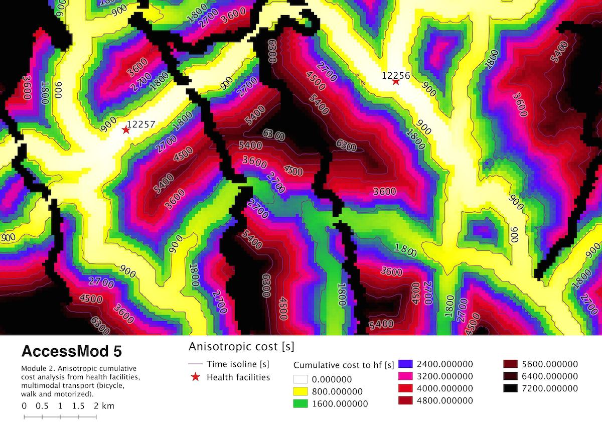
In Fig. 1, we can see an exemple of the cumulative time map produced with the module 2 of AccessMod 5, displayed here in a composition created with the map composer in QGIS.
User manual
Download the latest version of the user manual here : accessmod.org
Installation
AccessMod5 generic virtual machine can be downloaded from accessmod.org
Code
AccessMod 5 has multiple parts:
Accessmod_shiny: the core functionalities of the project. Uses mainly R, shiny, and GRASS GIS.Accessmod_r.walk: a modified version of the module r.walk from GRASS GIS. Compute anisotropic cost with multimodal transport process.Accessmod_server: a virtual machine to provide a portable environment forAccessMod 5
If you want to produce a full working environment for AccessMod 5 without installing a virtual server, you can look at the dependencies in the provisioning file.
Issues
The bugs and new functionality request should be reported here :
AccessMod 5 issues