Geotrek, paths management for National Parks and Tourism organizations.
- master

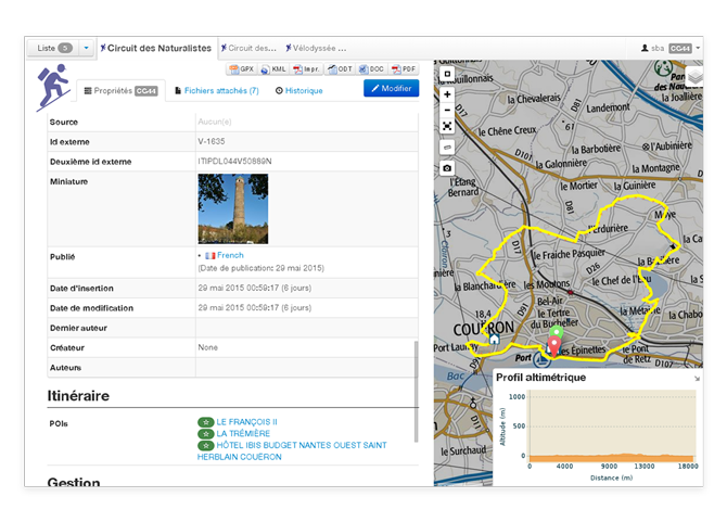
- Web mapping application offering GIS features
- Manage paths, interventions, signage, treks, POIs, touristic events and so much more
- Track maintenance of equipments and infrastructures
- Control objets by district, protected areas, physical and legal status of paths
- Compute 3D attributes using DEM draping
- Allow to interconnect with multiple applications to synchronize data (Suricate, Apidae, Tourinsoft, etc.)
- Publish a public website with Geotrek-rando (e.g. PNE, PNM-PNAM)
- Publish a public mobile application with Geotrek-mobile (e.g. OTGC, CD39)
More information on product website http://geotrek.fr
- User manual (in french)
- Installation and configuration instructions
- Help us translate on Weblate
- OpenSource - BSD
- Copyright (c) 2012-2023 - Makina Corpus / Parc national des Ecrins - Parc National du Mercantour - Parco delle Alpi Marittime