This package has been archived until such time that it can be brought up-to-date with Laravel Nova. We have stopped using Laravel Nova, and no longer have a license for it. As such we currently cannot justify further development on this package. Please check here for availability of similar packages: https://novapackages.com
Map Marker Field for Laravel Nova
Supporting This Package
This is an MIT-licensed open source project with its ongoing development made possible by the support of the community. If you'd like to support this, and our other packages, please consider becoming a sponsor.
We thank the following sponsors for their generosity, please take a moment to check them out:
Requirements
- Laravel 9.0+
- Nova 3.9+
Installation
- Install the package:
composer require genealabs/nova-map-marker-field
- Publish the marker icon assets (this is not necessary if you are specifying your own):
php artisan vendor:publish --provider="GeneaLabs\NovaMapMarkerField\Providers\Service"
Implementation
To create the map marker field, all that is necessary is the form label, and the remaining options will have defaults applied:
use GeneaLabs\NovaMapMarkerField\MapMarker;

MapMarker::make("Location"),
Coordinate Field Names
By default the field will look for latitude and longitude fields on the
model. However, if your model uses different names, you may customize them with
the ->latitude('lat') and ->longitude('long') methods:
MapMarker::make("Location")
    ->latitude('lat')
    ->longitude('long'),
Default Settings
You can specify default settings for zoom level, and initial map center coordinates. If not specified, the zoom level will default to 12; the coordinates will default to (0, 0).
MapMarker::make("Location")
    ->defaultZoom(8)
    ->defaultLatitude(41.823611)
    ->defaultLongitude(-71.422222),
Center Circle
The optional centerCircle() method allows the addition of a circle to be
rendered at the centerpoint of the map.
MapMarker::make("Location")
    ->centerCircle($radiusInMeters, $color, $borderWidth, $backgroundOpacity),
Search Provider
The underlying search capabilities are provided by leaflet-geosearch. Please refer to their documentation for provider configuration. By default we use the ESRI search provider.
MapMarker::make("Location")
    ->searchProvider('google')
    ->searchProviderKey('xxxxxxxxxxxxxxxxxxxxxxxxxxx'),
You can specify a custom search label in the geosearch box:
MapMarker::make('Location')
    ->searchLabel('Enter Address');
Tile Layer
You are free to use any tile provider that is compatible with Leaflet. Please refer to their documentation on tile layer URLs. By default we use tiles provided by OpenStreetMap:
MapMarker::make("Location")
    ->tileProvider('http://{s}.somedomain.com/{foo}/{z}/{x}/{y}.png'),
Recenter On Nova Custom Component Events
- From your custom component you can trigger the recentering of the map as
follows:
Nova.$emit("recenterMapOn", {latitude, longitude}); - You can define a custom event name that the MapMarker field will respond to:
You can then trigger the event from your custom component like so:
MapMarker::make('Location') ->listenToEventName('customCenterEventTriggerName');Nova.$emit("customCenterEventTriggerName", {latitude, longitude});
Usage
When creating or editing you can search for an address or city to get the map to the general area you wish to get coordinates for. Then you can precisely position the marker by dragging the map -- the marker will always stay positioned in the middle, while you move the map under it.
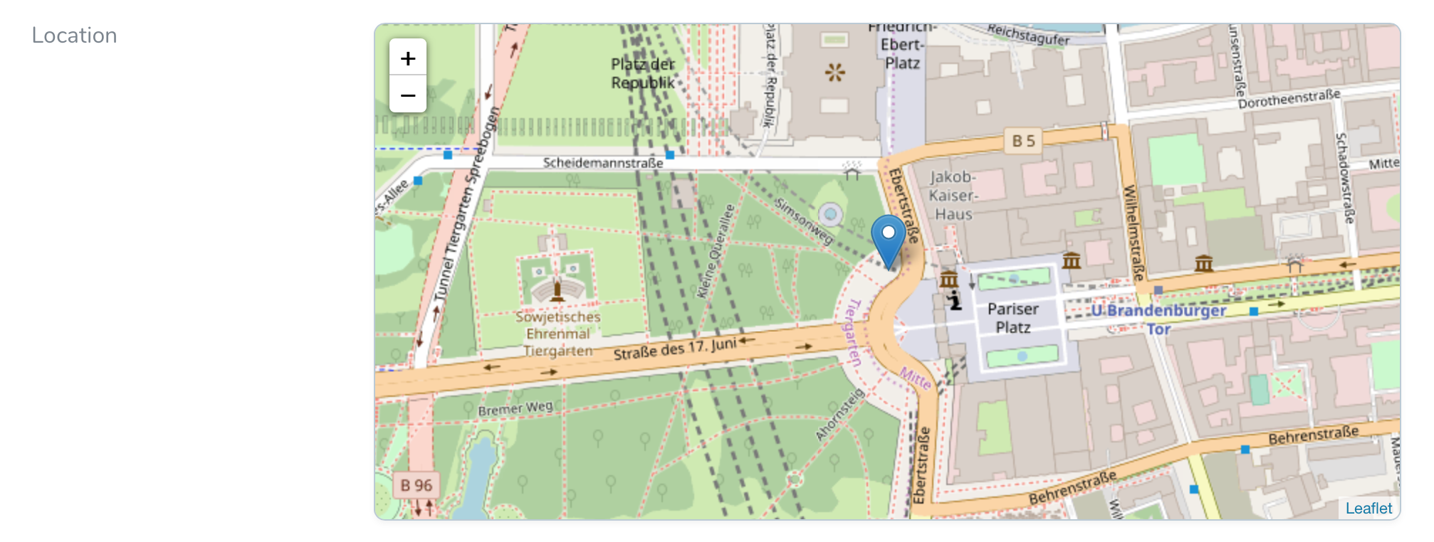
When viewing the map in on the detail page, the map and marker are not interactive, and there is no search functionality. However, the user is free to zoom in and out.
Screenshots
Create / Edit Field
Detail Field
Index Field
Commitment to Quality
During package development I try as best as possible to embrace good design and development practices, to help ensure that this package is as good as it can be. My checklist for package development includes:
✅ Achieve as close to 100% code coverage as possible using unit tests.- ✅ Eliminate any issues identified by SensioLabs Insight and Scrutinizer.
✅ Be fully PSR1, PSR2, and PSR4 compliant.✅ Include comprehensive documentation in README.md.✅ Provide an up-to-date CHANGELOG.md which adheres to the format outlined at http://keepachangelog.com.✅ Have no PHPMD or PHPCS warnings throughout all code.
Contributing
Please observe and respect all aspects of the included Code of Conduct https://github.com/GeneaLabs/nova-map-marker-field/blob/master/CODE_OF_CONDUCT.md.
Reporting Issues
When reporting issues, please fill out the included template as completely as possible. Incomplete issues may be ignored or closed if there is not enough information included to be actionable.
Submitting Pull Requests
Please review the Contribution Guidelines https://github.com/GeneaLabs/nova-map-marker-field/blob/master/CONTRIBUTING.md. Only PRs that meet all criterium will be accepted.
If you ❤️ open-source software, give the repos you use a ⭐️ .
We have included the awesome symfony/thanks composer package as a dev dependency. Let your OS package maintainers know you appreciate them by starring the packages you use. Simply run composer thanks after installing this package. (And not to worry, since it's a dev-dependency it won't be installed in your live environment.)


