Keywords: wpf map, map sample, heat map, gis mapping software, mapping software
This page is going to show you the WPF map samples that are categorized by function. You will find interesting and useful samples to integrate into your own GIS mapping software. Here is a preview of our samples.
This project already includes the runtime license. If your trial license is expired, it still can run the project by "ctrl + F5". Or try executable.
In the basic samples, we will show you 6 kinds of features.
- Geometry
- Layers
- Projection
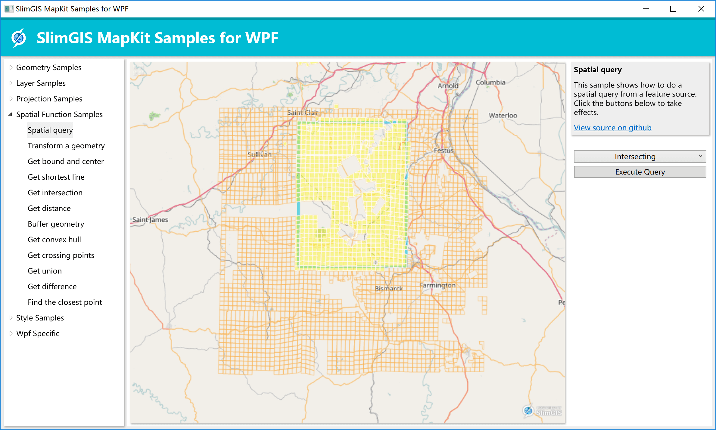
- GIS Analysis
- Style and Renderer
- Wpf Specific
Here is a 3-minutes short video
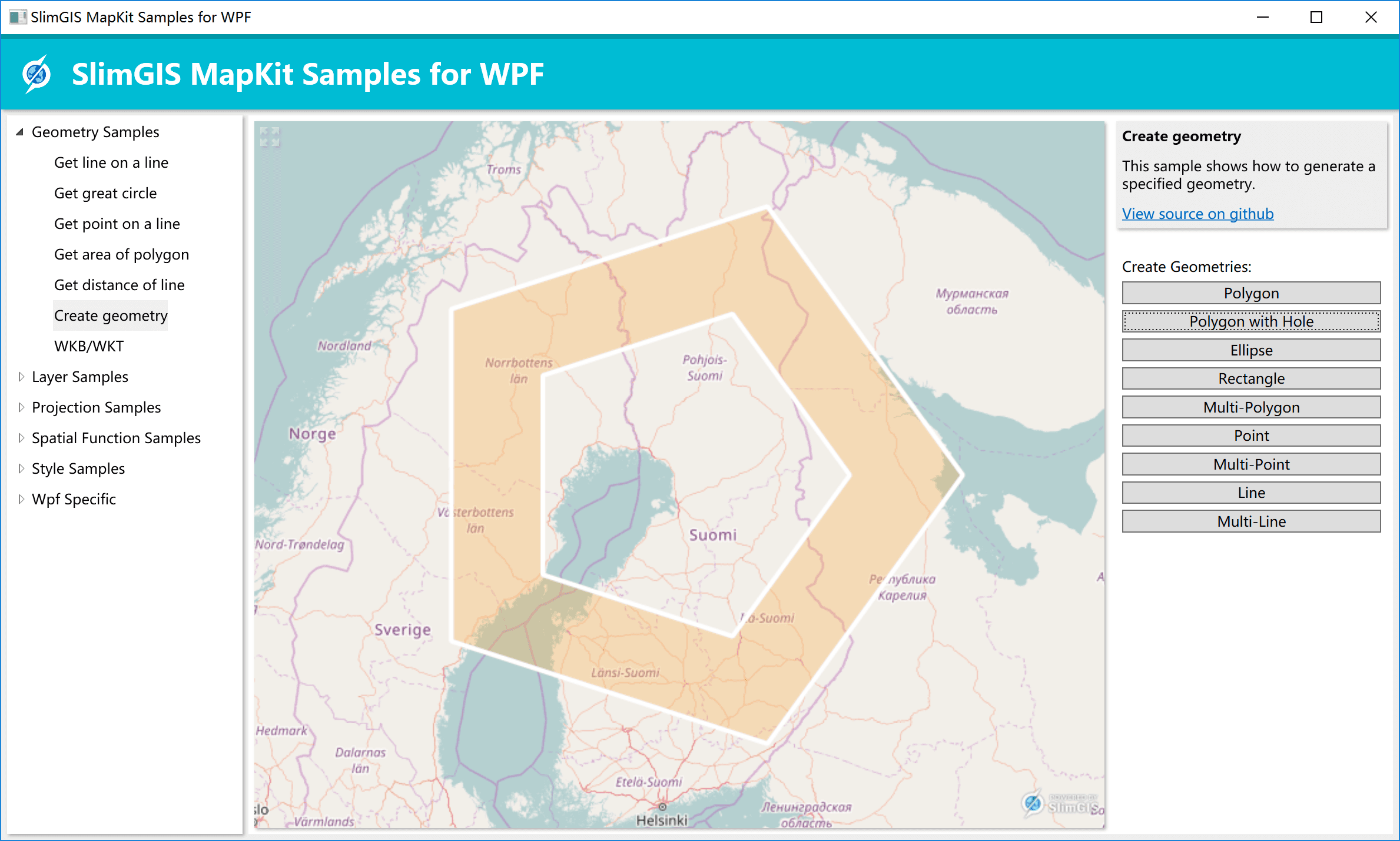
<iframe width="560" height="315" src="https://www.youtube.com/embed/MdiLK8vmUuE" frameborder="0" allowfullscreen></iframe>In this GIS word, geometry (; geo = earth, metria = measure) is a part of mathematics concerned with questions of size, shape, and relative position of figures and with properties of space. With SlimGIS MapKit, we could create various different geometries and manything related.
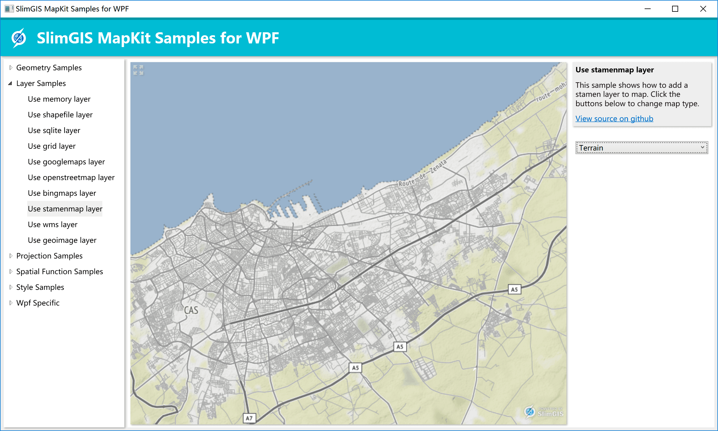
Layer represents a low-level slice that could renders raster and vectors. In this category, we will show you most data source that SlimGIS MapKit support. We will support more popular data format in the near future.
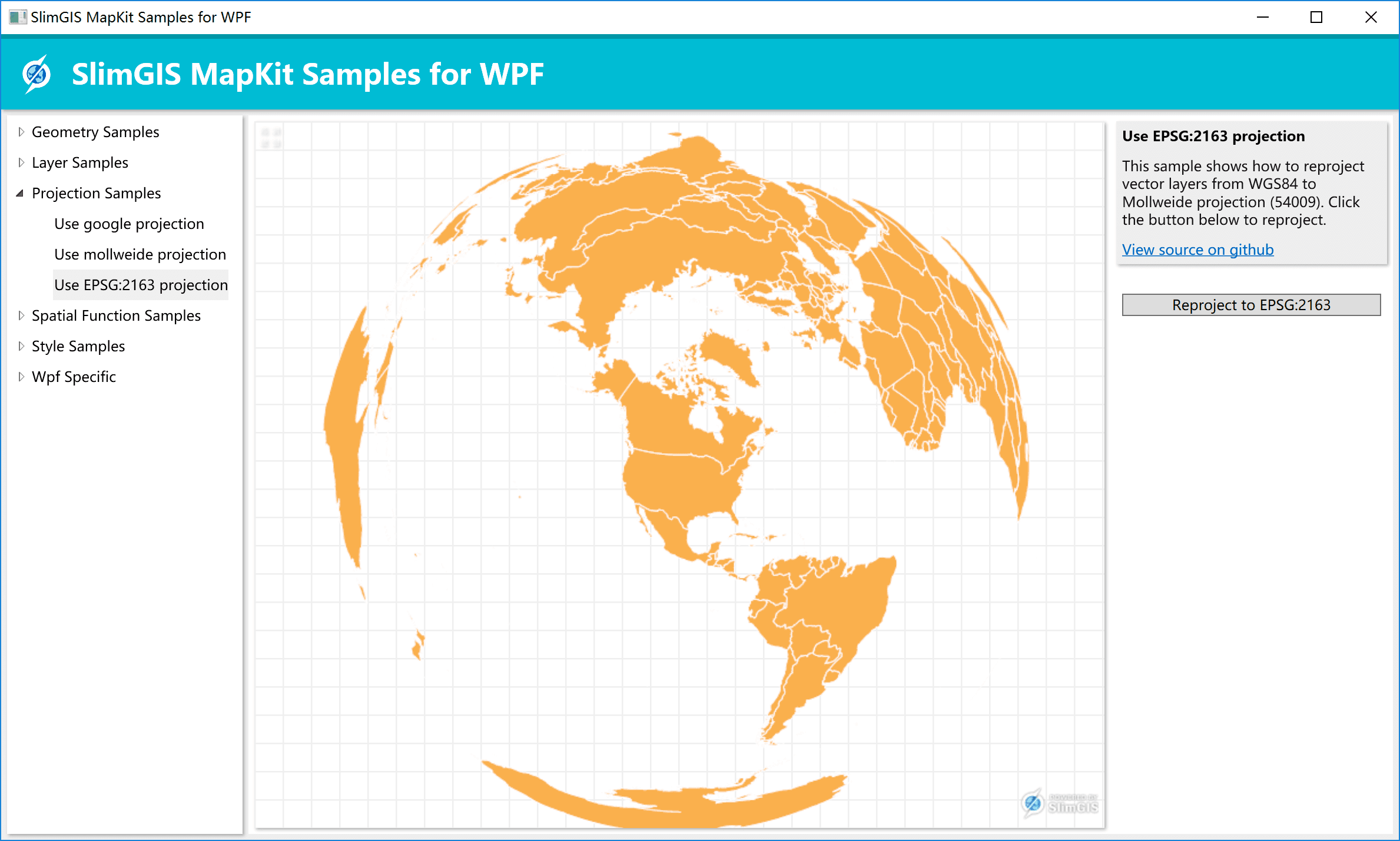
A map projection is one of many methods used to represent the 3-dimensional surface of the earth or other round body on a 2-dimensional plane in cartography (mapmaking). In this category, we will show you few common re-projected map. We support more than showing you in the sample :)
Spatial data refers to information about the location and shape of, and relationships among, geographic features, usually stored as coordinates and topology. Spatial data functions are used to transform spatial data files, such as digitized map, edit them, and assess their accuracy. This category will represent you part of the spatial analysis functions we have.
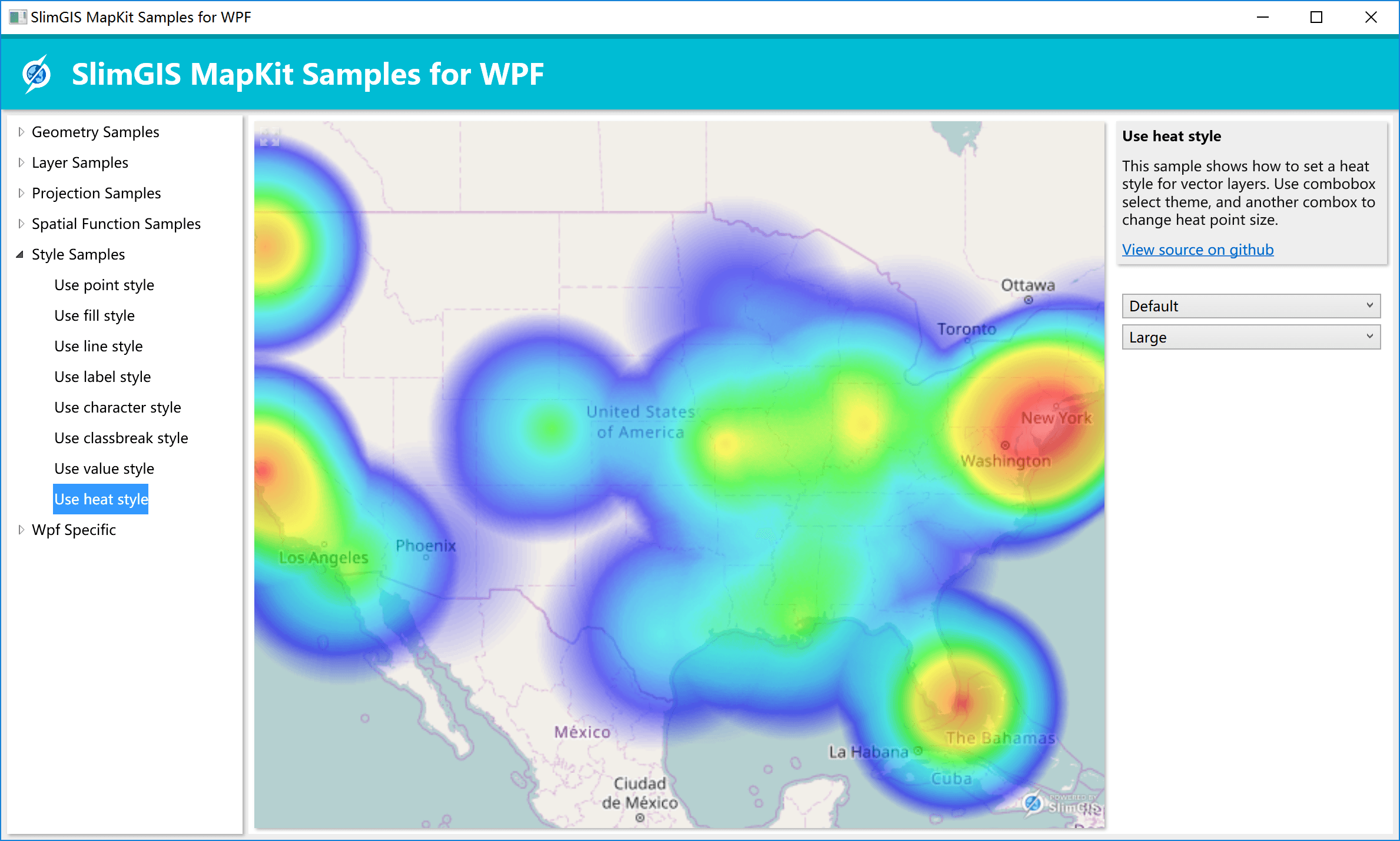
Styles and renderers are the objects that are used to render the spatial data. With SlimGIS MapKit styles and renderers, we can easily add styles for area, linear and points; also more advanced thematic styles and use heat style to create a heat map.
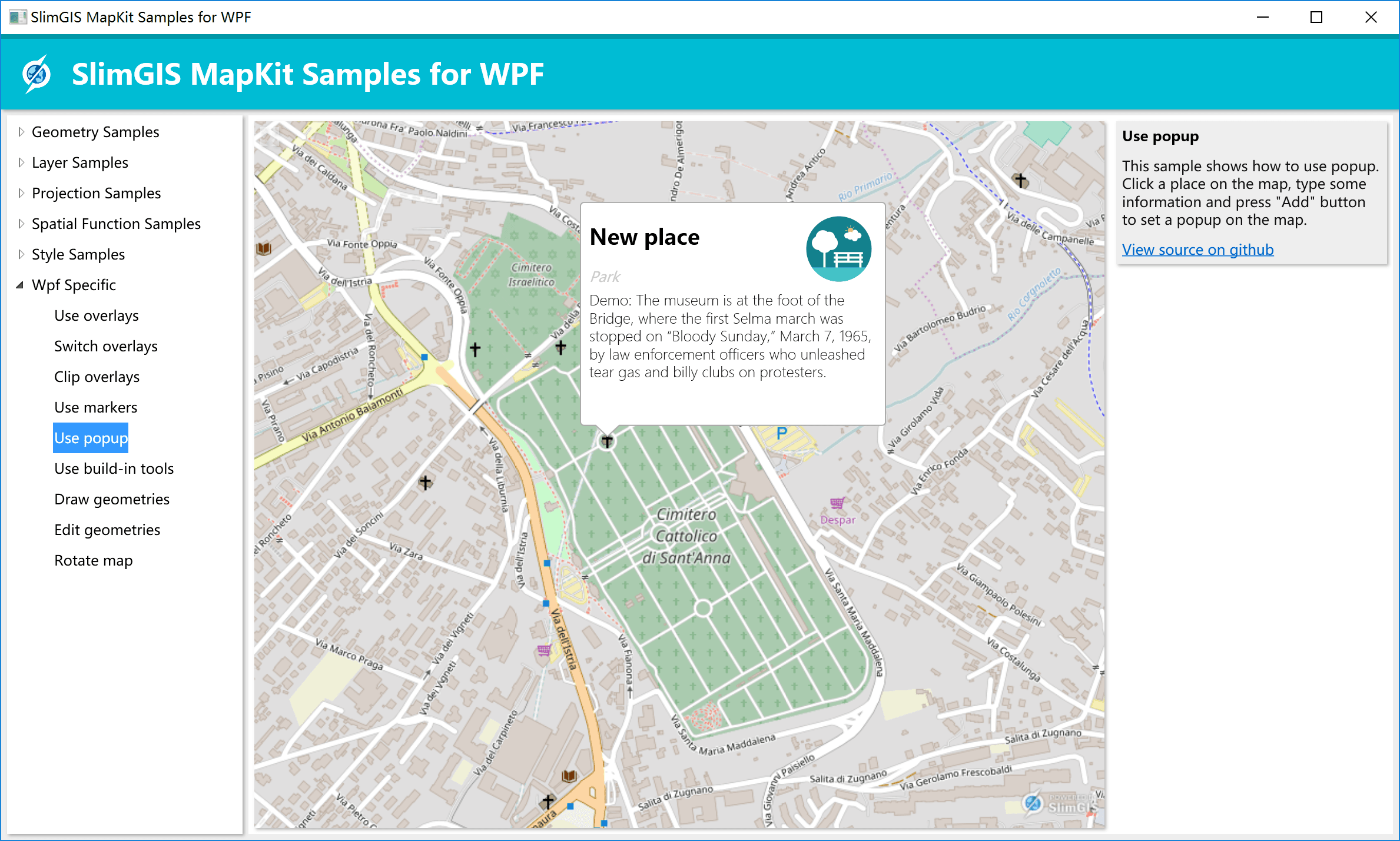
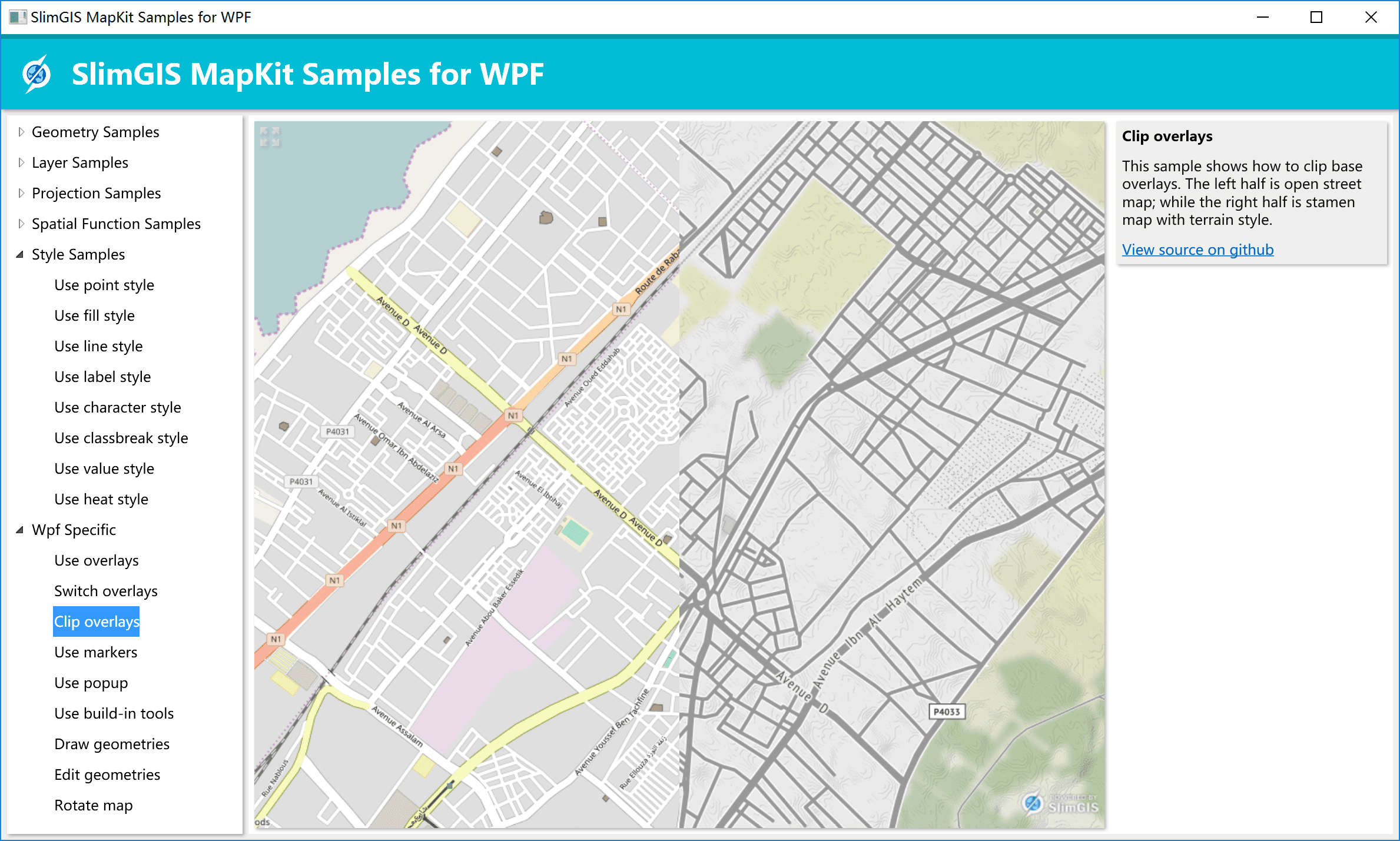
In this part, we will show you more specific features that only WPF owns. We have many build-in features like popup, marker, manipulation, track & editi, map controls and more. With those features, you can quickly build your own interactive map.
Happy Mapping!