This repository contains an R function for calculating the slope and
aspect from a Digital Elevation Model (DEM) using the raster package.
The function calculate_slope_aspect takes a raster object representing
the DEM as input and returns two raters representing slope and aspect.
calculate_slope_aspect(dem)
DEM for North Western Territories (NWT): A raster object representing the Digital Elevation Modelof North Western Territory for Canada in 2022.
list (slope, aspect): A list containing two rasters:
- slope: A raster representing the calculated slope in degrees.
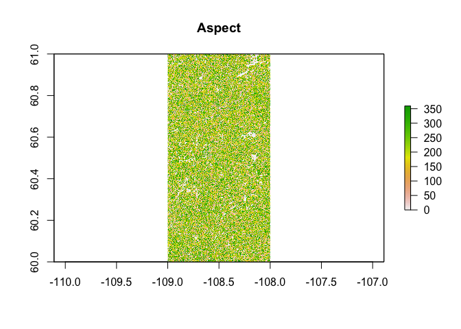
- aspect: A raster representing the calculated aspect in degrees.
#install.packages(“raster”)
library(raster)## Loading required package: sp
elevation_raster <- raster("/Users/chinyereottah/Desktop/Env/TopographyR/data-raw/NWTDEM_2022.tif")calculate_slope_aspect <- function(dem) {
# Calculate slope
dzdx <- focal(dem, matrix(c(-1,0,1,-2,0,2,-1,0,1), nrow=3, ncol=3),
fun=function(x) {sum(x)})
dzdy <- focal(dem, matrix(c(1,2,1,0,0,0,-1,-2,-1), nrow=3, ncol=3),
fun=function(x) {sum(x)})
slope <- atan(sqrt(dzdx^2 + dzdy^2))
# Convert slope to degrees
slope <- slope * (180 / pi)
# Calculate aspect
aspect <- atan2(dzdy, -dzdx)
# Convert aspect to degrees
aspect <- (aspect * (180 / pi) + 360) %% 360
return(list(slope = slope, aspect = aspect))
}
## example of how you can use this function
# Load DEM
elevation_raster <- raster("/Users/chinyereottah/Desktop/Env/TopographyR/data-raw/NWTDEM_2022.tif")result <-calculate_slope_aspect(elevation_raster)
result <- calculate_slope_aspect(elevation_raster)slope_raster <- result$slope
aspect_raster <- result$aspectplot(slope_raster, main="Slope")plot(aspect_raster, main="Aspect")calculate_slope_aspect <- function(dem) {
# Calculate slope
dzdx <- focal(dem, matrix(c(-1,0,1,-2,0,2,-1,0,1), nrow=3, ncol=3),
fun=function(x) {sum(x)})
dzdy <- focal(dem, matrix(c(1,2,1,0,0,0,-1,-2,-1), nrow=3, ncol=3),
fun=function(x) {sum(x)})
slope <- atan(sqrt(dzdx^2 + dzdy^2))
# Convert slope to degrees
slope <- slope * (180 / pi)
# Calculate aspect
aspect <- atan2(dzdy, -dzdx)
# Convert aspect to degrees
aspect <- (aspect * (180 / pi) + 360) %% 360
return(list(slope = slope, aspect = aspect))
}
## example of how you can use this function
# Load DEM
elevation_raster <- raster("/Users/chinyereottah/Desktop/Env/TopographyR/data-raw/NWTDEM_2022.tif")result <-calculate_slope_aspect(elevation_raster)slope_raster <- result$slope
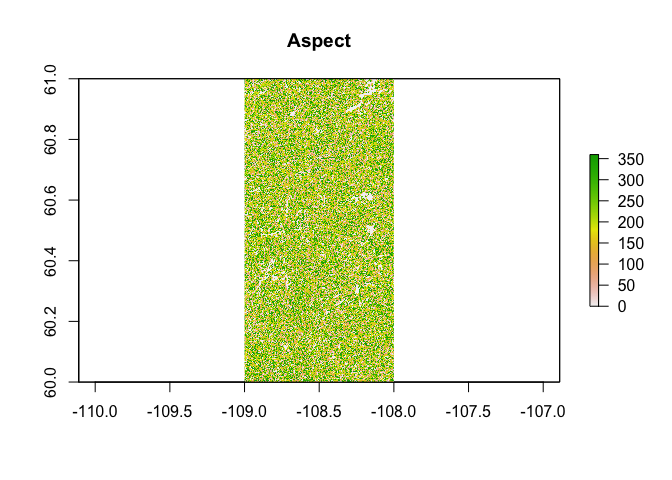
aspect_raster <- result$aspectplot(slope_raster, main="Slope")plot(aspect_raster, main="Aspect")


