![]()
![]()


EOmaps is a python package to visualize and analyze geographical datasets.
It is built on top of matplotlib and cartopy and provides an intuitive and easy-to-use interface to speed up and simplify the creation and comparison of maps.
For a quick hands-on introduction, checkout this article on dev.to:
Geographic data visualization and analysis with EOmaps: Interactive maps in python!
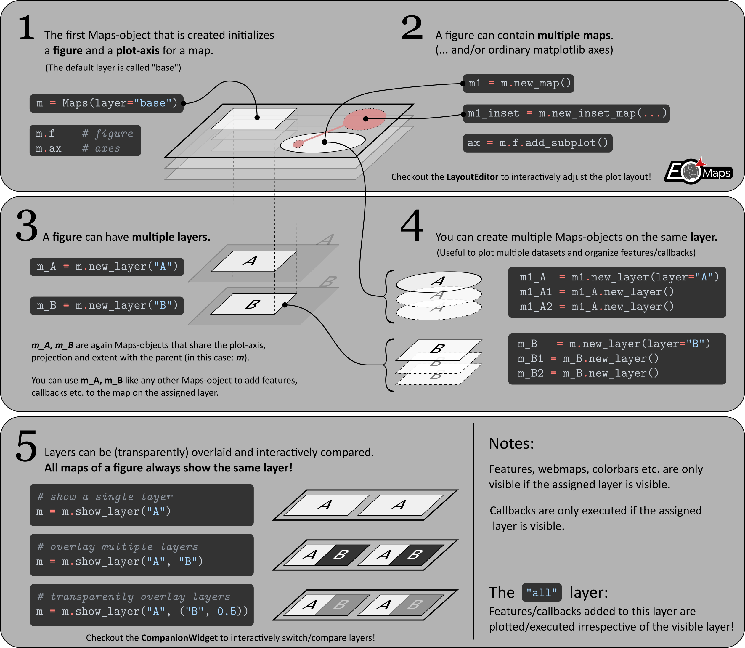
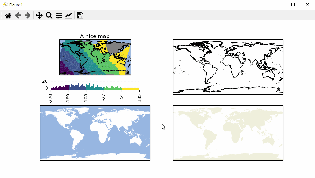
- Create ▤ multi-layered maps and interactively compare different layers with each other
- 🔴 Visualize datasets with millions of datapoints and handle reprojections
- Provide a comprehensive set of tools to customize the map
- Get a useful 🧰 CompanionWidget GUI
- Use 🛸 Callbacks to interact with the figure
- Interactively re-arrange multiple maps in a figure with the 🏗️ LayoutEditor
- 🗺 Export publication ready high resolution images (png, jpeg, tiff, ...)
or export figures as vektor graphics (svg, eps, pdf ...) - . . . and much more!
Checkout the 🌱 Basics in the documentation to get started!
To install EOmaps (and all its dependencies) via the conda package-manager, simply use:
conda install -c conda-forge eomaps... to get a huge speedup, use mamba to solve the dependencies!
conda install -c conda-forge mamba
mamba install -c conda-forge eomaps
Need more information?
- Have a look at the 🐛Installation instructions in the docs.
- Checkout the quickstart guide 🚀 From 0 to EOmaps.
Make sure to have a look at the 📖 Documentation which provides a lot of 🌐Examples on how to create awesome interactive maps (incl. 🐍 source code)!
Did EOmaps help in your research?
Support the development and add a citation to your publication!
Interested in contributing to EOmaps? Awesome!
- Checkout the 🚀 Contribution Guide on how to get started!
Found a bug or got an idea for an interesting feature?
Open an issue or start a discussion, and I'll see what I can do!


|

|

|

|

|

|
|

|

|

|
- Jakob Quast for designing the nice logo!